Mapping Software and GIS Glossary
Elevation is the height of a geographic location or feature above or below mean sea level. Elevation can be shown on a map with contours, which connect points with the same elevation, or by labeling the exact elevations of particular points. Maps that show elevations are called topographic maps.
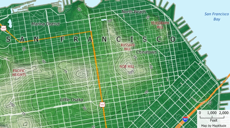
This contour map shows elevation contours. The bolder contour lines show elevations in 25-foot increments and the thinner lines show elevation in 5-foot increments.
Maptitude Mapping Software gives you all of the tools, maps, and data you need to analyze and understand how geography affects you and your business. You can use Maptitude terrain analysis tools to calculate spot elevations, generate elevation contours, and determine viewsheds.
Learn More Free Trial Free for Students/Teachers
![]()
![]()
![]()
![]()
![]()
![]()
![]()
![]()
Home | Products | Contact | Secure Store
