Mapping Software and GIS Glossary
An isoline map, also known as an isarithmic map, uses lines to connect point locations with similar values. A common example of this is a contour map of surface elevations. Isolines can also be used to show variables other than terrain. For example isolines are used in isobar maps of barometric pressure, isotherm maps of temperature, isobath maps of water depth, isochrone maps of travel time from a particular point, and isohyet maps of precipitation.
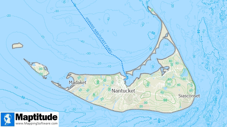
The isolines in this map show terrain elevations on land and ocean depths. Closer isolines indicate areas where terrain is more uneven.
Maptitude Mapping Software gives you all of the tools, maps, and data you need to analyze and understand how geography affects you and your business. Maptitude includes surface analysis tools for creating isoline maps.
Learn More Free Trial Free for Students/Teachers
![]()
![]()
![]()
![]()
![]()
![]()
![]()
![]()
Home | Products | Contact | Secure Store
