Mapping Software and GIS Glossary
The shape of the earth is irregular. To make a map, the earth’s shape needs to be "smoothed out" and shown on a regular surface, called a spheroid. A datum defines a particular spheroid that fits the whole earth, or part of the earth. For many years the standard datum for the United States and North America was the North American Datum of 1927 (NAD27). Since that time technological advances have improved the accuracy of measurements allowing for a much more accurate geocentric datum to be developed, the North American Datum of 1983 (NAD83). From NAD83, an even more precise datum was developed using GPS, called NAD83hp (high precision geodetic networks).
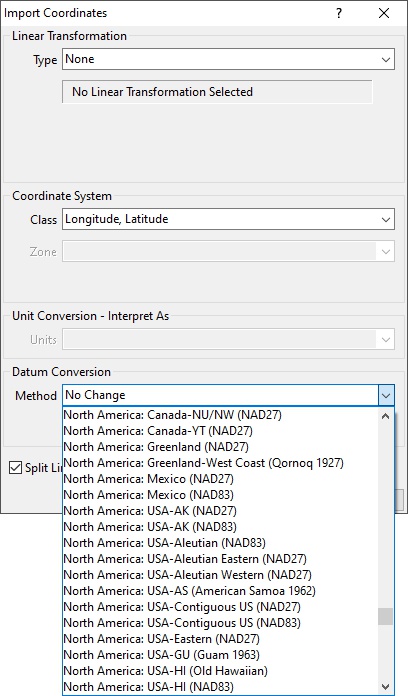
Maptitude Mapping Software gives you all of the tools, maps, and data you need to analyze and understand how geography affects you and your business. Geographic data can be stored in many different ways, including some that don’t fit neatly into a defined coordinate system. Maptitude includes support for multiple datums that helps you use geographic data from almost any source. Datums for the US, Canada, Australia, Austria, Brazil, France, Germany, Great Britain, Ireland, New Zealand, Portugal, and Switzerland are all supported in Maptitude.
Learn More Free Trial Free for Students/Teachers
![]()
![]()
![]()
![]()
![]()
![]()
![]()
![]()
Home | Products | Contact | Secure Store
