Maptitude mapping software includes nationwide state boundaries with dozens of demographic variables so that you can create insightful and informative maps at a state level anywhere in the United States. With a few clicks of the mouse, you can create thematic maps that will allow you to quickly analyze data for your area of interest. In addition, Maptitude includes a number of predesigned state level maps in a Map Library.
The Maptitude state data includes the District of Columbia, Puerto Rico, and the Island Areas (American Samoa, Guam, the Commonwealth if the Northern Mariana Islands, and the Virgin Islands) because they are treated as statistical equivalents to states for decennial census purposes.
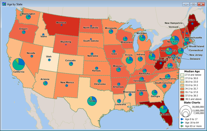
A Maptitude map of U.S. states with a color theme showing median age and a chart theme showing the age distribution.
Home | Products | Contact | Secure Store
