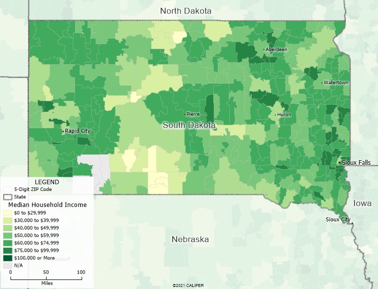
Maptitude Geographic Information System (GIS) software is easy-to-use and provides everything you need to realize the benefits of mapping and location-based analysis. Maptitude mapping software unlocks the trends hidden in your data and gives you the tools to understand how geography effects your business and to visualize those hidden patterns. With Maptitude mapping software you can:
Maptitude includes a FREE Country Package of your choice. The United States Country Package includes detailed nationwide geographic and demographic data which can be used for mapping any South Dakota neighborhood, ZIP Code, city, or county. The geographic data include an up-to-date street layer with address data for geocoding and travel time information for computing routes and drive-time rings, administrative boundaries, ZIP Codes, and comprehensive named landmarks that range from South Dakota public facilities to commercial buildings including shops, restaurants, and retail stores. In addition, Maptitude has no subscription fees, and supports secure off-line data storage*.
Maptitude analysis tools allow you to study locations, create territories, find drive-times, shortest paths, and routes, design trade areas, and compute market share based on your data, anywhere in South Dakota or any other state.

Use Maptitude South Dakota Mapping Software and the included demographic and geographic data to assess markets and find geographic patterns.
* Maptitude Online is available for customers that require online sharing or a Cloud application. Maptitude subscriptions are available for customers that prefer them to our one-time payment pricing.
Home | Products | Contact | Secure Store