Maptitude is a robust and easy-to-use professional mapping tool that can play a valuable role in geothermal energy mapping. Maptitude costs only US$795 and is packaged as a one-stop-solution, shipping with all the tools and data required by energy analysts and policymakers. There's no better mapping software at any price. Why spend more for less?
Learn more about energy mapping with Maptitude
Learn more about Maptitude mapping software
Includes a free Public Land Survey System (PLSS) download
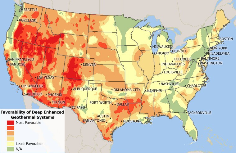
Maptitude map of geothermal favorability
 |
“Maptitude has been an important tool for showing the geography of a variety of facilities and parameters, from rig trends by state, to patent trends by metro area, to the location of important infrastructure installations both onshore US and offshore GOM. Being able to illustrate and map these elements with Maptitude was essential for the analysis and, in addition, the software is backed up with outstanding support if needed.” Charlotte Batson |
 Check out our G2 Reviews
Home | Products | Contact | Secure Store
