Mapping Software and GIS Glossary
Map labels are text postioned on a map in relation to map features, which collectively reflect real-world characteristics and attributes. Text successfully used in maps generates maps that are clear, instructive, and appealing.
The size of map labels can assist the viewer in understanding the information depicted in a map. For example, it is common to label cities with higher populations with labels that are larger than those for small towns. Similarly, using colors that complement the features they label, such as using blue labels for water features, make it easier to see which location the text refers to.
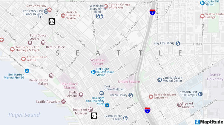
This map uses a variety of label features: The "SEATTLE" label is stretched, Interstate 5 and Washington Route 99 use highway shields, the streets and landmarks have white halos, and all of the labels use colors relative to the features that they reference.
Maptitude Mapping Software gives you all of the tools, maps, and data you need to analyze and understand how geography affects you and your business. Maptitude maps can help you better understand how geography affects you and your business.
Maptitude automatically decides exactly which locations should be labeled and where the text should be placed based on your preferences. Each time the map is drawn, Maptitude displays the most effective combination of labels. In addition, Maptitude lets you choose various map backgrounds, such as shadows, halos, and shields, lets you stretch labels, and lets you move and rotate individual labels.
Learn More Free Trial Free for Students/Teachers
![]()
![]()
![]()
![]()
![]()
![]()
![]()
![]()
Home | Products | Contact | Secure Store
