Mapping Software and GIS Glossary
A map symbol is used to represent and distinguish features on a map. Map symbols are defined in the map legend. In mapping software these can be fonts, icons, and image files. Map symbols can be further styled using color and thematics such as variations in size and other styling and analytical techniques.
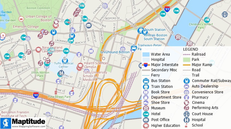
Map with different point symbols depicting different types of landmarks and different line styles depicting different types of roads and railroads.
Maptitude Mapping Software gives you all of the tools, maps, and data you need to analyze and understand how geography affects you and your business. Maptitude are fully customizable and include dozens of map symbols.
Learn More Free Trial Free for Students/Teachers
![]()
![]()
![]()
![]()
![]()
![]()
![]()
![]()
Home | Products | Contact | Secure Store
