Mapping Software and GIS Glossary
When you create a map, you should give some consideration to the background of the map. Typically a map background is a solid color or a satellite image.
In general, when using images in the background, consider the following:
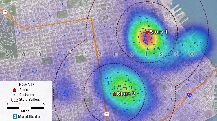
In this map, the image is displayed with 45% opacity so that the colors of the landmark areas show through and the customers, labels, buffers, and heat map are still legible.
Maptitude Mapping Software gives you all of the tools, maps, and data you need to analyze and understand how geography affects you and your business. Maptitude maps can help you better understand how geography affects you and your business. Maptitude includes tools for accessing satellite imagery and allows you to set the contrast and opacity levels so that the images provide reference to your audience while not detracting from your message.
Learn More Free Trial Free for Students/Teachers
![]()
![]()
![]()
![]()
![]()
![]()
![]()
![]()
Home | Products | Contact | Secure Store
