Mapping Software and GIS Glossary
A political map shows legal, jurisdictional, political, or administrative boundaries. These can be national country borders or sub-national lines such as counties, states, provinces, cities, or wards. Political maps are frequently used to depict Census data and election results.
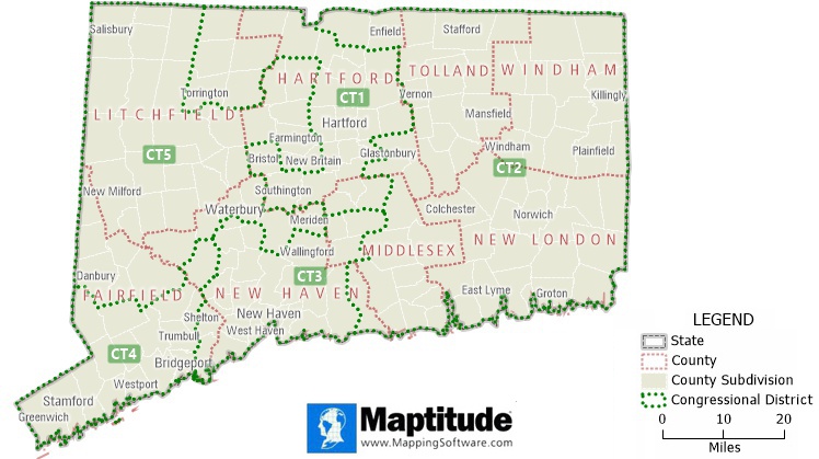
A political map of Connecticut that shows the state, county, county subdivision, and congressional district boundaries
Maptitude Mapping Software gives you all of the tools, maps, and data you need to analyze and understand how geography affects you and your business. Maptitude Country Packages include numerous administrative boundary layers for creating political maps.
Learn More Free Trial Free for Students/Teachers
![]()
![]()
![]()
![]()
![]()
![]()
![]()
![]()
Home | Products | Contact | Secure Store
