Mapping Software and GIS Glossary
A reference map provides a general overview of a location. Reference maps are used to display geographical information such as natural features (mountains, rivers, etc.) and political data (administrative boundaries, urban areas, transportation infrastructure, etc.) for a variety of purposes such as in tourist guide books or orienteering maps.
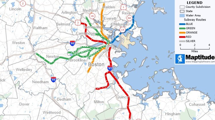
A reference map showing the Greater Boston cities and towns served by the subway system
Maptitude Mapping Software gives you all of the tools, maps, and data you need to analyze and understand how geography affects you and your business. Create informative reference maps using the detailed data that are included.
Learn More Free Trial Free for Students/Teachers
![]()
![]()
![]()
![]()
![]()
![]()
![]()
![]()
Home | Products | Contact | Secure Store
