Mapping Software and GIS Glossary
A census tract is a small, relatively permanent statistical subdivision of a county delineated by a local committee of census data users for the purpose of presenting census data. Census tract boundaries normally follow visible features, but may follow governmental unit boundaries and other non-visible features, and they always nest within counties. Census tracts are designed to be relatively homogenous units with respect to population characteristics, economic status, and living conditions at the time the users established them. They usually contain 1,500 to 8,000 people and are made up of on average about four block groups. There are about 73,800 tracts nationwide. Tracts were first defined in 1970 and the Census Bureau maintains them as consistently as possible across the decades.
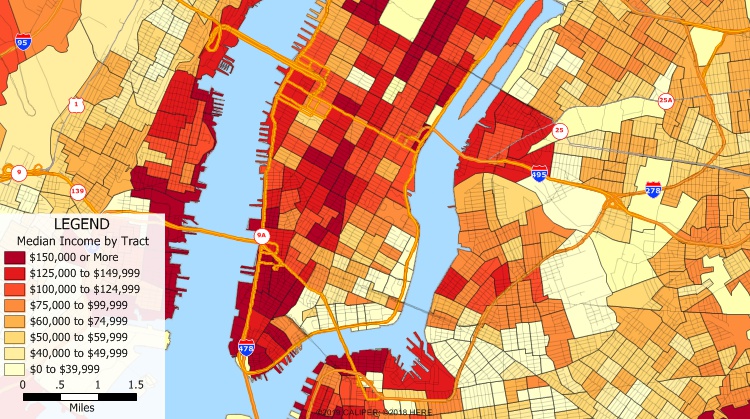
What is census tract? This Maptitude map shows census tracts in New York City. The census tracts provided with Maptitude include demographic data such as population and income and are ideal for demographic analysis.
Maptitude Mapping Software gives you all of the tools, maps, and data you need to analyze and understand how geography affects you and your business. The census tract layer included with Maptitude is ideal for demographic mapping and for estimating the demographics of territories or around sites.
Learn More Free Trial Free for Students/Teachers
![]()
![]()
![]()
![]()
![]()
![]()
![]()
![]()
Home | Products | Contact | Secure Store
