Mapping Software and GIS Glossary
A travel-time table (or drive-time table) shows the driving time over streets from one or more origins to one or more destinations. A travel-time table is useful for finding out how long customers are willing to drive to a store and nearest store alternatives. A travel-time table is typically a matrix where the origins are shown in the first column and the destinations are shown in the first row. The time that it takes to drive from an origin to a destination is shown where the row and column intersect.
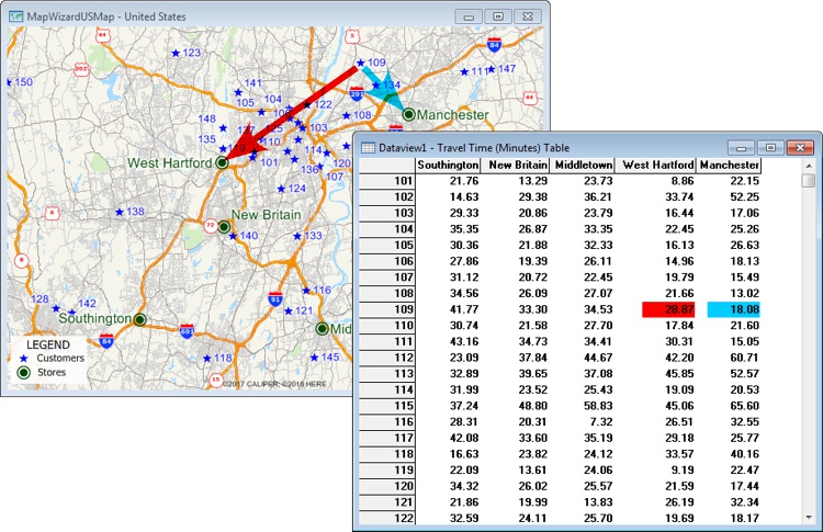
This travel-time table shows how far different stores are from customers. For example, customer 109 is 18.08 minutes from the Manchester store and 28.87 minutes from the West Hartford store.
Maptitude Mapping Software gives you all of the tools, maps, and data you need to analyze and understand how geography affects you and your business. Maptitude includes tools for creating travel-time tables and distance tables.
How do I Calculate Multiple Point-to-Point Driving Drive Times at Once with Maptitude?
Learn More Free Trial Free for Students/Teachers
![]()
![]()
![]()
![]()
![]()
![]()
![]()
![]()
Home | Products | Contact | Secure Store
