Mapping Software and GIS Glossary
Conflation is the process of reshaping the segments in a line layer to align with a more accurate line layer. For example, when editing lines with a geographic information system (GIS) you may have a line layer of bus routes or bike lanes. You can conflate your line layer with a detailed street layer to increase the accuracy of your layer.
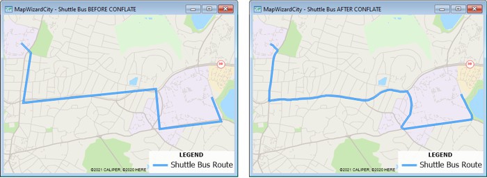
Before conflating, the shuttle bus route does not align with the streets (left). After conflating, the shuttle bus route does align with the streets (right).
Maptitude Mapping Software gives you all of the tools, maps, and data you need to analyze and understand how geography affects you and your business. Maptitude country packages include detailed street layers that you can use with the Tools>Editing>Conflate Line Segments command to quickly and easily conflate your less-detailed geographic data into geographically accurate layers.
Learn More Free Trial Free for Students/Teachers
![]()
![]()
![]()
![]()
![]()
![]()
![]()
![]()
Home | Products | Contact | Secure Store
