Mapping Software and GIS Glossary
Rubbersheeting refers to the process of adjusting and distorting a geographic layer so that it aligns with features in another layer. Imagine putting pins in a distorted map and moving those pins to their correct location to remove the distortion. The areas between the pins will be stretched and moved as well. The more pins (control points) you use, the more detailed the correction can be.
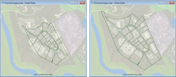
When an imported geographic file does not properly align to the geography (left) it can be rubbersheeted so that it does align (right)
Maptitude Mapping Software gives you all of the tools you need to locate and analyze your data. In addition, Maptitude has tools for rubbersheeting geographic files so that you can align CAD and other geographic files within your GIS map.
Learn More Free Trial Free for Students/Teachers
![]()
![]()
![]()
![]()
![]()
![]()
![]()
![]()
Home | Products | Contact | Secure Store
