Maptitude Geographic Information System (GIS) software is the intelligent mapping solution for business, government, and education. Maptitude is a powerful combination of software and geographic data that provides everything you need to realize the benefits of desktop mapping and spatial analysis with a single, easy-to-use package.
Maptitude with the Europe Country Package is the best buy for those needing to create detailed maps and analysis in Italy and elsewhere in Europe.
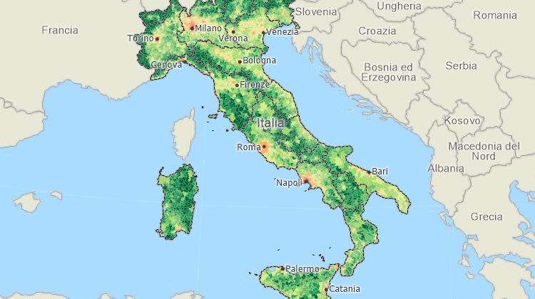
Maptitude mapping software for Italy.
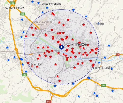
Locate your customers
Perform drive-time analysis
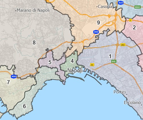
Visualise spatial patterns

|
“I work with Maptitude on a daily basis for mobility and transport data analyses. Maptitude in its ease of use is undoubtedly the most powerful and feature-rich GIS. Thematic maps are truly unique in terms of graphic capabilities and data representation, highly appreciated by customers. With a low cost combined with an excellent training program and support service, Maptitude is an added value for my business!”
|
The Europe Country Package for Maptitude includes extensive geographic data so that you can get started as soon as you install the software. The following geographic files are included:
| Nationwide HERE Europe Geographic Data Layers |
|---|
|
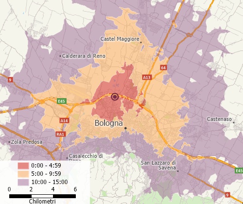
Create balanced territories
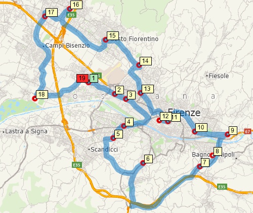
Find optimised routes serving multiple stops
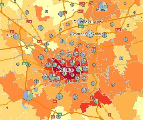
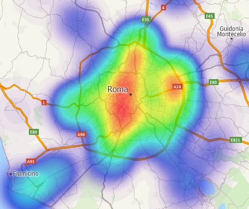
Create may types of thematic map
For more information on Maptitude please visit the Maptitude Overview Page (English or Italiano) or email a request for a live demo.
Email Caliper or call +1 617-527-4700 for pricing information.
Home | Products | Contact | Secure Store
