Maptitude 2020 Released!
|
Maptitude 2020
|
 |
Maptitude 2020 has new premium data, new features for MapPoint users, and enhanced analysis tools.

|
“We cannot recommend Maptitude enough! The software offers a number of different features and is packed full of free data. It’s cost effective as well. The platform is very easy to navigate and there are many options for in-person trainings, webinars, and tutorials to further your knowledge of the software. Maptitude Customer Service deserves an A+.” Chelsey Pousland |
 |
“Overall, this product makes it incredibly simple to visualize and map both customer & company specific data. It is very intuitive and easy to pickup from the get go. I highly suggest utilizing a quick training video or session as it will improve your usability 10 fold with just a few tips & tricks. This product is incredible for what it was built for.” Matt Rosenfield |
New U.S. data provide access to the most up-to-date geographic information available. Only Maptitude 2020 users will have access to completely new business-critical data. Now included are 54 new fields covering population projections out to 2060, GDP by NAICS Code, and Qualified Opportunity Zones (QOZs). We will also be updating our free premium data for Maptitude 2020 customers.
The Maptitude Geodemographic Segmentation layer is now free for Maptitude 2020 USA customers. Use this layer to help you discover target markets that you didn't even know you had!
The boundaries (e.g., tracts, ZIP Codes, counties) have updated demographics and Census data such as buying power/disposable income, banking compliance data, and 2018 Census ACS data.
Maptitude 2020 also ships with the January 2020 ZIP Code boundaries, ensuring that you are using the latest nationwide postal data.
The 2020 U.S., Australia, Brazil, Canada, Mexico, New Zealand, and United Kingdom & Ireland country packages all include updated streets that allow for accurate address locating and street visualization, directions, drive-time rings, and drive-time territories.
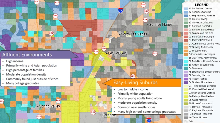
The geodemographic segmentation layer is included for USA users
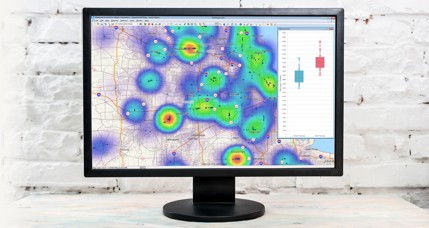
Maptitude 2020 is our fastest version yet, with improvements to layer drawing speed, quicker layer creation for tools such as drive-time rings, better software download times, and quicker loading of all the routing tools.
Maptitude 2020 now includes one of the best features of Microsoft MapPoint, the ability to copy drawing items between maps to the exact same location. In addition, you can now clearly differentiate points on a map using a numbered symbol theme. Once you have created your maps, you can save them using a new export to PDF tool that automatically uses landscape or portrait orientation.
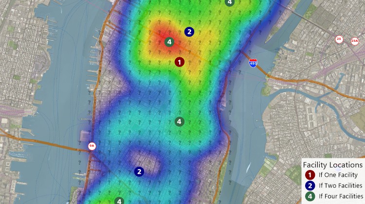
The logistics and operations tools have also been enhanced. The Facility Location tool allows any number of potential sites to be considered when you don't already know where you would like to site a new property. Also, when modeling long-haul trips, the rest settings support government rules such as those for interstate truck drivers in the USA.
Data sharing enhancements include support for ERDAS IMAGINE® and GeoJSON files, and for Esri ArcGIS® Pro. In addition, you can connect to external services such as Microsoft Bing™ to analyze driving, public transportation, or walking travel times, or real-time travel by arrival time, departure time, and date.
Interoperability has been expanded with new API functions, including those supporting PostgreSQL and database linking/updating, and support for Intellisense in our Microsoft Visual Studio add-on.
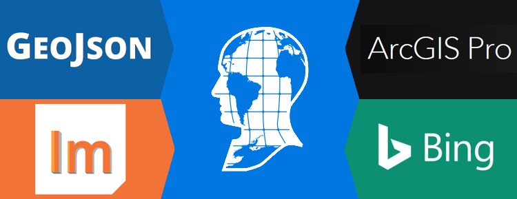
Maptitude supports GeoJson and ERDAS Imagine® files, ArcGIS® Pro, and third-party web service providers like Bing™
|
|
WEBINAR New in Maptitude 2020 |
Click here to see features that were new to Version 2019.
Home | Products | Contact | Secure Store