Mapping Software and GIS Glossary
Geodemographics is the analysis of population characteristics, sorted by location, and uses clustering algorithms to create similarly classified demographic areas. The primary source of data for geodemographic segmentations is the national census. Sparsity of information collected in a census, and infrequency of collection, has resulted in substitute datasets also being used such annual surveys of a representative sample of the population such as the American Community Survey in the USA. Other supplementary sources include court records, property values, mortgages, etc. For marketing and sales professionals geodemographics can be vital in market analysis. Geodemographic segments can help you identify who your best customers are and to target them in new markets.
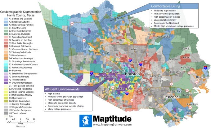
What is geodemographics? This map shows the geodeographics of Harris County, Texas
Maptitude Mapping Software gives you all of the geographic analysis tools, maps, and data you need to analyze and understand how geography affects you and your business. Maptitude users in the United States can download a free geodemographic layer for use with the latest version of Maptitude.
Learn More Free Trial Free for Students/Teachers
![]()
![]()
![]()
![]()
![]()
![]()
![]()
![]()
Home | Products | Contact | Secure Store
