Mapping Software and GIS Glossary
A boundary line is a line along which two areas meet. A boundary line between privately owned parcels of land is usually termed a property line. A boundary line between political entities (such as counties, states, or countries) is usually termed a political boundary. If a boundary is a line of the United States public land surveys, it is given a particular designation, such as section line or township line.
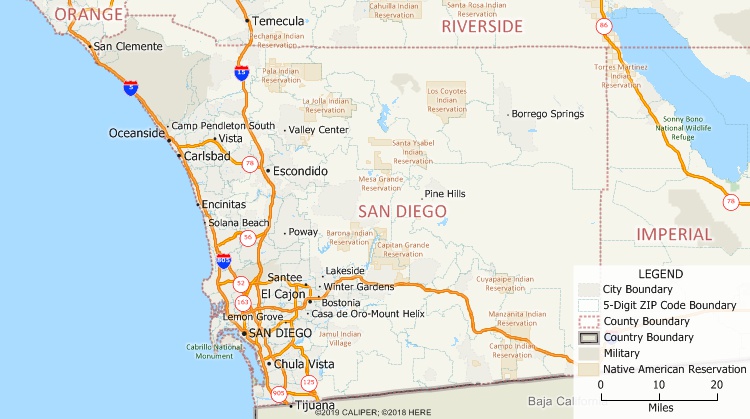
What is boundary line? This Maptitude map shows some of the boundary lines that are provided with Maptitude mapping software.
Maptitude Mapping Software gives you all of the tools, maps, and data you need to analyze and understand how geography affects you and your business. Maptitude includes many boundary layers including census tracts, postal codes, cities, counties, states, provinces, countries, and Public Land Survey System boundaries.
Learn More Free Trial Free for Students/Teachers
![]()
![]()
![]()
![]()
![]()
![]()
![]()
![]()
Home | Products | Contact | Secure Store
