Mapping Software and GIS Glossary
GPS stands for Global Positioning System, a network of satellites which provide extremely accurate position and time information. A GPS can be used for wayfinding in remote areas. GPS are also useful for field data collection and creating accurate inventories of facilities for use in a GIS.
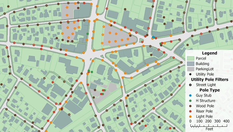
A GPS is useful for field data collection for use in a Geographic Information System such as this point layer of utility poles
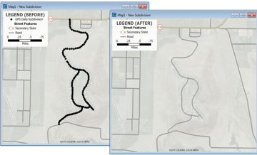
Maptitude Mapping Software gives you all of the tools, maps, and data you need to analyze and understand how geography affects you and your business. Maptitude can display the location of features collected in a GPS, track and display GPS location, and create new lines from points collected with a GPS such as hiking trails and utility lines.
Learn More Free Trial Free for Students/Teachers
![]()
![]()
![]()
![]()
![]()
![]()
![]()
![]()
Home | Products | Contact | Secure Store
