Mapping Software and GIS Glossary
A hexabin map uses tesellations of hexagons to represent space. Thematics such as shading and dot density can then be applied to the areas to represent your data. Hexagons are useful because they cover the earth in a uniform pattern.
If you have Maptitude you can follow these steps to create a hexabin map: https://www.caliper.com/learning/how-do-i-map-using-hexagons/.
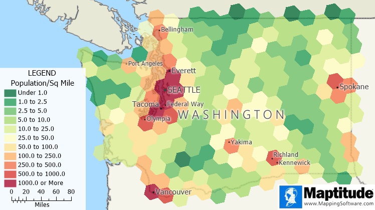
A hexbin map of population density in Washington state
Maptitude Mapping Software gives you all of the tools, maps, and data you need to analyze and understand how geography affects you and your business.
Learn More Free Trial Free for Students/Teachers
![]()
![]()
![]()
![]()
![]()
![]()
![]()
![]()
Home | Products | Contact | Secure Store
