What is a map?
A map communicates information that is related to locations in a remarkably efficient way, reducing volumes of information to a single, clear visual presentation. An effective map does not try to communicate everything about a location, but rather the details that are necessary to convey its message. A weather map lets you know in an instant whether it will be cloudy or sunny, how warm or cold it will be, and whether it will rain or snow. Traffic maps let you know what route you should take to avoid an accident or steer clear of construction. In politics, history, advertising, and recreation, maps are a part of our everyday lives because they tell us so much of what we want to know.
A map uses symbols, line styles, and colors to represent geographic features and usually contains a legend that explains what the different symbols represent. Typically a map also includes a scale so that the real-world sizes and distances can be inferred from the map. Maps also use projections as a means of depicting the round Earth on a flat surface.
What are some types of maps?
Reference maps give you an overview of a location and are useful for finding your way or comparing relative distances, sizes, or locations. You may use a reference map to find your way around a strange city.
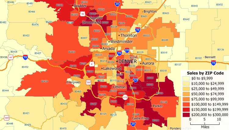
Thematic maps show you attributes about locations. For example, a thematic map could use different colors, sizes, or charts to show you how many people live in different places or how high your sales are in different ZIP Codes.
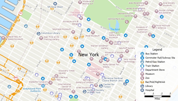
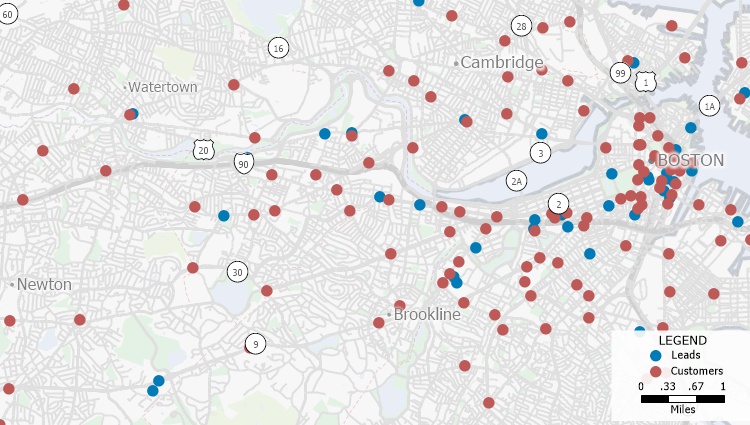
Pin maps show the specific locations of individual features such as customer locations, crime locations, or store locations. Mapping software can automatically take lists of locations stored in a database or spreadsheet and display those locations as pins on a map.
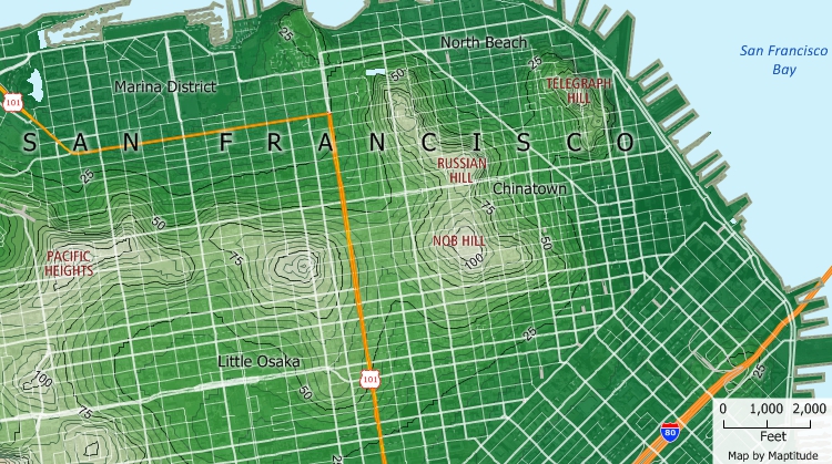
Contour maps show you attributes about terrain. For example, a contour map could show you where lower locations prone to flooding are. Weather maps also frequently use contours to show temperatures.