Mapping Software and GIS Glossary
Relief is the variations in the elevation of the ground surface, also features of height above a plain or reference datum. On a relief map, relief is depicted by hachures or shading, or, more accurately, by contours or by spot elevations or both.
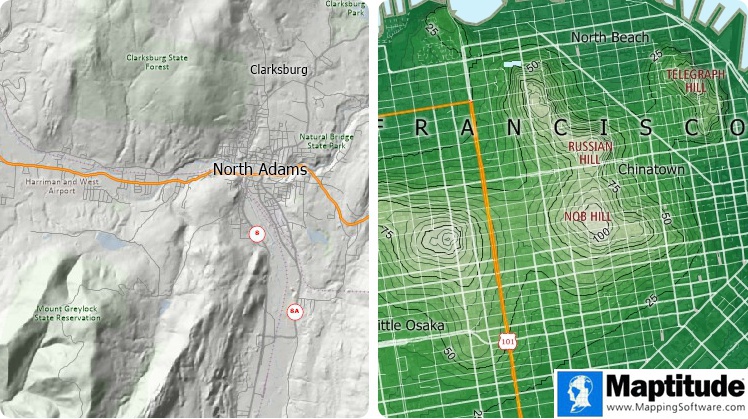
This relief map shows elevation contours. Hills are steeper where the contours are closer together and higher where the color is lighter. The darker relief contours are labeled to show their elevation above sea level.
Maptitude Mapping Software gives you all of the tools, maps, and data you need to analyze and understand how geography affects you and your business. With Maptitude you can create relief maps that use contours.
Learn More Free Trial Free for Students/Teachers
![]()
![]()
![]()
![]()
![]()
![]()
![]()
![]()
Home | Products | Contact | Secure Store
