Tutorials
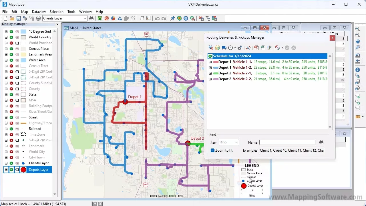
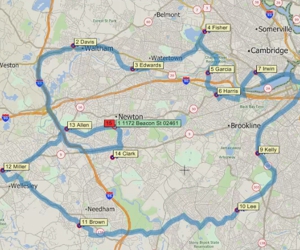
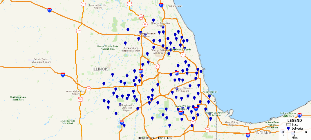
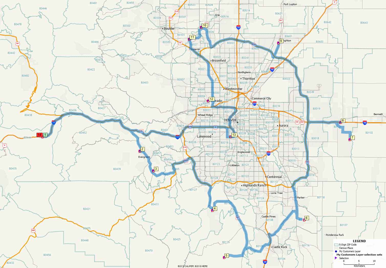
Vehicle Fleet Routing and Logistics
Creating optimized delivery and/or pickup routes for a fleet of vehicles with Maptitude mapping software.
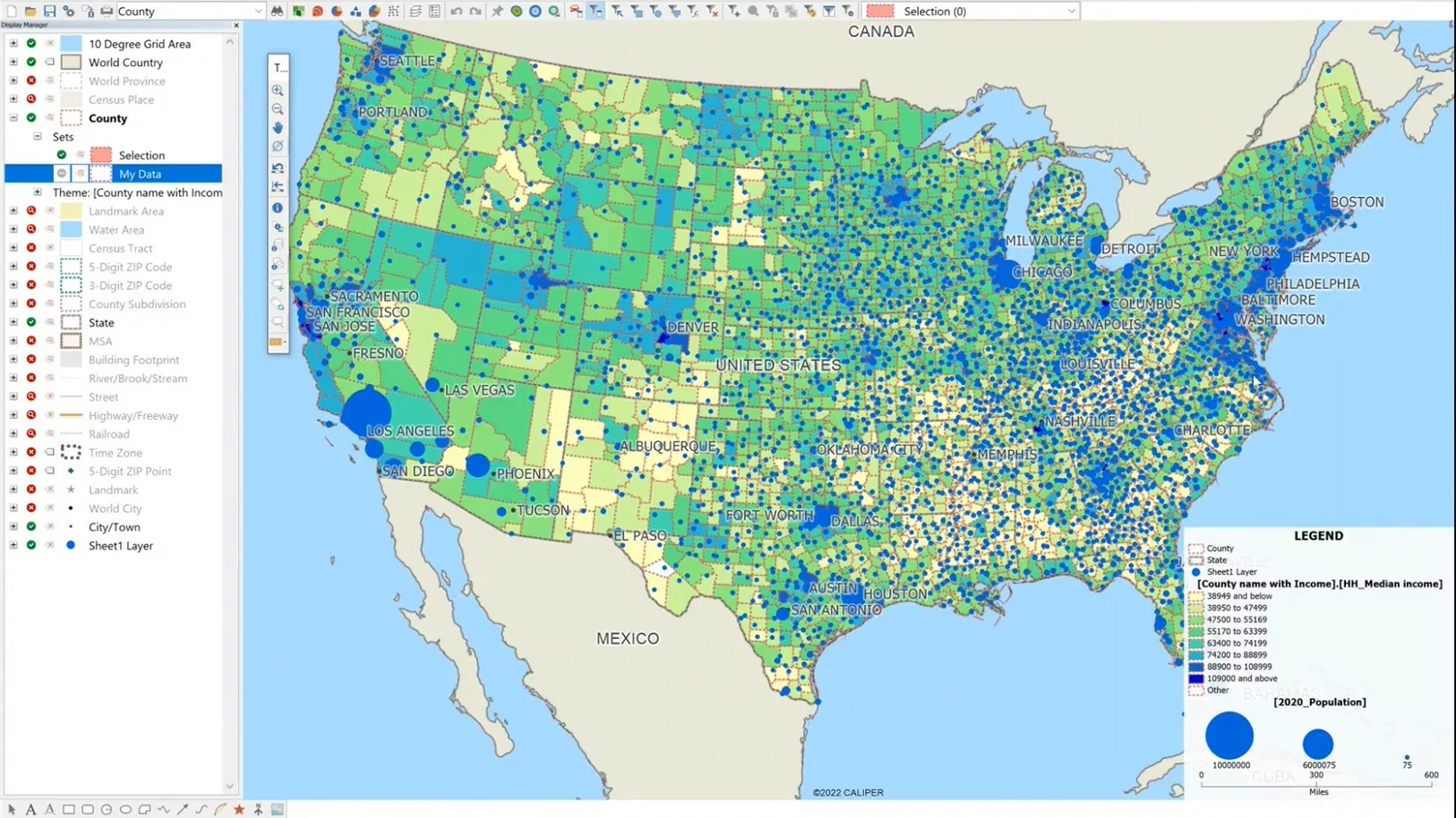
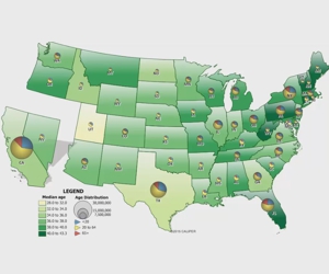
How to create County maps with user data in the US
This video shows how user data can be used to map at the County level in the US. The first part of this video shows how to locate user data by county. This will create a map showing points inside of counties. The second part of the video shows how to Show County boundaries with …
How to create County maps with user data in the US Read More »
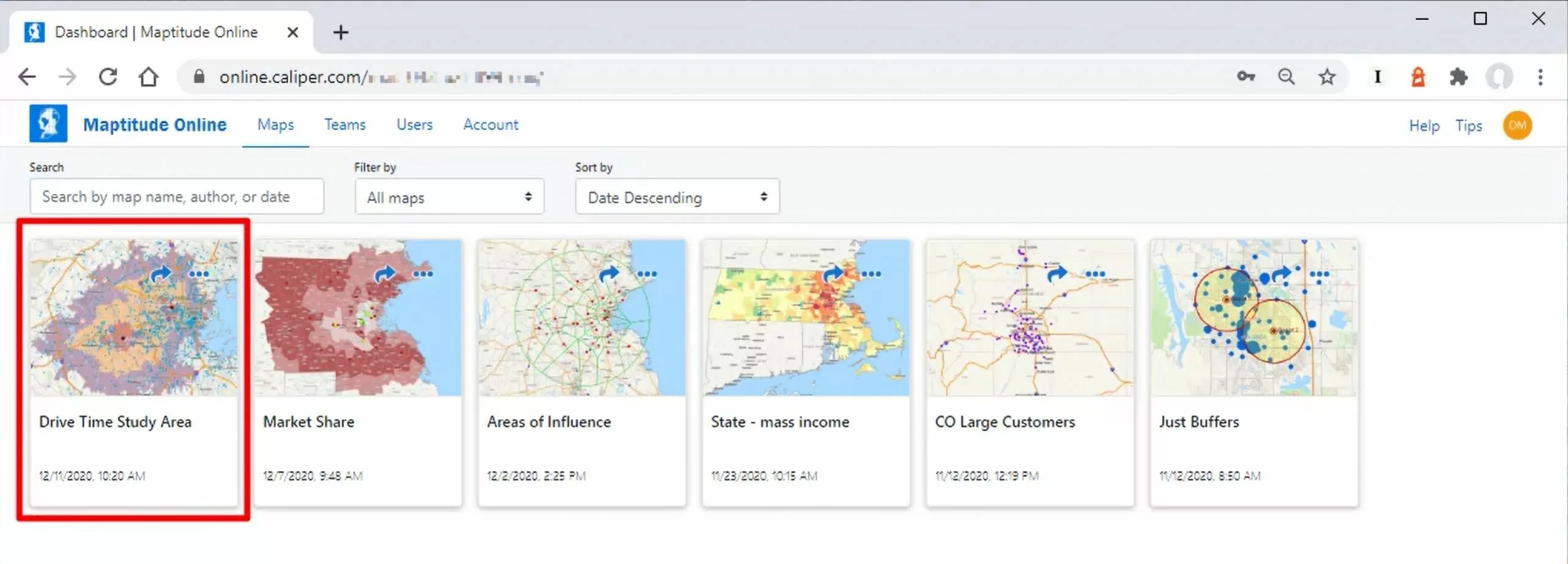
How to Upload Your Maps to Maptitude Online
How to upload and share your maps using Maptitude online
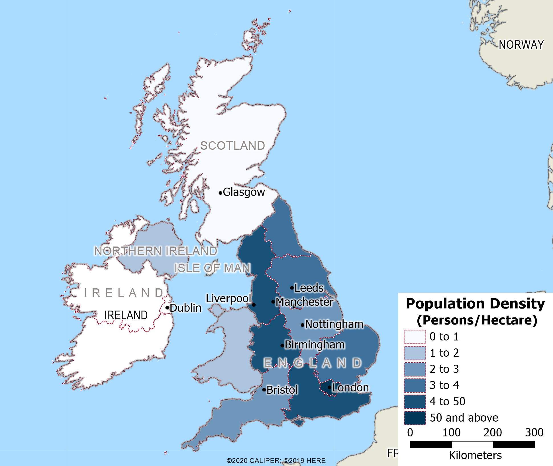
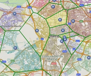
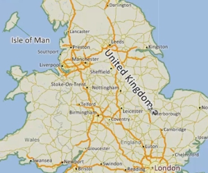
Using Maptitude with the UK & Ireland Country Package
This video shows how to map and analyse your data using Maptitude and the United Kingdom Country Package.
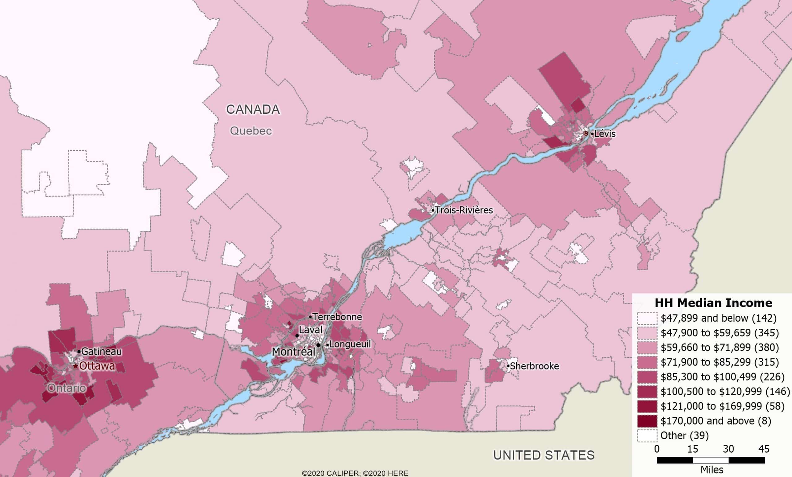
Using Maptitude with the Canada Country Package
This video shows how to map and analyse your data using Maptitude and the Canada Country Package.
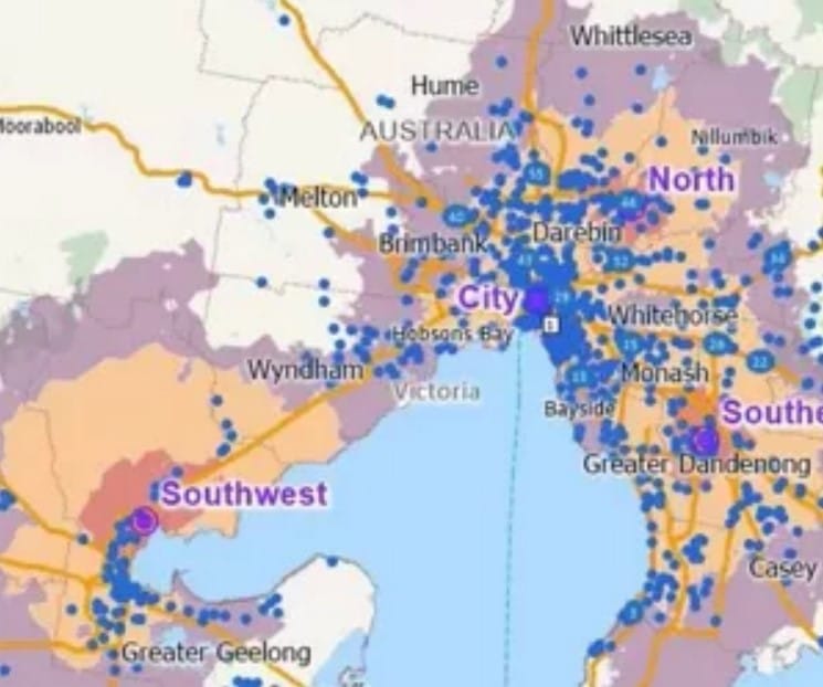
Using Maptitude with the Australia Country Package
This video shows how to map and analyse your data using Maptitude and the Australia Country Package.
Saving Maptitude Maps to Other Graphic Formats
Saving Maptitude maps to different graphic file formats and using Maptitude maps in other applications
Attaching Data from Nearby Features
How to tag features in a layer with data from nearby features in another layer
Joining Your Data to a Maptitude Map
How to join data in a spreadsheet or table to a layer in a Maptitude map
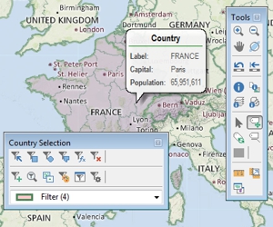
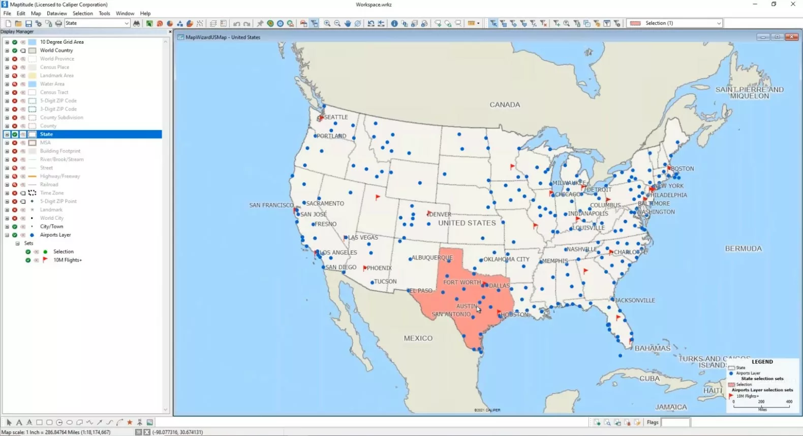
Working with Maptitude Selection Sets (Filters)
Using the selection tools, selecting features by location or condition, combining selection sets, and computing statistics
Measuring Distance, Area, and Feature Proximity
Using the measuring tools to find distance or area, and determining the proximity of map features
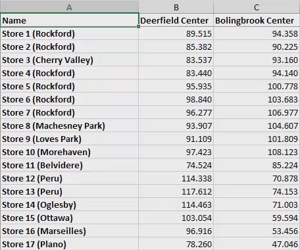
Creating Travel-Time Tables
A walkthrough of creating travel-time and distance matrices and tables to find distances and times between groups of locations
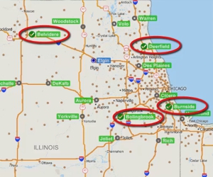
Solving a Facility Location Problem
Finding the best location for one or more facilities from a set of possible locations
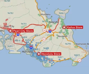
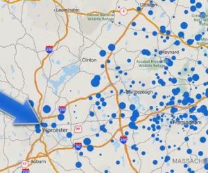
Creating a Pin Map by Locating Your Data on a Maptitude Map
Locating (geocoding) your data on a map automatically with the Locate commands or by manually pointing on a map
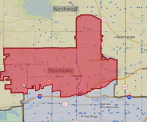
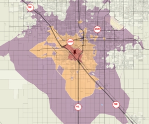
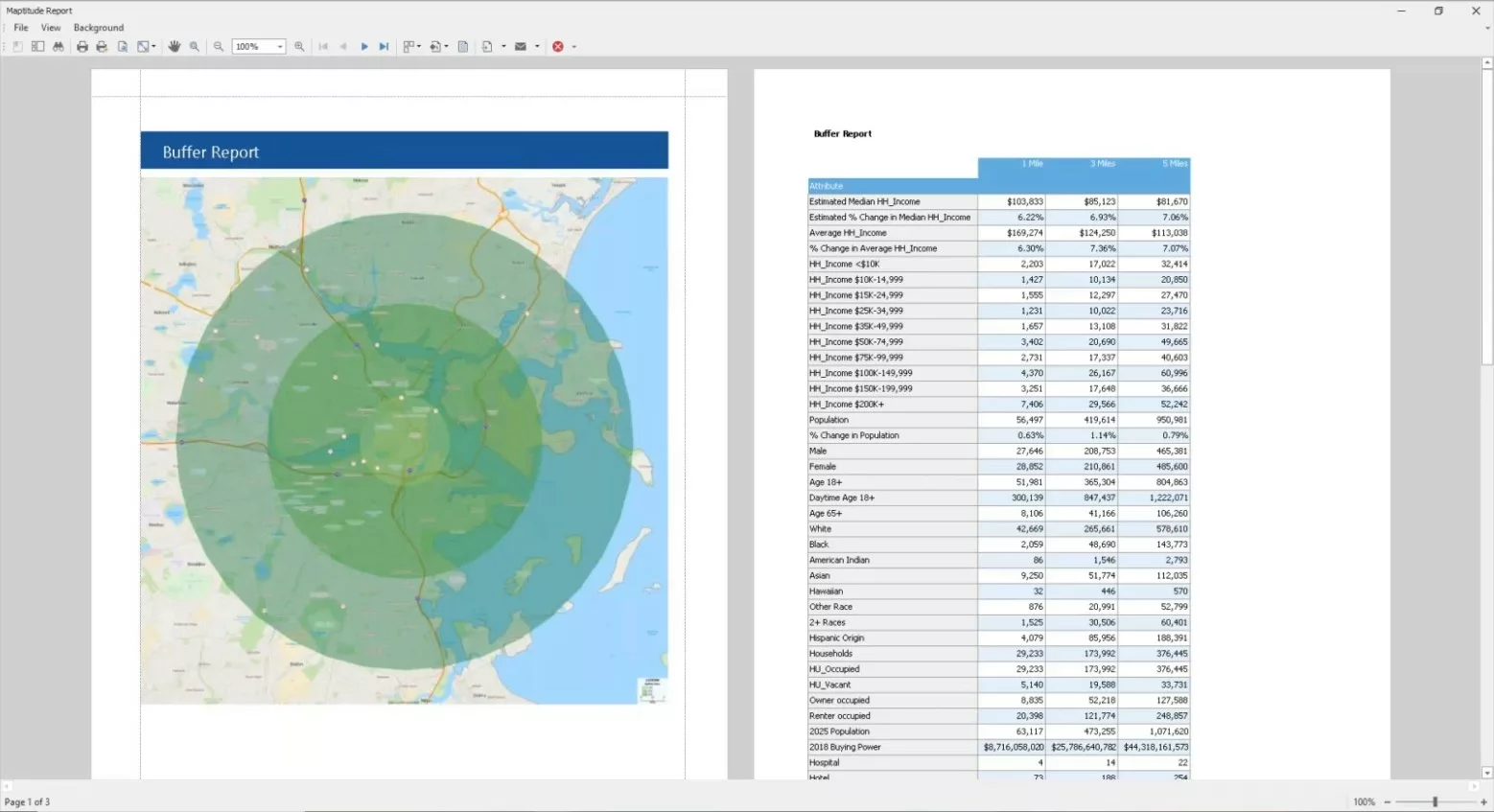
Areas of Influence and Network Partitions
Creating catchment areas based on proximity to features in a point layer based on straight-line distance or driving-distance.
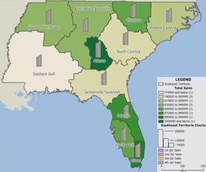
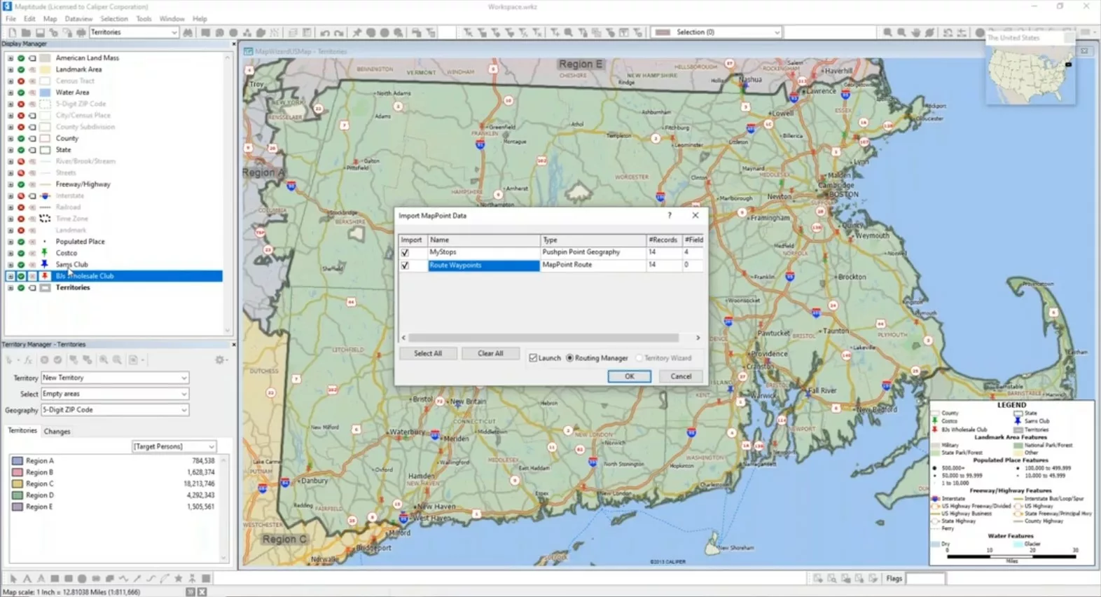
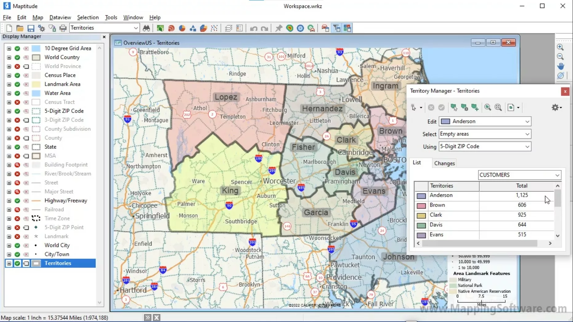
Working with Territories in Maptitude
Using the Maptitude Territory Manager to create and modify territories in a territory layer
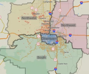
Creating Territories in Maptitude
Using the Maptitude Territory Wizard to create and modify a territory layer
Finding Shortest Paths and Routes with Maptitude
Using the Maptitude Routing & Directions Manager to find and optimize routes
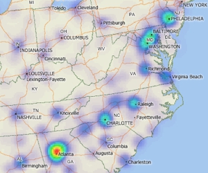
Creating a Maptitude Hot-Spot Density Grid Map
Using a density grid based on features in a point layer
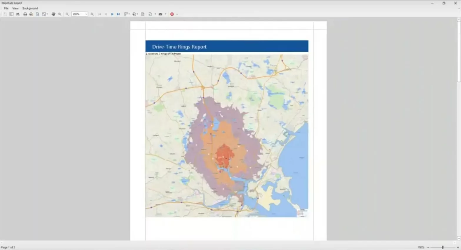
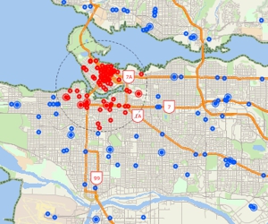
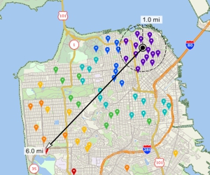
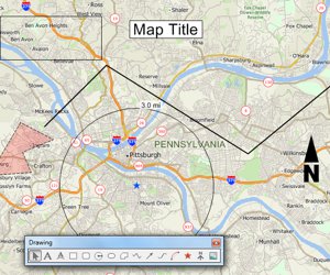
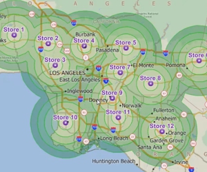
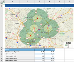
Creating Drive-Time Rings in Maptitude
Using Maptitude to create rings based on the time it takes to travel over a street network from one or more origins
Linking and Updating Data
Creating a point file that is linked to your data and updating it when the source data change
Using the Maptitude drawing tools
An introduction to using the tools on the Drawing toolbar for embellishing a map and performing basic analysis
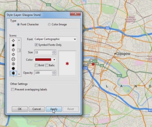
Working with Labels on Maptitude Maps
Modifying layer, feature display, and individual labels in a map
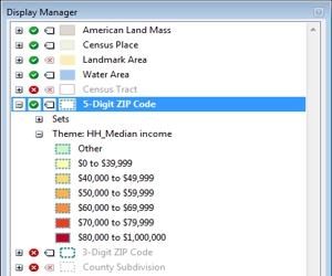
Using the Maptitude Display Manager
How to change the contents, styles, and labels in a map with the Display Manager
Using Other Geographic File Formats in Maptitude
Using files stored in other geographic file formats (e.g., Esri Shapefile, Google Earth KMZ file) in Maptitude
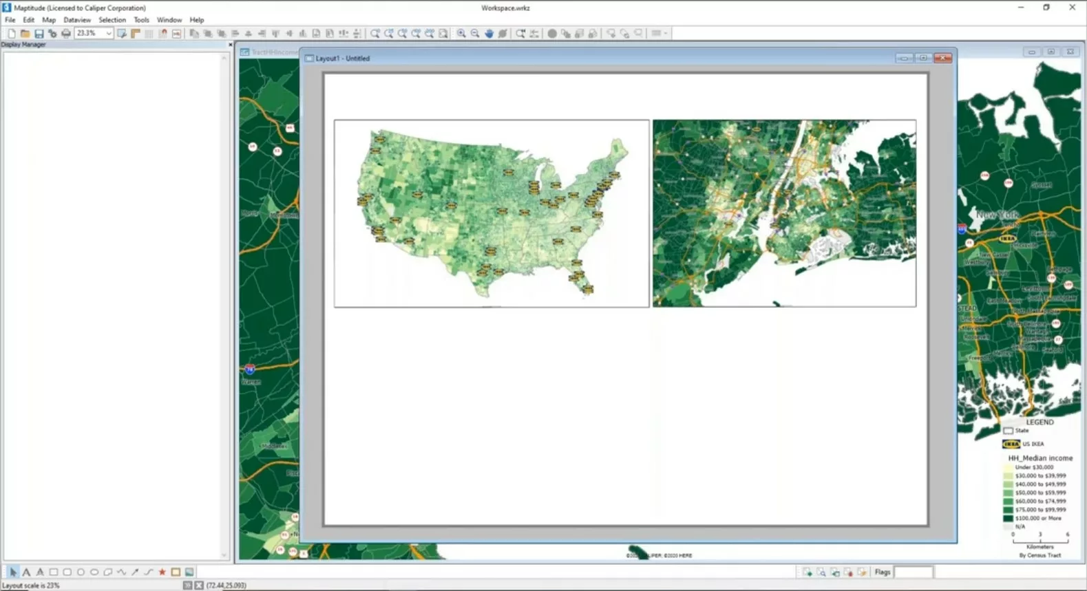
Using Aerial and Satellite Imagery in a Maptitude Map
How to add images to a map and access online image resources
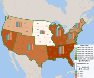
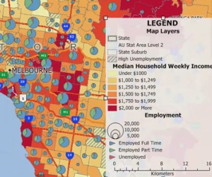
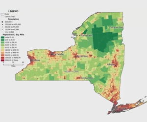
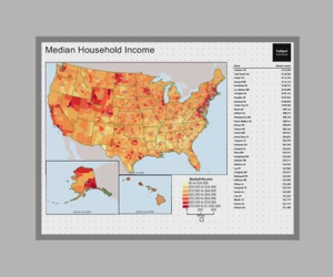
How to Make a Thematic Map in Maptitude
Using the MapWizard® tools to create color/heat themes, chart themes, dot-density themes, 3D themes, and scaled-symbol size themes, pattern and multiple symbol themes, and bubble theme maps.
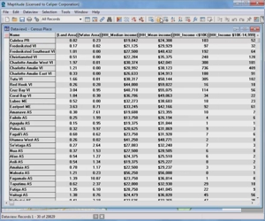
Working with Data in Maptitude
Using the Info tool, displaying data in a dataview, and working with dataviews
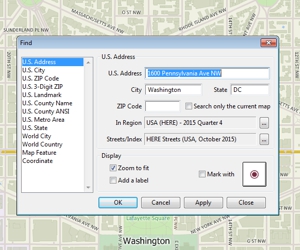
Moving Around a Maptitude Map
How to zoom in and out on a map, pan a map, use the map locator, and find a particular location on a map
Creating an Overview Map with Maptitude
Creating a general purpose map with Maptitude using Create-a-Map Wizard™ or the Map Librarian
Basic Maptitude Concepts
An introduction to basic Maptitude concepts including toolbars, help, shortcuts, context-sensitive menus, the working layer, and workspaces
Creating a Maptitude Map Using Your Own Data
Using Maptitude Create-a-Map Wizard™ to show your data joined to postal codes and to geocode (pin map) your data by street address
Webinars
Creating Points, Lines, Areas and Buffers Interactively
Webinar on creating points, lines, areas, and buffers in Maptitude