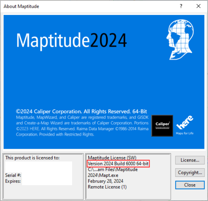
As we improve the Maptitude software, new “builds” of the software are released with incremental improvements. You can see which build of the software you are using by going to Help>About… from the main toolbar.
For details on what has changed in the latest version, see the new features page and the Maptitude 2024 PDF.

If you have Maptitude 2024, you can get the latest version of Maptitude 2024 by going to Help>Check for Updates and clicking on the link.
Below are the release notes for the different builds of Maptitude:
| Build # | Ship Date | Release Notes |
| 6000 | 2/28/2024 | Initial Release |
| 6005 |
3/8/2024 |
Increased processing speed in the Multiple Vehicle Routing tool |
| Improved geocoding for Canada | ||
| Fixed loading of dataviews when adding external layers | ||
| Improved behavior of running total fields when selecting/deselecting areas | ||
| Web Geocoding now defaults to using unlocated points |
||
| 6010 |
5/10/2024 | Improved handling of unicode characters |
| Added warning messages when modifying the codepage | ||
| Improved importing of ESRI shapefiles | ||
| Locate tools provide a warning if input fields are missing | ||
| Improved default field matching when geocoding | ||
| Feature display settings can now be created for point layers | ||
| Improved handling of xls and csv files | ||
| Added support for OpenStreetMap (OSM) geocoding | ||
| Improved handling of drive-time rings with large point sets | ||
| Distance and travel time tables can now be cancelled mid-process | ||
| Routing tool fuel cost now defaults to UK measurements for UK regions | ||
| Maps now redraw automatically when creating a mask | ||
| Streamlined the reports from the Multiple Vehicle Routing tool | ||
| Locate by coordinate can now accept string fields | ||
| 6015 | 5/31/2024 | Added a new option in the routing manager to copy an existing route |
| Cost by driving time is now included as a variable in the Multiple Vehicle Routing tool | ||
| The Routing Manager export to Excel now includes a summary sheet | ||
| 6020 |
6/12/2024 |
Multiple Vehicle Routing Tool automatically recalculates time when moving stops manually |
| Updated the side panel help for the Multiple Vehicle Routing tool | ||
| Various other improvements and fixes to the Multiple Vehicle Routing tool | ||
| Map labels can now use OpenType fonts | ||
| 6025 |
7/12/2024 |
The Multiple Vehicle Routing tool can now minimize either travel time or stop time |
| Added the ability to create a new route based on the stops of an existing route | ||
| Various additional improvements and fixes to the Multiple Vehicle Routing tool | ||
| 6030 |
7/26/2024 |
Reformatted the routing speed adjustment window for high-resolution screens |
| Improved geocoding summary report | ||
| Various improvements and fixes to the Multiple Vehicle Routing Tool |