
Author:
Stewart Berry
8 January 2025
As 2025 unfolds, map drawing software has evolved with new tools prioritizing customization, usability, and advanced data visualization. From professional cartography to hobbyist projects, the latest advancements empower users to create visually compelling maps that meet diverse needs.
Maps are invaluable as an intuitive data visualization. When customization is needed, drawing tools are essential for helping communicate the business data contained in your maps. Drawing tools allow you to directly edit your maps. You may need to add a legend with a north arrow, draw pointers with text to identify important sites, add a title, manually add pushpins, show lengths and areas, edit circles/radii, or make any other number of stylistic changes.
But which application has the strongest toolset for map customization? Continue reading to explore our meticulously curated list of the ten best map drawing software solutions. Uncover the distinctive features of each tool to make an informed decision that aligns perfectly with your business needs.
Looking for reliable map drawing software to meet your needs in 2025? You've come to the right place! In this blog post, we'll present the top ten map drawing applications. Keep reading to discover the best options, with Maptitude taking the number one spot!
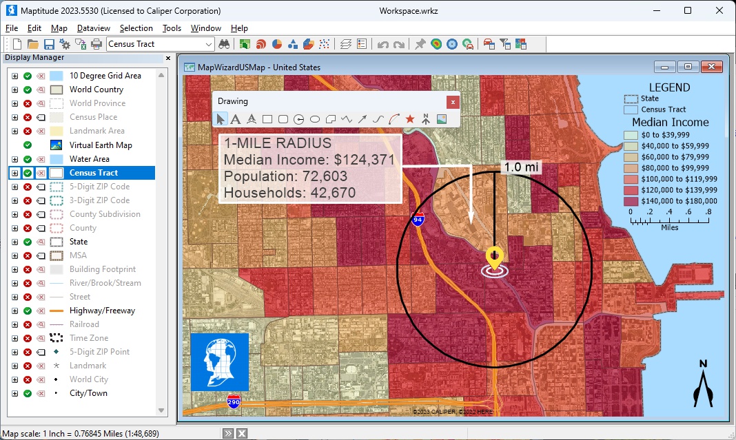
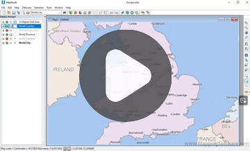
Maptitude is the best professional map drawing software for 2025, offering tools for professional users and businesses. Maptitude allows you to customize any element of the map in addition to providing an extensive drawing toolkit. You can control map labels, change map layer styles, design thematics, perform geospatial analysis, and more. Maptitude lets you embellish your maps by adding text, symbols, lines, circles, rectangles, images, and other graphics. There is almost no limit to the customizations you can make. You can, for example, use legends and any number of drawing items to enhance a map so that it communicates more effectively and looks more attractive.
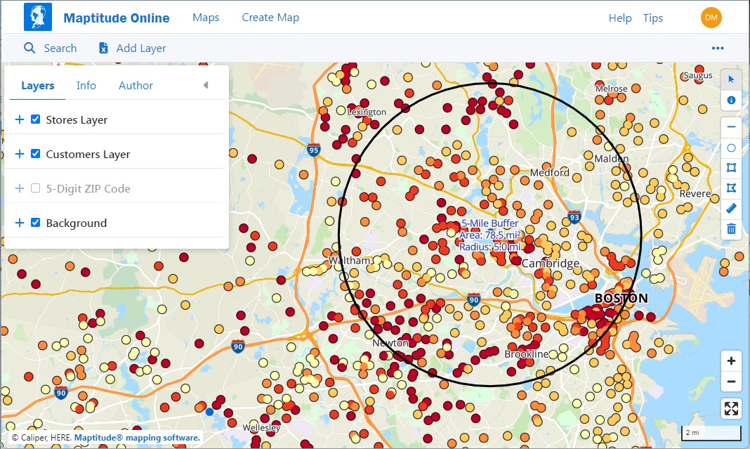
In 2024, it introduced hierarchical layer management, enabling users to efficiently organize and manage regions, districts, and other territories. Maptitude also updated its geographic and demographic datasets, ensuring access to the most accurate information available. The Maptitude Online platform allows users to create and share maps as web applications, enhancing collaboration across teams. These updates solidify Maptitude as a powerful tool for both novice and expert users.
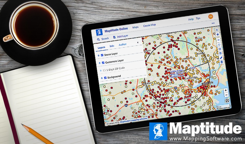
Maptitude empowers you to create visually compelling maps whether on the desktop or on any device or operating system when using the Cloud-based Maptitude Online.
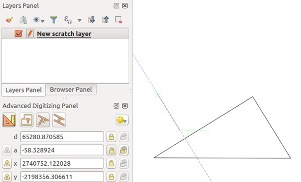
Learn how to use online map drawing tools or download Maptitude for sophisticated map editing.
To draw on this map:
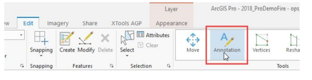
ArcGIS Pro provides map drawing capabilities, supporting cartography and layout design. Users can create maps incorporating various elements such as legends, scale bars, and annotations.
ArcGIS Pro continues to dominate professional mapping, thanks to its robust editing tools and integration with Esri’s extensive GIS ecosystem. The 2024 updates focused on improving annotation workflows, enhancing symbology tools, and refining the layout designer for creating detailed maps tailored to specific audiences. These updates, combined with its powerful geospatial analysis capabilities, make ArcGIS Pro indispensable for advanced cartography and map drawing.
ArcGIS Pro integrates with the broader ArcGIS ecosystem, allowing users to leverage additional tools, datasets, and services and is mainly used by GIS professionals.
QGIS is GIS Software, is free, and provides tools for map drawing, and for creating, editing, and customizing maps. It offers a variety of symbology options, allowing users to visually enhance their maps. QGIS supports a wide range of plugins, making it customizable for various spatial analysis tasks. It also has a user community, for questions on how to use this opensource tool. It is primarily used by GIS professionals.
QGIS is a popular open-source alternative for map drawing, providing exceptional flexibility and a thriving plugin ecosystem. In 2024, QGIS introduced tools for line smoothing, improved its symbology editor, and enhanced plugin compatibility for advanced users. These updates allow cartographers and GIS professionals to create more polished and accurate maps. QGIS’s open-source model also ensures accessibility for users of all budgets.
Mapbox Studio offers unparalleled customization options for developers and designers creating highly interactive and visually engaging maps. In 2024, Mapbox expanded its 3D rendering capabilities, introducing detailed city landmarks and improved map style controls. Updates also enhanced performance for high-resolution basemaps and supported new tools for real-time data visualization. These features make Mapbox a top choice for those seeking cutting-edge map drawing technology.
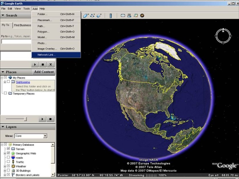
Google Earth Pro is also free and allows users to draw and customize paths, shapes, and placemarks directly on the globe. It's a user-friendly tool for creating interactive maps with personalized annotations. Google Earth Pro allows users to import and visualize data alongside Google's vast satellite imagery. It serves as a valuable tool for creating presentations and visualizations.
Google Earth Pro continues to provide powerful visualization tools for geographic storytelling. In 2024, Google Earth Studio received updates to its animation tools, enabling users to create smoother, more dynamic map presentations. The expanded global 3D imagery offers greater detail for terrain and landmarks, enhancing its appeal for educators, researchers, and media professionals. Google Earth Pro remains a staple for users requiring immersive, presentation-ready maps.
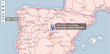
CARTO supports map drawing, allowing map creators to design dynamic online maps. It provides tools for customizing styles and adding informative elements. It also integrates with “draw” tools from Leaflet. CARTO's cloud-based platform facilitates map creation and analysis, with the ability to customize the functionality, look, and feel of the interface. It's suitable for businesses that want to develop a location intelligence solution on the CARTO platform.
CARTO combines data-driven mapping with advanced visualization capabilities, making it ideal for businesses and analysts. The 2024 updates include dynamic clustering for large datasets, new styling properties like _carto_point_density for point-based visualizations, and streamlined data import processes. These tools enhance CARTO’s functionality for creating engaging and insightful maps for decision-making and storytelling.
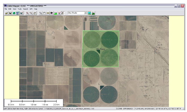
Global Mapper enables users to create, edit, and annotate maps. It supports many file formats, making it versatile for data import. Global Mapper's interface makes it another choice for geospatial professionals. It also offers scripting capabilities for automating repetitive tasks.
Global Mapper excels in handling large datasets and advanced 3D visualizations. In 2024, it introduced enhancements for managing larger geospatial files and improved tools for creating high-quality 3D maps. With scripting capabilities and robust format support, Global Mapper is perfect for large-scale geospatial projects requiring precise and automated workflows.
Google My Maps benefited from a major update in August 2024, introducing modernized map pins and enhanced map styles. These updates improve visual clarity and usability for creating and sharing simple, interactive maps. While it remains a lightweight tool, these changes make it more appealing for casual users and small businesses looking for quick, easy-to-share maps.
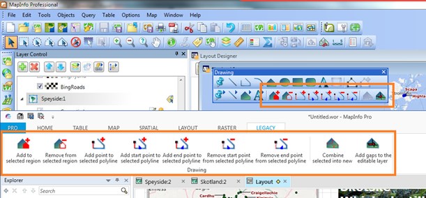
MapInfo Professional is designed as a GIS, allowing users to make thematic maps and customize visual elements. It has a suite of drawing tools in the Annotation Toolbar, as well as geographic editing tools. MapInfo Professional can create thematic maps and supports spatial SQL queries, enabling map makers to perform complex spatial analysis directly within the application.
MapInfo Pro caters to advanced users needing precise mapping and data analysis capabilities. The 2024 updates improved workflows for map editing and introduced better integration with external databases. These features enhance its suitability for professional applications, including market research and urban planning.
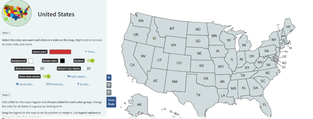
MapChart is a free online tool for creating simple custom maps. It's perfect for students, hobbyists, and anyone else on a budget.
MapChart's specialty is regional and country maps, but you can also use it to create maps of any region or country in the world. It's easy to use, even if you're new to mapmaking. You can color code countries and states, add patterns, create legends, and hide certain countries and states. You can also save your maps to work on later or download them to share.
MapChart is a user-friendly platform for creating simple, visually appealing maps. Its 2024 updates added new templates and export options, making it easier for educators, hobbyists, and small businesses to create maps tailored to their needs. While less advanced than other tools on this list, its simplicity and accessibility ensure its continued relevance.
MapChart isn't as powerful as some other mapping software, but it's a great option for simple projects. MapChart also contains ads.
The following do not make the top 10 list, but are still valuable tools but cater to specific needs like lightweight mapping, creative projects, or advanced geospatial analysis.
In 2025, the best map drawing software continues to set benchmarks for intuitive design and powerful capabilities, enabling users to create maps that communicate data effectively and creatively. Each of these map drawing platforms offers unique capabilities and features that can be used to help organizations customize and personalize their visualizations. However, as shown in the rankings above, Maptitude is the perfect choice for businesses seeking to generate impactful maps that can boost their bottom line.
For those seeking a comprehensive map drawing solution, Maptitude stands out with intuitive tools for freehand drawing as well as for map style and layer customization. With all these great tools, at an unbeatable price point, there's no better map drawing software around.
Learn more about Maptitude to see how you and your team can benefit from mapping software!
Schedule a Free Personalized Demo
 Check out our G2 Reviews
Home | Products | Contact | Secure Store

