
Author: Stewart Berry

Amazon is performing a competitive site selection process and is considering metro regions in North America for its second corporate headquarters.
The Maptitude mapping software is an excellent tool for data analysis and visualization. We will use several different Maptitude tools to explore how they work together to provide tangible results. As an exercise we will:
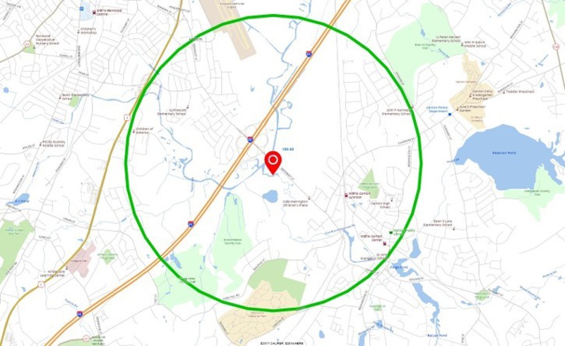
First, we will filter the metro areas that meet the population and educational requirements, by having at least:
The existing Seattle HQ MSA meets these criteria, so it seems that we are on the correct path!
These cities meet the above criteria.
Each of the MSAs contains a major airport as required by the RFP.
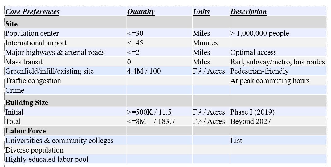
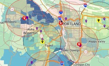
We will now focus on the Boston MSA to see how it meets the Amazon criteria.
We created a 30-mile ring and a 45-minute drive-time ring that encompass:
We then extract the demographics for those rings to list the higher education institutions, explore the racial/ethnic/gender diversity of the region, and to list the airports in the region.
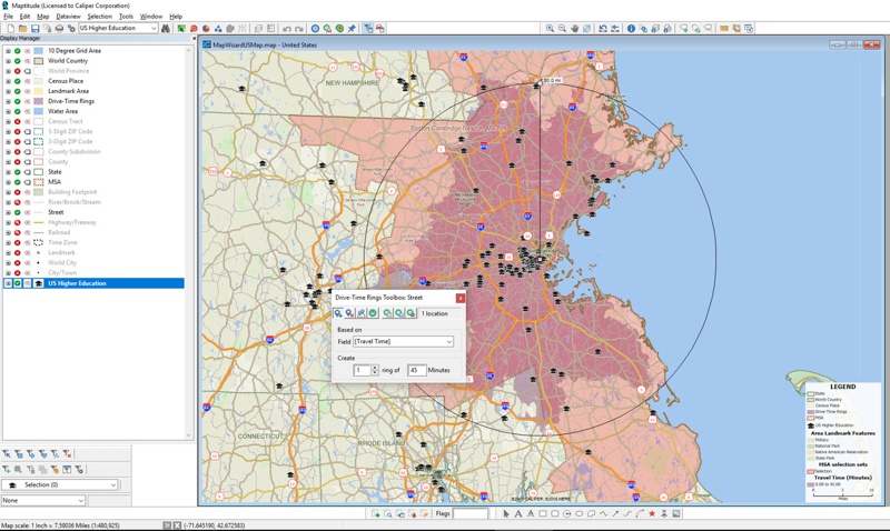
The above analysis is possible with Maptitude mapping software out-of-the-box. We are now going to geocode our address list of potential site locations and analyze their suitability:
We obtained and geocoded in Maptitude a list of brownfield sites
In this exercise, we will not be looking at greenfield sites
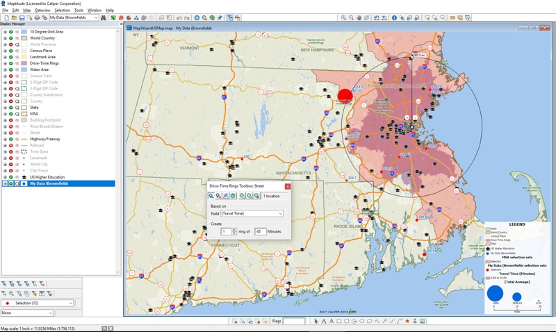
The former Canton Airport site has the most commuter rail stations in the closest proximity. This site is also adjacent to a major interstate intersection and many amenities.
Mapping software has progressed to the point that wizard-driven tools, embedded data, and intuitive interfaces mean that even novice users can tackle and explore complex tasks. We call this "Mapping without Tears"™. We were able to quickly explore the criteria laid out by Amazon with the US$795 Maptitude software.
The former Canton airport site may have been converted into a park, but is listed as a brownfield site by the MA DEP. Maybe losing a park for an Amazon HQ would be an acceptable trade-off for residents!
Learn more about Maptitude to see how you and your team can use Maptitude in data science and research analysis!
Schedule a Free Personalized Demo
Home | Products | Contact | Secure Store
