Maptitude vs. GeoLibre
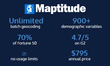
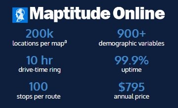
Maptitude is a commercial business mapping platform that includes the data and the analysis tools with the license: 900+ demographic variables, streets, and boundaries, plus 70+ tools in Maptitude Online and 150+ in Desktop Maptitude, for a flat $795 per year. The tables below set Maptitude, Maptitude Online, and GeoLibre side by side, row by row, across platform, data formats, analysis, cartography, and automation.
The comparison is useful in both directions. If your work is territory design, drive-time markets, site selection, or demographic analysis, and you would rather not assemble and license the data yourself, Maptitude is built for that.
About this comparison, and who wrote which column
The row structure and the GeoLibre column come from the comparison published by the GeoLibre project at geolibre.app/comparison, reproduced unedited and current as of August 2026. The Maptitude and Maptitude Online columns are ours: we researched and wrote those cells, row by row, for this comparison.
GeoLibre does not review, verify, or endorse this page, and we do not speak for GeoLibre: for the current, authoritative account of what it does, see the GeoLibre feature list. Found something out of date about GeoLibre? Report it to the GeoLibre issue tracker. Found something out of date about Maptitude? Tell us and we will correct it.
Maptitude Online Free Trial Maptitude Desktop Free Trial Request a Demo
In this article:
Cartography, styling, and layout
Automation, extensibility, and sharing
Where each one is the right choice
Where GeoLibre is not the strongest option
Comparison
| GeoLibre | Maptitude | Maptitude Online | |
|---|---|---|---|
| License | MIT, open source | Proprietary | Proprietary |
| Cost | Free | $795/year, or $1,095 for a one-time license (single user) | $795/year |
| Browser | Full app, nothing to install | No, installed desktop application | Yes (the product is the browser app) |
| Desktop | Windows, macOS, Linux (Tauri) | Windows; on a Mac it runs via Windows | Not available |
| Mobile | Native Android and iOS apps; responsive touch layout | Windows tablets, with GPS tracking and field collection | Responsive browser interface carrying the full toolset; no app |
| In Jupyter | Full app as an anywidget, two-way sync | Yes, out of process: a notebook drives Maptitude through the caliperpy package, not the UI | Not available |
| Works offline | Yes — PWA install, offline area download, desktop build | Yes, fully, including geocoding, routing, drive-time analysis, and demographics1 | No, requires a connection |
| Where your data lives | Your device — processed client-side in the browser session | Your device or your own network; by default, location data is not sent to outside mapping or geocoding services | Vendor cloud, hosted on AWS; geocoding, routing, map tiles, and demographic data all run on Maptitude infrastructure, so location data is not sent to outside mapping or geocoding services |
| Project file | .geolibre.json (open, documented) | Workspace, .wrkz (proprietary) | Hosted map on a stable share URL (no local file) |
Platform, license, cost, and data location. Rows and the GeoLibre column from geolibre.app/comparison; Maptitude columns written by us.
| GeoLibre | Maptitude | Maptitude Online | |
|---|---|---|---|
| Format breadth | Wide — DuckDB-WASM Spatial plus in-house readers | Wide: read and write over 50 file types and 100+ GIS and CAD formats | Excel, CSV, Google Sheets, Maptitude Desktop map uploads |
| Cloud-native vector | GeoParquet, FlatGeobuf, PMTiles, streamed over HTTP range requests | FlatGeobuf, read and write; no GeoParquet or PMTiles | Not available |
| Cloud-native raster | COG, Zarr, Cloud-Optimized NetCDF/HDF, kerchunk, MBTiles | MBTiles, GDAL Virtual Raster (VRT), GeoTIFF, ECW, MrSID, JPEG2000, ERDAS IMG, and USGS orthophotos; no COG or Zarr | Satellite and street basemap imagery as background layers |
| STAC | Built-in catalog browser + STAC Index discovery | Not available | Not available |
| OGC services | XYZ; WMS/WFS/WMTS discovered via GetCapabilities; OGC API Features/Tiles from a landing page, collection, or items URL | OGC WMTS, WMS, and XYZ/TMS | Not available |
| Esri services and geodatabases | ArcGIS FeatureServer, VectorTileServer, I3S, plus local .gdb File Geodatabase folders (desktop) | Shapefile read and write, File Geodatabase and Feature Class, Personal Geodatabase, ArcSDE geodatabase (needs ArcGIS installed), Arc ASCII Grid, E00, Ungenerate, and ArcView 3.x project and legend files | Not available |
| Databases | PostGIS browsing, DuckDB, in-browser PGlite/PostGIS | SQL Server Spatial, PostgreSQL/PostGIS, Oracle Spatial, Access, and ODBC, as live linked layers; built-in relational engine holding up to 2.14 billion records per table | Not available |
| 3D and point clouds | LiDAR, 3D Tiles, I3S, Gaussian splats, glTF/GLB, Cesium globe pane | 3D views, models, and fly-throughs, 3D prism and cylinder themes, DEM/TIN surfaces, viewsheds and lines of sight | Not available |
| Planetary basemaps | Moon, Mars, Mercury, Venus, Galilean moons, Titan, Pluto, Charon — with a per-project ellipsoid driving measurements | Not available | Not available |
File formats, services, databases, and 3D. Rows and the GeoLibre column from geolibre.app/comparison; Maptitude columns written by us.
| GeoLibre | Maptitude | Maptitude Online | |
|---|---|---|---|
| Geoprocessing tools | 1,000+ (Whitebox suite + GeoLibre's own), running in the browser on WebAssembly | 1,000+ (GISDK function library, plus built-in tools, wizards, and free add-ins) | 70+ built-in tools, each a step-by-step wizard |
| Where analysis runs | Your browser (WASM), no server required; optional Python sidecar on desktop | Your machine | Vendor cloud |
| Vector analysis | Buffer, overlay, dissolve, joins, selection, topology checks — Turf.js, or GeoPandas via Pyodide/sidecar | Comprehensive: buffers, overlay with aggregation and disaggregation, dissolve, merge, intersect, union, clip, simplify, conflate, topological editing, point-in-area tagging, adjacency and SQL selection | Buffers and concentric rings, Voronoi catchments, weighted centers, aggregation to boundaries, filtering and selection |
| Raster analysis | Hillshade, slope, contour, zonal/focal stats, raster calculator, reclassify, mosaic — rasterio sidecar with a browser fallback | Surface and terrain analysis: contours, DEM and TIN export, viewsheds, lines of sight, least-cost path across a grid, image resampling | Not available |
| Spatial SQL | DuckDB Spatial, PGlite/PostGIS, and Apache Sedona — all in the browser | SQL conditions in queries and selection sets; live layers from SQL Server Spatial, PostGIS, and Oracle Spatial | No; visual multi-condition filter builder instead |
| Model / batch chaining | Batch runner with model and pipeline chaining | Batch add-ins and automated area layouts, chained with GISDK or Python scripts | Not available |
| Spatial statistics | Toolbox including Emerging Hot Spot Analysis | Moran's I, density surfaces, Huff gravity market share, regression and binary logit, capacity-limited clustering, and MCMC territory ensembles scored on Polsby-Popper and cut edges | Weighted heat maps and aggregation only |
| Network analysis | Isochrones, service areas, OD cost matrices, routing | Deep and fully local: drive-time and distance rings of any duration, drive-time territories, multi-stop shortest and fastest routes, vehicle routing with depots, capacities and time windows, origin-destination matrices, closest facility, facility location models | Drive-time rings up to 10 hours, route optimization up to 100 stops, turn-by-turn directions |
| AI / ML | AI Segmentation (SamGeo/SAM 3), in-browser ONNX/YOLO object detection | Natural-language demographic queries in Maptitude Online export tables for mapping on the desktop | Natural-language querying of the 900+ bundled demographic variables |
| Processing history | Every run listed, re-runnable, with copyable Python | Autosave every 1 to 30 minutes, undo and redo | Not available |
Geoprocessing, statistics, network analysis, and where the work runs. Rows and the GeoLibre column from geolibre.app/comparison; Maptitude columns written by us.
| GeoLibre | Maptitude | Maptitude Online | |
|---|---|---|---|
| Renderers | Single, categorized, graduated, rule-based, expression, heatmap, cluster, proportional symbols, diagrams | Color, pattern, category, dot-density, size and proportional symbol, pie and bar chart, 3D prism, plus four-color cartographic coloring (Dsatur) | Color, size, combined color and size, symbol, heat, weighted heat, cluster, cluster pie chart, pie and bar chart |
| Data-defined everything | Expression Builder wired into filters, labels, styling, field calculation, selection | Formula fields and conditions across themes, labels, selection, and calculated fields, plus label priority and alternate label fields driven by data values | Theme and filter fields chosen per layer through a visual builder |
| Labeling | Data-defined engine with placement, offset, rotation, wrap, dedup | Placement engine with rotation along lines, along latitudes, or to a set angle, plus priority, alternate fields, wrap, dedup, shields, and callouts | Layer and street label toggles |
| Print layout | Print Layout composer with legend, scale, title block, atlas / map series, PNG and PDF | Layout composer combining maps, legends, tables, and charts; large-format printing; automated one sheet per area; PDF and image export | PNG map and legend export, plus a viewer for PDF reports attached from the desktop |
| Style interchange | Imports and exports OGC SLD, QGIS QML, and Mapbox GL JSON | Theme and label settings files, map templates; Maptitude formats only | Not available |
| Project import | Reads QGIS .qgs/.qgz and ArcGIS Pro .aprx/.mapx | Reads its own workspaces; imports layers from 100+ GIS and CAD formats | Maps published from Maptitude Desktop |
| Story maps | Built-in story map builder with presenter view and standalone HTML export | Via Maptitude Online | Shareable maps, not chaptered stories |
| Dashboards | Dashboard panel of chart and indicator widgets with cross-filtering | Charts, plots, and filters in-map | Filters and chart themes in-map, plus view analytics for public maps |
Renderers, labeling, print output, and dashboards. Rows and the GeoLibre column from geolibre.app/comparison; Maptitude columns written by us.
| GeoLibre | Maptitude | Maptitude Online | |
|---|---|---|---|
| Scripting | Python Console, geolibre Python package, docked Jupyter notebook beside the map | GISDK included: 850+ functions from Caliper Script, Python (caliperpy, both directions), R, C#, and .NET, with a compiler and debugger | Not available |
| Notebook integration | The whole app embeds as a Jupyter anywidget with two-way project sync | Notebooks drive Maptitude via caliperpy, not the UI | Not available |
| Plugin ecosystem | TypeScript plugin API, built-ins, zip installs, bundled drop-ins | Free precompiled add-in library; custom add-ins in Caliper Script, .NET, or C# | Not available |
| AI assistant | Natural-language assistant that turns plain English into auditable, undoable operations; bring your own API key | AI help assistant for support questions | Natural-language demographic data library, plus an AI support assistant |
| Real-time collaboration | Yes (MVP) — hosted relay, optionally self-hosted — plus anchored review comments | Multi-user geographic file editing with locks and check-in; workspaces themselves overwrite rather than merge | Yes, simultaneous editing of the same map or territory with automatic merging, included in every subscription |
| Embedding | maponly and layout=viewer URL modes, a versioned postMessage API, and the typed @geolibre/embed npm client | .NET or COM component in your own application | Embeddable maps |
| Self-hosting | Docker image, or serve the static build anywhere | Runs on your own hardware; the Enterprise edition adds Citrix Server | No, vendor-hosted SaaS |
| Standalone export | Whole project to one offline HTML file, no server | Image, HTML, and animated GIF export | PNG map and legend export |
Scripting, plugins, collaboration, embedding, and export. Rows and the GeoLibre column from geolibre.app/comparison; Maptitude columns written by us.
Maptitude Online Free Trial Maptitude Desktop Free Trial
Fit
The GeoLibre paragraph below is theirs, reproduced unedited. The two Maptitude paragraphs are ours.
Choose GeoLibre when you want a real GIS in a browser tab with nothing to install, your data has to stay on your machine, you work with cloud-native formats (COG, GeoParquet, PMTiles, Zarr, STAC), you want the same app on desktop, Android, and inside a notebook, or you are embedding a map workspace into your own product and want an open, documented project format and license.
Choose Maptitude when the work is business and market geography, territory design and balancing, site selection, trade areas, drive-time markets, and demographic analysis, and you want streets, boundaries, and thousands of Census and ACS variables included, running locally at a fixed price on Windows.
Choose Maptitude Online when a team needs territory, drive-time, and demographic mapping in a browser with nothing installed and no GIS background, at a fixed price with geocoding, routing, and demographics included rather than metered.
The GeoLibre project states its own limits plainly, and we reproduce them here unedited. These are their words about their own product:
Maptitude Online Free Trial Maptitude Desktop Free Trial
Cost and support
Open-source mapping tools can be powerful, and many organizations use them effectively. They come without the commercial infrastructure that Maptitude provides as standard:
Maptitude holds 4.7/5 from 150 verified G2 reviews. For a business team that needs mapping without GIS training, those differences matter.
Compare Maptitude, Maptitude Online, and GeoLibre on:
FAQ
Because for business geography the software is rarely the largest cost. A Maptitude subscription covers the demographic data, the street network used for geocoding and drive times, the territory and site-selection tools, phone and email support, free live training, and unlimited geocoding and routing within your plan.* Assembling and licensing those pieces separately usually costs more than $795 per year. If you already have the data and the GIS skills, free software is a reasonable choice.
Yes. Maptitude Online and Desktop Maptitude both offer a 30-day free trial with no credit card. You can run either one next to GeoLibre on the same dataset and compare the output before you commit.
Maptitude Online Free Trial Maptitude Desktop Free Trial Request a Demo
* Unlimited up to 20GB storage per account. All public and private map loads count toward a combined 100,000 map loads per month. If that allowance is exceeded, shared maps continue to run without interruption.
1 Desktop Maptitude runs all mapping functions (geocoding, routing, drive-time analysis, and demographic queries) locally on your computer. The default installation uses a software key with periodic online license validation, and some features such as online background imagery need a connection. Fully air-gapped configurations, with manual activation and no online check-ins, are available free on request from Maptitude support.
The row structure, the GeoLibre column, the "Choose GeoLibre when" paragraph, and the "Where GeoLibre is not the strongest option" list are reproduced from the GeoLibre documentation, which is published by the GeoLibre project under the MIT License. GeoLibre neither reviews nor endorses this page. The Maptitude and Maptitude Online columns are our own work.
GeoLibre is a trademark of its respective owner. QGIS, ArcGIS, ArcGIS Pro, CARTO, Felt, and kepler.gl are trademarks of their respective owners, referenced here only within quoted material. Maptitude is a registered trademark of Caliper Corporation.

 Check out our G2 Reviews
Third-party trademarks are used for identification and descriptive purposes and do not imply affiliation or endorsement. See Third-Party Trademarks.

Home | Products | Contact | Secure Store
 Call Us

