Mapping Software and GIS Glossary
Coordinates are linear and/or angular quantities that designate the position of a point in relation to a given reference frame. In a two-dimensional plane, x and y are commonly used to designate coordinates of a point. Latitude and longitude are used together to specify the coordinates of a precise location on the Earth. GIS and GPS are useful tools for finding the longitude/latitude coordinates of locations on the Earth.
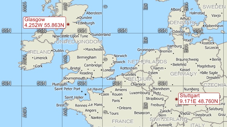
Longitude and latitude coordinates for Glasgow, UK and Stuttgart, Germany.
Maptitude Mapping Software gives you all of the tools, maps, and data you need to analyze and understand how geography affects you and your business. Maptitude can display the location of any coorinates on the earth and can geocode data to coordinates on the earth.
Learn More Free Trial Free for Students/Teachers
![]()
![]()
![]()
![]()
![]()
![]()
![]()
![]()
Home | Products | Contact | Secure Store
