Mapping Software and GIS Glossary
A topographic map shows a variety of different features and elements using relief imagery or contour lines to show a representation of the earth's surface.
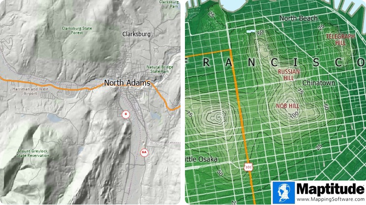
The topographic map on the left uses relief imagery and the topographic map on the right uses contour lines to show variations in the earth's surface.
Maptitude Mapping Software gives you all of the tools, maps, and data you need to analyze and understand how geography affects you and your business. Maptitude includes three-dimensional mapping and topographic mapping tools.
Learn More Free Trial Free for Students/Teachers
![]()
![]()
![]()
![]()
![]()
![]()
![]()
![]()
Home | Products | Contact | Secure Store
