Maptitude mapping software is a powerful GIS for managing and sharing your land use and property ownership maps. Maptitude includes data ranging from golf courses and schools to water bodies and natural features.
Maptitude is used in a wide variety of industries:
For example, the Maptitude Public Land Survey System (PLSS) Data are used for:
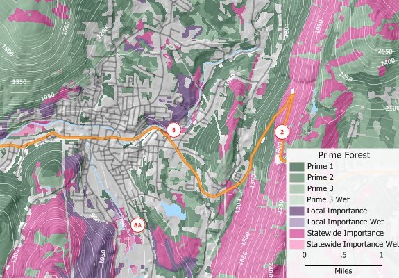
Land management mapping with Maptitude MapRight alternative
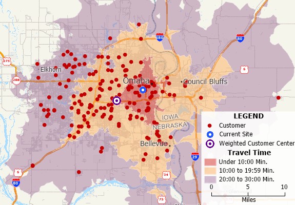
Accessibility analysis with Maptitude MapRight alternative
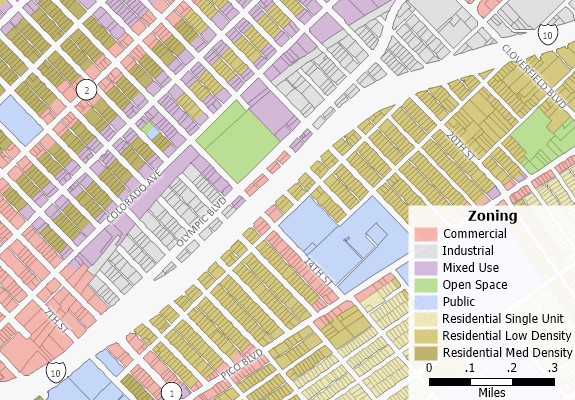
Zoning map created with Maptitude MapRight replacement
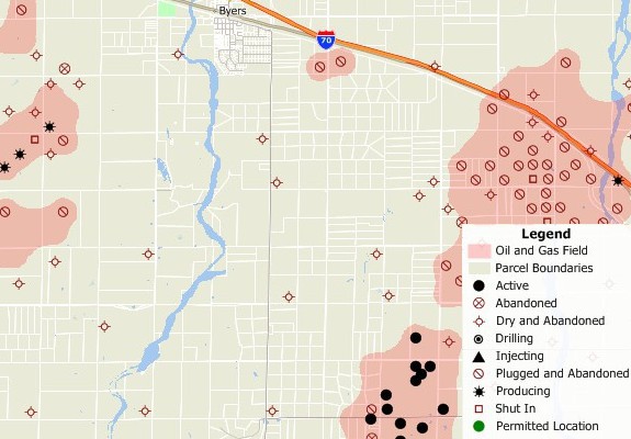
Oil and gas field and well location map created with Maptitude MapRight replacement
![]() Maptitude in Real Estate, Land Use, and Site Location Analysis
Maptitude in Real Estate, Land Use, and Site Location Analysis
 |
“Maptitude is critical for providing information in commercial real estate location selection. Maptitude is a very versatile GIS system which is able to produce a wide variety of maps economically.”
Louis Scudere
|

|
“I have access to traffic counts, local businesses, demographic information, drive times, and aerial imagery, all at the tips of my fingers. The program is easy to use, as well.”
Kellye Martin |
 |
“I am in real estate/property industry, and use Maptitude for trade area analysis, site selection, and creating quality custom maps for my reports. Trade area analysis is awesome as built in are numerous types such as radius, drive-time, etc. With a little extra skill, I completed complete retail gravity (Huff model) trade areas, weighted on different features. I also taught spatial analysis to real estate students at university, and Maptitude was our software choice.”
Matt Myers |
Learn more about Maptitude to see how you and your team can access the data critical to making successful property and real estate decisions!
 Check out our G2 Reviews
Home | Products | Contact | Secure Store
