If you need a custom map for your story, blog, or website, contact us because we offer a limited number of free custom maps on a first-come, first-served basis! See our Featured Maps for inspiration.
Maptitude is the best mapping software for business intelligence! Maptitude mapping software allows you to incorporate data from numerous sources into your maps.
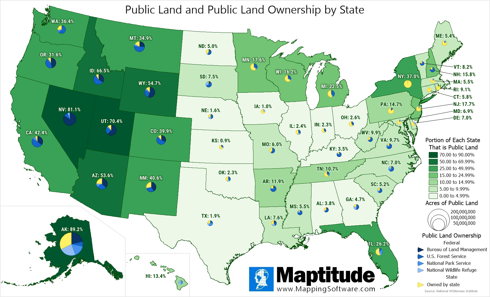
For National Public Lands Day (Fourth Saturday in September) we mapped the percent of public land in each state by area. The highest percentage of public land is found in Alaska (89.2% of land area), Nevada (81.1%), and Utah (70.4). The states with the smallest portions of public land are Kansas (0.9%), Iowa (1.0%), and Nebraska (1.6%).
The pie charts show the percent break down of public land ownership. Various federal land stewards are shown in blue and state ownership is shown in yellow. For some states, such as Hawaii, Nevada, South Dakota, North Carolina, and California, almost all of the public land is Federally owned in contrast with states such as New York, Connecticut, and Rhode Island where most public land is state owned.
Map: Created with Maptitude Mapping Software by
Caliper, September 2025
Source: National Wilderness Institute
#Maptitude #NationalPublicLandsDay
Home | Products | Contact | Secure Store
