Mapping Software and GIS Glossary
Geographic analysis tools are software or techniques used to examine and interpret spatial data to understand patterns, relationships, and trends in geographical information. One of the best reasons to use a Geographic Information System (GIS) is to perform geographic computations that help you in your work. Geographic analysis tools can perform a variety of analyses that can unearth geographic patterns in your data. Some examples of geographic analysis tools are:
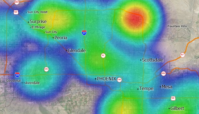
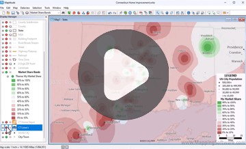
Density tools identify hot spots
Drive-time area of influence tools
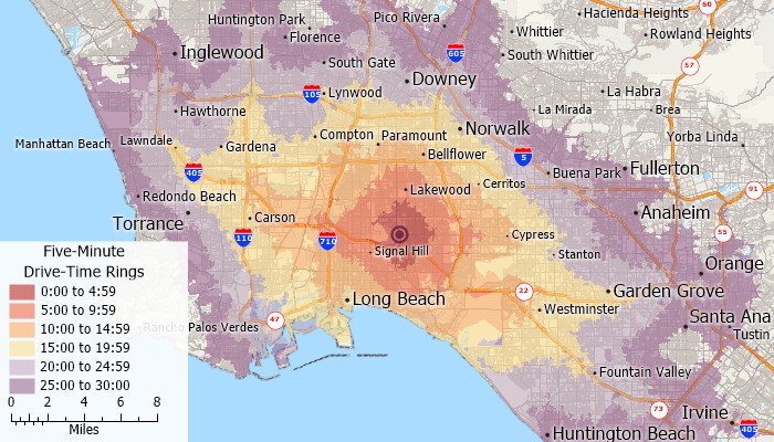
Drive-time rings
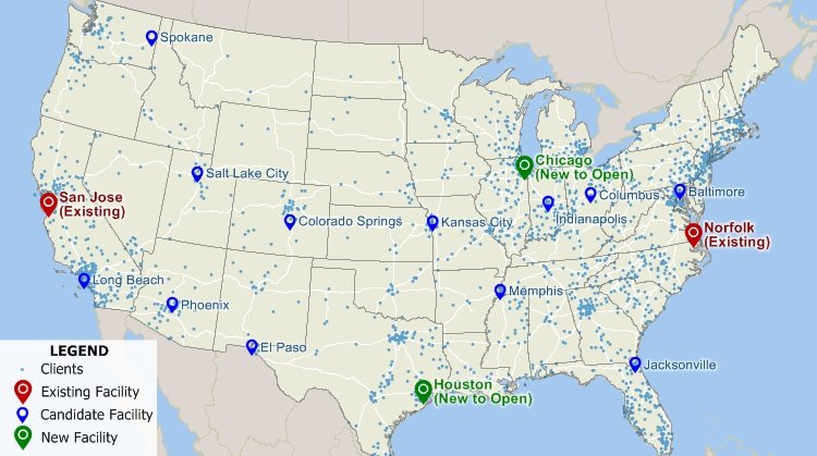
Facility location tools
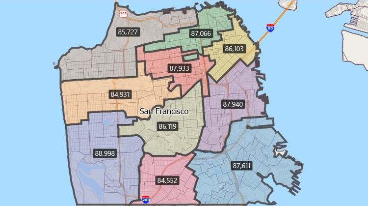
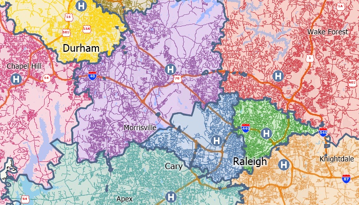
Territory tools group smaller areas into balanced larger areas
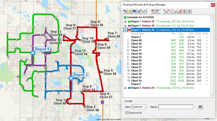
Routing tools
Maptitude Mapping Software gives you all of the geographic analysis tools, maps, and data you need to analyze and understand how geography affects you and your business.
Learn More Free Trial Free for Students/Teachers


Home | Products | Contact | Secure Store
