Last Updated: March 5, 2025
You can get a list of all ZIP Codes within 10 miles of your locations using ZIP Code mapping software.
Oftentimes you have either a single location or a list of locations and you want to know the areas serviced within a given radius of your locations. A good way of looking at the serviced areas is seeing which ZIP Codes are within a certain distance. For example, you may have a list of stores and want to know which ZIP Codes are covered by a 10-mile radius around all your stores.
To do this we will create buffers around your store locations and use the Export to Excel tool to output a list of the surrounding ZIP Codes.
This article will go over the steps to plot your addresses from a file (such as an Excel Worksheet), make a 10-mile radius around them and then export the list of surrounding ZIP Codes to Excel.
Step 1: Plot your addresses
You can skip this step if you already have your locations as a point layer in your map. There is a video here going over this procedure as well.
- Download a free mapping software trial of Maptitude Desktop or use your existing Maptitude Desktop license.
- Choose New map of my data/table/spreadsheet in the Home Window; click OK.
- Browse for your data and click Open; if using Excel choose the sheet and click OK.
- Make changes to match fields as needed; click Next.
- Choose the Locate method for your data; click Next.
- Choose to either Import or Link your data to map it; click Next.
- Click Finish.
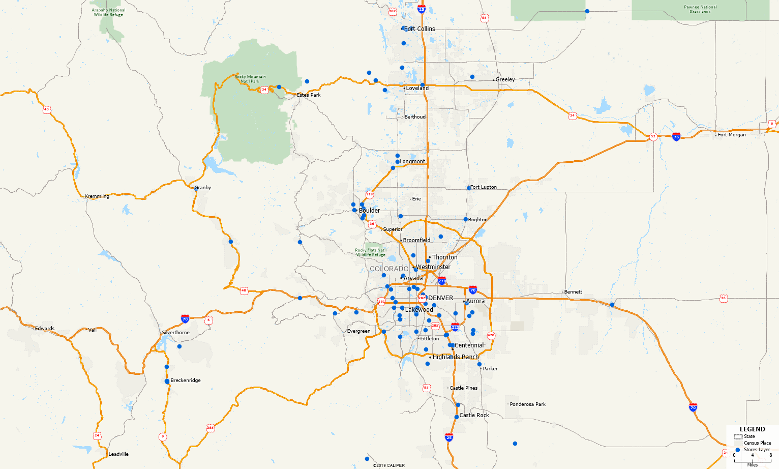
See below an example map of my points. In this example, my points layer is called Stores Layer and will be referenced in the following steps as that.
Step 2: Create Buffers around your locations
- Make sure the Stores Layer is the working layer.
- Go to Tools>Analysis>Buffers… or click
 in the Standard Toolbar.
 - Use the following settings:
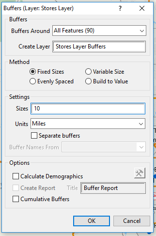
How Can I Find a List of all ZIP Codes within 10 Miles of my Data? Buffer Settings. - Note if you want a different size radius around your stores, enter a different value in Sizes.
- Click OK.
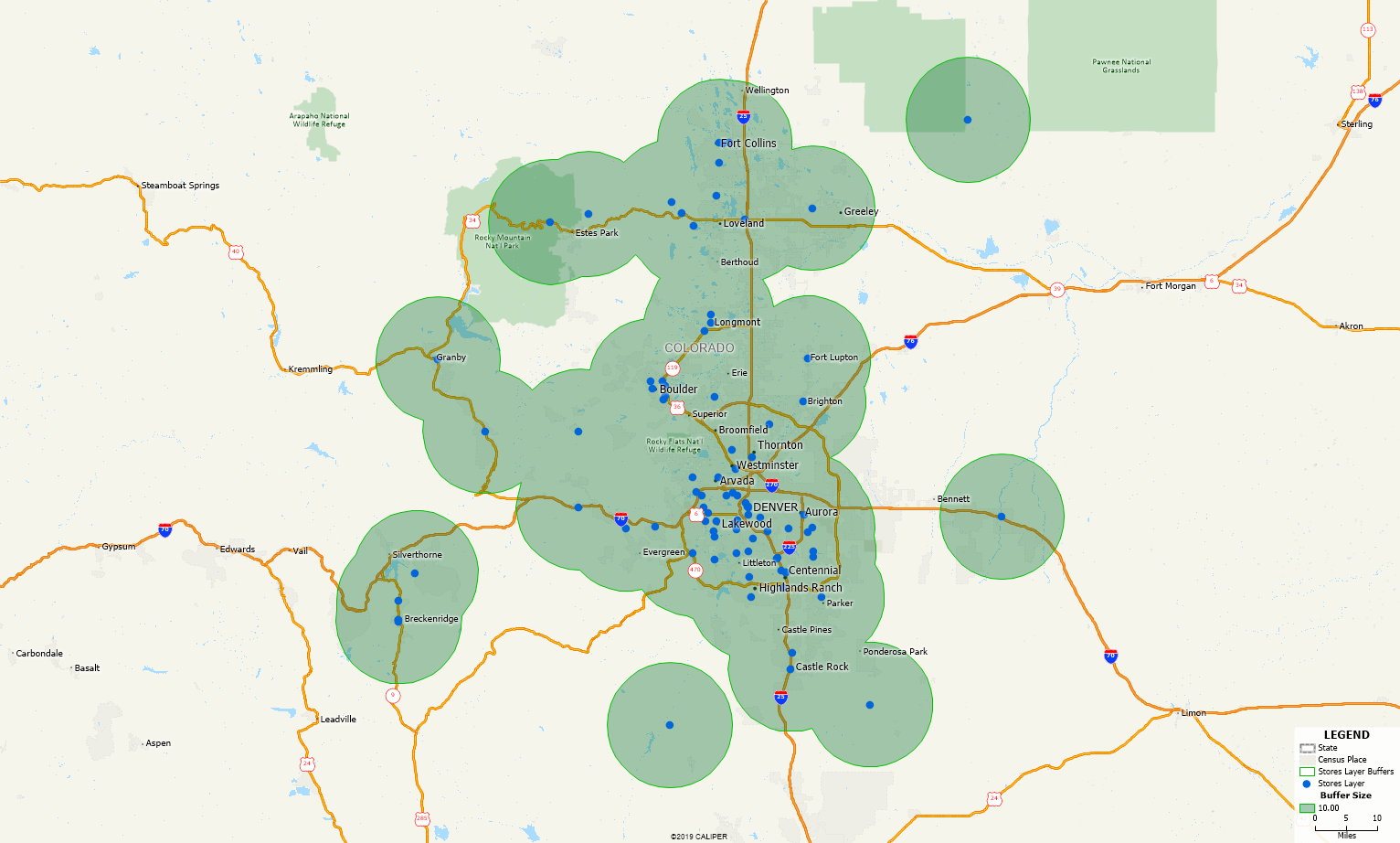
This will create the Buffer showing you the area within 10 miles of all your stores.
Step 3: Exporting to Excel (optional)
- Right click on 5 Digit ZIP Point in the Display Manager and choose Show Layer.
- Go to Edit>Preferences and navigate to the Reporting tab.
- Check the Allow me to choose the layers included in the report option and click OK.
- Make sure Stores Layer Buffers is the working layer.
- Go to Tools>Reports>Export to Excel or click
 in the Standard Toolbar.
 - Enter a name for the file; click OK.
- Pick the layers to include in the output. Make sure 5 Digit ZIP Centroid is checked.
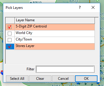
How Can I Find a List of all ZIP Codes within 10 Miles of my Data? Export Settings. - Click OK.
Maptitude will create an Excel report for the area within 10 miles of your stores with:
- A tab for each layer you chose to export that shows the places in that layer that were inside the 10 mile radius you created, including one for the ZIP Code layer showing the ZIP Codes
- A tab called US Census Overlay which has demographic information for the area within 10 miles