
Author: Stewart Berry
6 October 2025
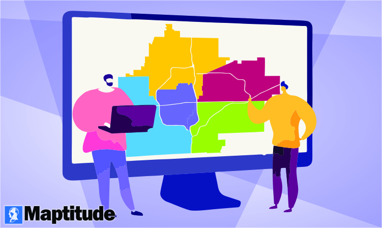
Sales territory mapping software has become a must-have for business development and revenue operations (RevOps) teams heading into 2026. These specialized tools empower organizations to visualize sales regions on a map, assign and balance territories among reps, and analyze performance geographically. Over the past year, the industry has seen transformative advancements, from AI-driven territory balancing to one-click realignments and richer data visualizations, making modern sales mapping platforms more powerful than ever. By leveraging these innovations, companies can manage territories more effectively, boost sales team productivity, and make smarter strategic decisions about where to focus their efforts.
Despite the clear benefits, the sheer number of territory mapping solutions on the market can make it challenging to choose the right one for your needs. Each platform offers a unique mix of features, pricing, and capabilities. To cut through the noise, we conducted a comprehensive market assessment (drawing on expert insights and real user reviews) to identify the top solutions. This guide highlights the most significant developments in territory mapping and compares the top 25 tools available in 2025.
For clarity, we’ll start by explaining what sales territory mapping software is and the key features that define a great tool. After that, you'll find our curated list of the 25 best sales territory mapping software solutions for 2025, each with an overview of its standout features and ideal use cases.
You can use the table of contents to skip straight to the reviews.
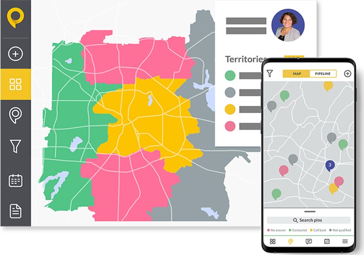
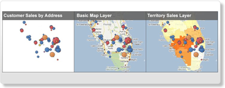
Sales territory mapping software is an application that allows businesses to map out, visualize, and manage sales territories using interactive geographic maps. In practical terms, it lets sales leaders divide a market into clearly defined regions (such as by ZIP code, city, or state) and assign those territories to individual sales representatives or teams. The software typically includes tools for balancing territories based on factors like customer count, revenue potential, or geographic area, ensuring each rep has a fair and productive territory.
Using sales territory mapping tools, organizations can easily see who covers which areas, identify gaps or overlaps in coverage, and adjust boundaries as market conditions change. The visual map interface simplifies what can otherwise be a complex planning process. For example, a RevOps manager might display all customers and prospects on a map, then realign territory boundaries to even out workloads or maximize sales opportunities in each region.
The benefits of adopting territory mapping software are significant. Companies with well-designed sales territories often achieve higher sales performance because reps focus on the best opportunities without stepping on each other’s toes. Effective territory alignment also leads to improved customer coverage and reduced travel waste. In fact, businesses that leverage dedicated territory management tools have reported increased revenue, better customer retention, and lower operational costs thanks to more efficient sales routing. In short, territory mapping software is crucial for optimizing sales coverage, promoting fair representative assignments, and ultimately driving greater revenue growth.
Next, let's examine the key features to look for when evaluating these solutions.
In 2025, leading sales territory mapping platforms offer a rich array of capabilities to streamline sales planning. Many modern solutions now incorporate advanced features, for instance, some provide AI-powered algorithms that automatically balance territories, and most include dynamic dashboards that update sales metrics by region in real time. However, no matter how sophisticated the tool, there are core functionalities you should expect. The best sales territory mapping software typically includes:
Together, these key features give sales managers and RevOps professionals everything needed to design strategic territories and glean insights from geographic data. A well-rounded territory mapping solution will make it simple to adjust sales areas on the fly, collaborate on planning, and ensure your sales resources are deployed in the most effective way possible.
Now that you know what to look for in a sales territory mapping tool, let's explore the top software options. Below, we present the 25 best sales territory mapping software platforms of 2025 and what makes each one stand out.
To help you find the right solution, we have compiled a definitive list of the 25 best sales territory mapping software platforms in 2025. This list spans both free and paid tools, from simple mapping applications to advanced enterprise systems. We based our selection on comprehensive market research, feature comparisons, and feedback from real users, so you can trust that these are truly leading options.
In the sections that follow, each section introduces one of the top territory mapping tools and summarizes its key capabilities along with any notable pros and cons. Use this overview to compare different platforms side by side. Whether your priority is intuitive map drawing, powerful analytics, or seamless CRM integration, this guide will point you to a territory mapping solution that fits your needs.
Let’s dive into the list, starting with our #1 ranked solution.
Summary: In 2024, Maptitude introduced advanced sales territory management for hierarchical territories, with AI-driven "ensemble" tools, enhanced vehicle routing, and up-to-date demographic and business data.
Pros:
Cons:
Details:
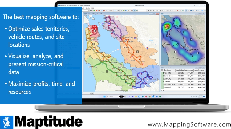
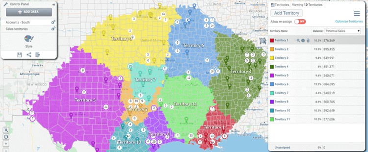
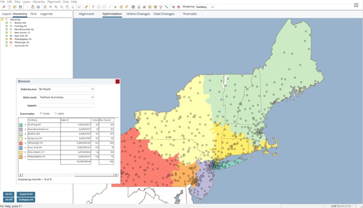
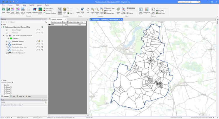
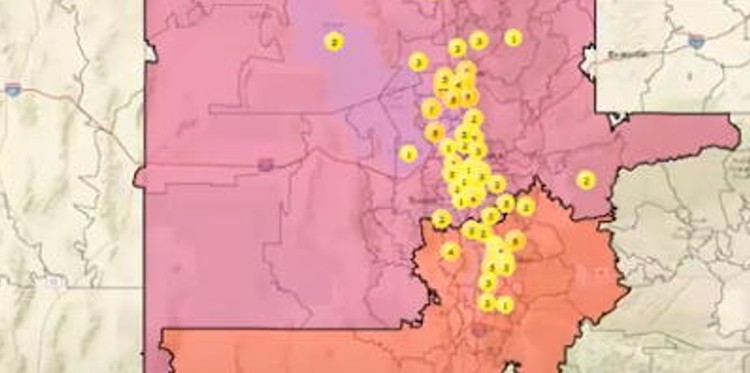
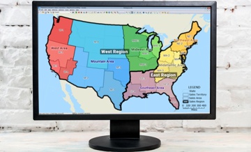
In 2024, Maptitude introduced advanced sales territory management features designed to enhance hierarchical territory management. New AI-driven "ensemble" tools allow users to create balanced territories based on metrics like revenue, population, or drive time. Enhanced vehicle routing and logistics capabilities simplify field team planning, while up-to-date demographic and business data ensure accurate decision-making. These updates reinforce the position of Maptitude as the leader in professional territory mapping software.
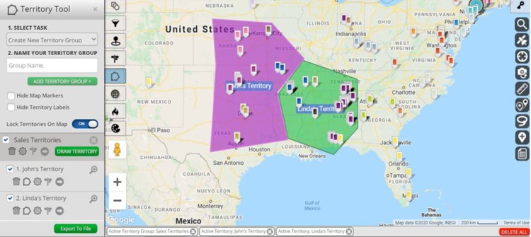
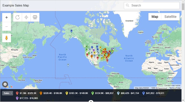
Territory mapping is a crucial aspect of sales management, offering numerous benefits. These include improved sales efficiency, optimized resource allocation, and enhanced customer targeting. Among the top 25 mapping applications for sales territory mapping, Maptitude stands out as the best choice. Maptitude is a complete package for sales, marketing, and business development professionals.
Maptitude provides a comprehensive suite of tools, data, and demographics designed specifically for sales territory mapping. Its powerful capabilities enable businesses to visualize and manage their sales districts with precision. Maptitude offers advanced optimization and visualization tools such as those for automatically balancing hierarchies (e.g., territories, districts, and regions) and for handling overlapping territories. These features empower users to identify opportunities and make data-driven decisions.
The maps created are attractive and professional. While you have an unlimited ability to customize the graphics and layers, the maps are immediately presentation ready, providing compelling stories based on your sales data.
With robust routing and territory alignment, Maptitude ensures efficient sales operations. Its user-friendly and wizard-driven interface further enhances usability, making it a top choice for businesses in need of a reliable sales territory mapping solution.
Interested in trying Maptitude? Maptitude offers a free, no risk, 1-month trial (no credit card required!), so you can start mapping now.


|
“We use Maptitude extensively for running complex Territory Alignment scenarios. The depth of the product, its total utility and functionality is immense. Import-Export capability with Excel is seamless. It is easy to work with and Maptitude support is second to none. My complements to the Maptitude team: They have created a solid product and it is one of the best software investments we have made as an organization.”
|

|
“Maptitude is helping our organization plan our field service territories and control our travel and response time.”
|
Summary: eSpatial’s 2024 updates focus on territory optimization for field-based sales teams, with account‑based optimization using road network data and a simplified map wizard.
Pros:
Cons:
Details:
eSpatial’s 2024 updates focus on territory optimization for field-based sales teams. A new account-based optimization feature uses road network data to balance territories effectively. Additionally, the platform introduced a simplified map wizard, improving accessibility to different map types and ensuring users can efficiently manage and visualize their sales territories. These features make eSpatial an excellent choice for field operations.
eSpatial offers robust sales territory mapping, but at a notably higher price point than most other offerings. It provides an online interface and a range of tools for creating and managing territories, including hierarchies. eSpatial allows users to import and analyze location data, visualize sales territories, and optimize routes for efficient sales operations. It also offers reporting and analytics, enabling insights into sales performance and growth opportunities.
Unlike a product such as Maptitude, eSpatial offers functionality add-ons at additional cost, rather than providing a single integrated package. The functionality to support complex territory management is hard to make seamless and flexible in a web interface, where smooth navigation and workflow are important.
Summary: A 2024 “Starter” offering supports importing up to 20,000 records per map and enhances territory tools for small and medium-sized businesses.
Pros:
Cons:
Details:
MapBusinessOnline launched a new "Starter" offering in 2024, catering to businesses with basic mapping needs. This version supports importing up to 20,000 location records per map and provides enhanced tools for creating and managing sales territories. These improvements simplify territory management and visualization, particularly for small and medium-sized businesses.
MapBusinessOnline offers tools for creating and managing territories, allowing users to assign sales territories based on various criteria. MapBusinessOnline also provides demographic data overlays, helping businesses gain an understanding of their target markets. It includes Esri map background tiles.
Simplicity is the focus of the software, but as a result it may lack options found in more robust applications and is limited to 3-tier territory hierarchies. However, it can still be useful for applications ranging from ZIP Code visualizations to sharing maps.
Summary: In 2024, Maptive released Automated Territory Creation and improved performance/visualization via OpenGL.
Pros:
Cons:
Details:
In 2024, Maptive released its Automated Territory Creation feature, enabling users to generate balanced territories based on factors such as sales rep location, customer data, and drive time. Additionally, Maptive improved performance and data visualization through OpenGL technology. These updates cater to businesses seeking dynamic and efficient territory management tools.
Maptive provides a basic interface and standard features for creating and managing territories. Maptive allows users to import location data, draw freehand territories, and create territories from groups of boundaries. While it may not offer the same level of professional functionality as other mapping applications, Maptive is a great option for businesses with simpler territory mapping needs.
Analytical tools may be limited when compared to more specialized territory applications, seemingly lacking the ability to create hierarchies such as the territory-district-region relationship. Pricing is on the higher end of the scale, especially for small teams.
Summary: 2024 updates include an Incontiguous Tool to fix non-contiguous territories and customizable color palettes.
Pros:
Cons:
Details:
AlignMix introduced several updates in 2024 to streamline sales territory management. The new Incontiguous Tool identifies and resolves non-contiguous territories, ensuring geographic consistency. Additionally, custom color palette options allow users to tailor map visuals to meet specific business needs. These features enhance AlignMix’s usability for sales planning and territory adjustments.
Unlike other applications that have limited support for alignments, or that integrate such features as part of a larger toolkit, Alignmix is designed specifically for sales territory management. It offers a range of features for visualizing, balancing, and optimizing sales territories. Alignmix allows users to import and analyze location data, create custom territories, and perform advanced analyses. Alignmix helps businesses optimize their sales territories but appears to only support 3 hierarchy levels and has limits on the number of territories that can be optimized.
Worthy of note is that the application is pricey versus the market. In addition, territories don’t exist in isolation. Most companies require additional features to better understand how to manage their sales reps and manager distributions, such as routing tools.
Summary: Expanded heat mapping in 2024 for deeper insight into data concentrations.
Pros:
Cons:
Details:
Mapline expanded its heat mapping features in 2024, offering deeper insights into data concentrations within sales territories. These enhancements empower businesses to make strategic decisions by visualizing key performance metrics and customer data. Mapline’s simplicity and focus on actionable insights make it a valuable tool for sales territory planning.
Mapline offers basic sales territory mapping. It allows users to import and visualize tabular data, create territories, and perform basic analysis. The software supports a variety of political and postal boundaries as building blocks for sales regions.
Mapline is a user-friendly option suitable for simple needs, supporting filtering by color, heat maps, and other standard ways to present data. Pricing has historically been about average for the market but is now only available as part of the sales process.
Summary: Widely used, free option with an extensive API leveraged by many competing online tools.
Pros:
Cons:
Details:
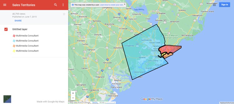
Google Maps, the widely used map service, can also be utilized for basic territory creation. On the plus side, it offers an intuitive interface and extensive geographic data. However, it lacks much of the sophistication found in dedicated sales territory mapping software. Instead, it provides a free and accessible option for businesses with the most basic mapping requirements. It also has an extensive API that other entries on this top 25 list leverage to support their competing online tools.
Functionality includes that for drawing lines and shapes, for example. You can save your work to Google My Maps and upload and download your files in the KML/KMZ file format. Not having the ability to track demographics as you manage your boundaries, coupled with simple map shading, may rule Google Maps out of consideration for many managers. If you outgrow Google Maps, Maptitude is a great option to upgrade to, allowing you to import your KML files directly into a new territory layer.
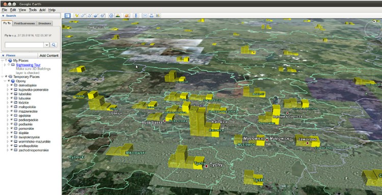
Summary: Virtual globe and imagery platform usable for basic territory mapping with KML/KMZ support; extensible via Google Earth Engine API.
Pros:
Cons:
Details:
Google Earth, although primarily known as a virtual globe and aerial imagery platform, can also be utilized for basic territory mapping. KML/KMZ file support allows the import and export of data, and you can visualize your information in 3D and over satellite photos. The platform is also extensible via the Google Earth Engine API.
It offers an uncomplicated interface and access to extensive background data, allowing businesses to visualize territories in unusual ways. While it may serve as a starting point, businesses with more advanced needs may well be disappointed. Google Earth focuses on visualizing geographic data, and lacks common territory tools, which can limit meaningful insights. If you hit the limits of Google Earth, consider importing your KML files directly into Maptitude territories using a step-by-step wizard.
Summary: Developer platform with tools/APIs for custom, programmatic territory solutions; plugins/datasets like Boundaries using GeoJSON.
Pros:
Cons:
Details:
Mapbox is a platform that provides a range of tools and APIs for developers to build custom applications, including sales territory mapping solutions. It is programmatic and scalable for businesses with more specialized requirements. There are various plugins and datasets available such as Boundaries, that you can build your custom tools on using the GeoJSON file format.
There are many MapBox powered services that you can partner with. But the learning curve for programmatically utilizing Mapbox yourself may be steep for some users, while there are additional costs involved in contracting with third parties to do the development work for you.
Summary: Offers a suite of tools for territory mapping within a complete GIS, with add-ons for business analysis.
Pros:
Cons:
Details:
Esri is a large company that offers a suite of tools for sales territory mapping. Esri ArcGIS provides advanced spatial analysis and allows users to create and manage territories, perform complex analyses, and visualize sales data. ArcGIS is a complete geographical information system (GIS), with additional paid add-ons for those wishing to perform business analysis. The tools range from those for environmental analysis, utilities, and 3D landscapes, to those for network planning and creation.
The Esri ecosystem is deep and wide, providing something for everyone. But the platform's licensing costs, and complexity, may be a barrier for businesses without a dedicated geo-team, or for those with limited geo-technical resources.
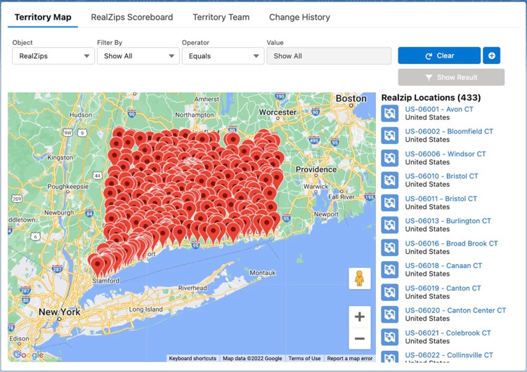
Summary: Salesforce-integrated territory mapping on a Google Maps background, with available add-ons and demographic data products.
Pros:
Cons:
Details:
RealZips integrates with Salesforce, providing territory mapping within the CRM system. It offers tools for creating, visualizing, and managing territories based on a Google Maps background. RealZips allows businesses to manage and align territories within Salesforce, enhancing sales productivity and performance. There are various add-ons and demographic data products that are available.
While a useful Salesforce plugin that utilizes the attractive Google Maps UI, the software is limited primarily to Salesforce users, excluding businesses that use other CRM platforms. In addition, visual territory management appears limited to push-pin locations, rather than actual boundary maps, with templates for territories being sold at additional, and not insignificant, cost via RealDatasets.
Summary: Tailored to field sales teams for territory handling, push‑pin customers, and real-time activity tracking with CRM integrations.
Pros:
Cons:
Details:
Spotio offers functions tailored specifically to field sales teams. It provides an interface that enables users to create and manage territories and push-pin customers. Spotio allows for real-time tracking of sales reps' locations and activities, providing insights into sales performance. The platform also integrates with CRM systems, streamlining data management.
The application may have a less extensive and simpler territory toolkit than other systems. The free-form approach to territory hierarchies may be overwhelming for users, lacking a clear-cut approach to the territory-district-region structure. Pushpin handling and responsiveness, especially when out in the field, have been pain-points for customers. But overall users appear happy with the ability to track and record sales leads and visits.
Summary: Enables freehand territory drawings on Google Maps; simple and cost‑effective for sharing custom shapes.
Pros:
Cons:
Details:
Scribble Maps allows users to draw and visualize territories on Google Maps. Scribble Maps is another simple and cost-effective option for those with specific needs, here being the ability to freehand draw on a map and share the results.
The clear and flexible nature of the offering, which are its bestselling points, means that data analysis and optimization are limited.
Summary: Territory management and alignment with rule‑based assignments, analytics, and reporting.
Pros:
Cons:
Details:
Xactly AlignStar focuses on providing territory management and alignment solutions for businesses. It supports creating, visualizing, and optimizing sales territories. Xactly AlignStar allows users to assign territories based on predefined rules and criteria, ensuring fairness and efficiency. The platform also provides analytics and reporting tools, enabling businesses to track sales performance.
This is a strong product offering and if there are any down sides to it, customer reviews point to an aging interface design, a steep learning curve, and a high cost for the enterprise edition that is required when plotting more than 50 territories.
Summary: Salesforce add-on for territory mapping integrated with Salesforce objects; mapping side is simpler than professional tools.
Pros:
Cons:
Details:
Geopointe integrates with Salesforce, providing territory mapping within the CRM system. It offers tools for managing territories integrated with Salesforce objects. The Salesforce integration necessitates familiarity with the operation and structure of the CRM, while the mapping side can be seen as simplistic when compared to other professional territory tools.
Geographic areas can be interactively selected or identified from lists “copy and pasted” into the tool. Geopointe supports users who need to analyze location data, optimize routes, and track sales performance within Salesforce. Pricing is tiered, with limits on the base package such as the number of territories that can be created.
Summary: Desktop mapping (Precisely) with a territory toolkit under “redistricting,” plus tools like Voronoi and district balancing.
Pros:
Cons:
Details:
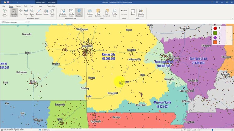
MapInfo Pro is a venerable desktop mapping application, with its current parent company being Precisely. It has a territory toolkit under the unusual title of “redistricting”, a term normally reserved for pollical boundary management in the USA. MapInfo supports tools such as Voronoi diagrams and balancing of districts based on variables such as sales value.
MapInfo Pro is a powerful option for businesses with advanced mapping needs. MapInfo provides for importing and analyzing location data and performing complex spatial analyses. The software may have a steeper learning curve and require more technical expertise than other products that have explicit tools for sales management.
Summary: Cloud mapping platform with APIs for creating/managing/analyzing territories and dashboard-style interfaces; plugin library for tasks such as CRM linking.
Pros:
Cons:
Details:
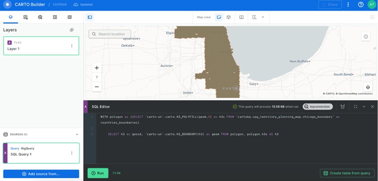
Carto is a mapping platform that offers a range of tools for spatial analysis and data visualization. It provides an API for creating, managing, and analyzing territories, and can be set up with dashboard style interfaces. There is a nice library of various plugins for specific tasks and for operations such as linking to a particular CRM.
Carto's scalability makes it suitable for businesses with the technical expertise and technology stack to deploy it. The platform's technical requirements can be relatively high, making it less accessible for some organizations, especially those without programming skills.
Summary: Open‑source desktop GIS offering spatial analysis and polygon/feature tools; cost‑effective for teams with advanced GIS capability.
Pros:
Cons:
Details:
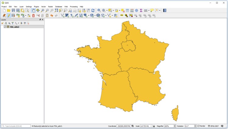
QGIS (Quantum GIS) is an open-source desktop software that offers spatial analysis, including area mapping. It provides tools for working with polygonal vector layers and features. It is first and foremost a geographical information system (GIS). QGIS is a cost-effective option suitable for businesses with advanced GIS and geospatial data technical capabilities. While free, and with extensive capabilities, the additional costs incurred to repurpose the product for commercial needs should be considered.
The software's interface may be harder to use than those of commercial products and initial data collection and startup time is likely to be longer than out-of-the-box or online solutions. There are open source and commercial plugins for QGIS that support various aspects of the boundary alignment process, with varying levels of support and complexity.
Summary: Sales performance management platform where map view is not primary; apps add dynamic territory modeling, analytics, and what‑if scenarios.
Pros:
Cons:
Details:
Anaplan is first and foremost a sales performance management application. A map view does not appear to be the primary element in how Anaplan manages territories. However, it has a variety of apps that add functionality to the platform, providing dynamic territory modeling and advanced analytics, as well as scenario “what if” simulation.
There may be a high learning curve due to the platform's sophistication and potential challenges in the lack of an intuitive map driven interface.
Summary: Focused on sales and franchise territory mapping with online U.S. ZIP Code mapping and demographic reporting.
Pros:
Cons:
Details:
GeoMetrx focuses on providing sales and franchise territory mapping solutions. It emphasizes online ZIP Code mapping and reporting of demographics for the USA. GeoMetrx provides census and market reports, enabling businesses to gain insights into their target markets.
The organization appears to be a geospatial consulting group, that partners with others such as MapBusinessOnline to provide their mapping platform.
Summary: BI platform with mapping as part of broader reporting/analytics; version 7.1 highlighted location analytics; supports built‑in mapping and Google Maps API.
Pros:
Cons:
Details:
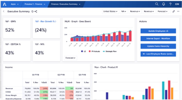
Yellowfin is a business intelligence (BI) platform that also offers mapping. It provides tools for a wide variety of BI operations including analyzing sales performance. With its integrated reporting and analytics, Yellowfin allows businesses to gain insights into their operations and make data-driven decisions.
The software does not explicitly focus on mapping, rather featuring it as an additional tool in a larger toolset. Yellowfin version 7.1 touted new location analytics functionality, and they currently emphasize Yellowfin’s own built-in mapping capability and the ability to use Google Maps API as part of a broader data visualization feature set.
Summary: Entry‑level Google‑Maps‑based tool for drawing/grouping regions into territories that imports from Excel, Google Sheets, KMZ, CSV and provides basic routing/aggregations.
Pros:
Cons:
Details:
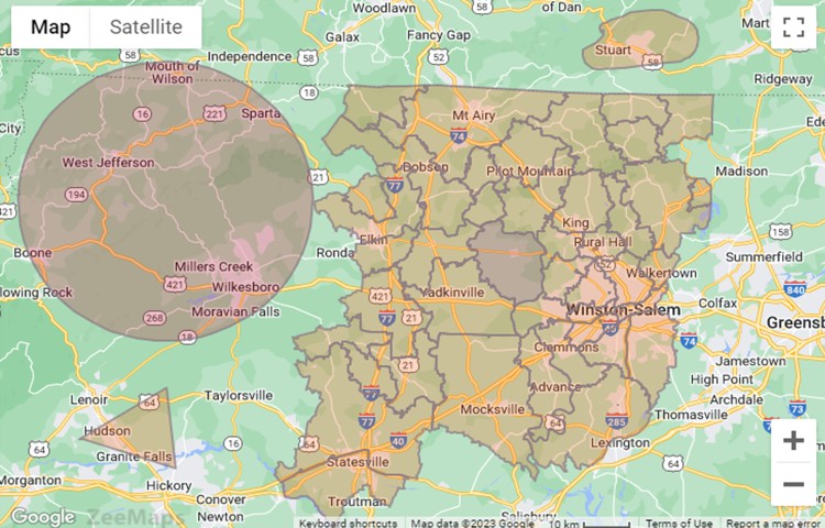
ZeeMaps allows users to create territories by drawing shapes on the map or by grouping highlighted regions. It is another entry level application that uses Google Maps as the map background. You can import point location data from a variety of formats including Excel, Google Spreadsheets, KMZ, and CSV. You can also perform basic analyses such as route planning and data aggregations.
The software's features and settings are a good fit for organizations that are leveraging sales territory tools in basic ways. Because of this, the toolset is more limited than in more substantial mapping applications.
Summary: Mobile mapping/routing app for field sales; visualize/optimize sales, manage routes, track visits; CRM integrations.
Pros:
Cons:
Details:
Badger Maps is a mobile mapping and routing application specifically designed for field sales teams. It provides tools for visualizing and optimizing sales, managing routes, and tracking customer visits, and offers integration with CRM systems.
Apart from issues related to some users finding that the mobile application's performance and reliability can vary depending on network connectivity, the tool does not appear to have any explicit territory boundary mapping capabilities. The functionality appears to be focused on push-pin mapping and routing related tasks and, so while a good product, its rank reflects this.
Summary: Web app focused on pin‑mapping lists of addresses; simple analysis and charting; based on Google Maps.
Pros:
Cons:
Details:
BatchGeo is a web application for importing location data and creating sales maps. It is highly focused on pin-mapping (or "geocoding") of lists of locations or addresses. It offers simple analysis tools and charting and does not have explicit territory tools. In fact, it does not appear to support boundary mapping of customer data at all. BatchGeo is a straightforward choice for low-level and point-based mapping. The maps and navigation buttons are reassuringly familiar, being based on Google Maps.
Summary: Enables custom, shareable maps with an intuitive interface and storytelling features; 3D buildings available; territory visualizations appear possible but not a major client focus.
Pros:
Cons:
Details:
Mapme enables users to create and share custom maps. It offers an intuitive interface and storytelling features, coupled with the ability to add sophisticated items such as 3D buildings. Territory visualizations appear to be possible using Mapme, although they do not seem to be a major focus for its clients.
The software's functionality is minimal for data-driven sales management. Limited numbers of point locations that can be mapped and there is a focus on styles rather than information. The graphics and presentation are professional and attractive, but the price is actually on the higher side.
The advancements in sales territory mapping software for 2025 demonstrate a clear focus on efficiency, accuracy, and usability. From AI-powered optimization to dynamic data visualization and real-time collaboration tools, these updates ensure businesses can adapt to ever-changing market demands. Whether you're looking to balance territories, optimize travel routes, or gain deeper insights into performance metrics, the tools featured here represent the best solutions for modern sales teams. As the landscape of sales territory mapping continues to evolve, these platforms remain indispensable for driving success in competitive markets.
As shown in the rankings above, Maptitude is the perfect sales territory mapping software for businesses seeking to generate impactful maps that can boost their bottom line.
There are many advantages to using Maptitude to align your territories, whether for business development and management in healthcare, banking, retail, franchising, field sales, marketing, or for any other geographic-based analysis.
Maptitude lowers the burden required for territory optimization and for managing ongoing territory alignments. While many factors go into a territory plan business model, Maptitude ensures that you maximize use of your time and are easily able to explain your findings to others.
Learn more about Maptitude to see how how you and your team can benefit from territory mapping software!
Schedule a Free Personalized Demo
 Check out our G2 Reviews
Home | Products | Contact | Secure Store
