Maptitude for Precinct and Election Management (Maptitude
P&E) combines sophisticated software, an easy-to-use interface,
and a wide array of customized data to create a complete voting
district and election management solution for county and state
election offices. Use Maptitude P&E to:
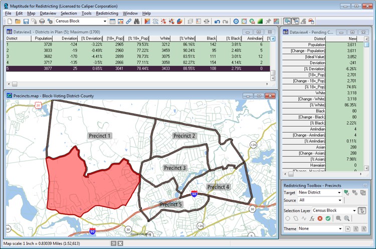
- Modify voting district boundaries. As you select
geographic areas (such as census blocks), the software
computes the number of registered voters along with any
other summary fields you have identified.
- Automatically create a list of registered voters and
street segments where voting districts have changed.
- Consolidate voting districts for each election to conserve
resources.
- Calculate unique ballot styles and voting district
splits.
- Geocode registered voters and assign them to
voting districts, ballot styles, etc.
- Create voting district maps, map books, and reports.
- Create street index files for your voter
registration software.
- Enhance voter files and correct errors.
- Create voting district splits.
- Analyze demographic data and provide targeted
language assistance.
- Update streets and other geographic features.
- Publish your voting district maps and information on the
internet.
Redrawing voting districts with
Maptitude voting district software
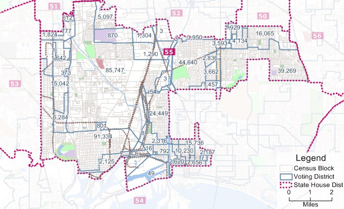
Voting district mapping
Learn more about Maptitude P&E
Maptitude redistricting software solutions:
 Check out our G2 Reviews