Last Updated: March 6, 2026
You can locate postcodes in Northern Ireland using United Kingdom mapping software.
If you want to geocode or locate Northern Ireland postcodes in Maptitude, you will need to download and use the Download Free Layers Add-In or use Web Services.
This article will explain how to download and use the add-in as well as the web service to find your Northern Ireland postcodes.
Geocoding Northern Ireland Addresses in Maptitude
You do not need the Download Free Layers Add-In if you are geocoding or locating Northern Ireland addresses using street address and postcode information.
You can follow the steps in the Create-a-Map Wizard to locate your Northern Ireland addresses without using the Download Free Layers Add-In.
Using the Download Free Layers Add-In to Map Ireland Postcodes in Maptitude
- Download a free mapping software trial of Maptitude Desktop or use your existing Maptitude Desktop license.
- Make sure that Maptitude is not open and install the Download Free Layers Add-in.
- Open the Maptitude software, close all maps and go to Tools>GIS Developer’s Kit>Add-ins> Download Free Layers
- From the second pulldown, choose “United Kingdom (UK ONS)” and click OK
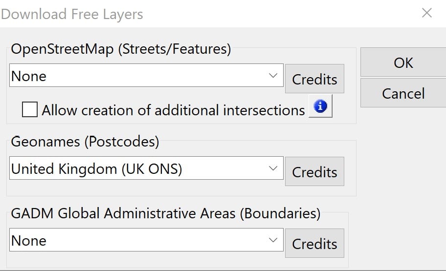
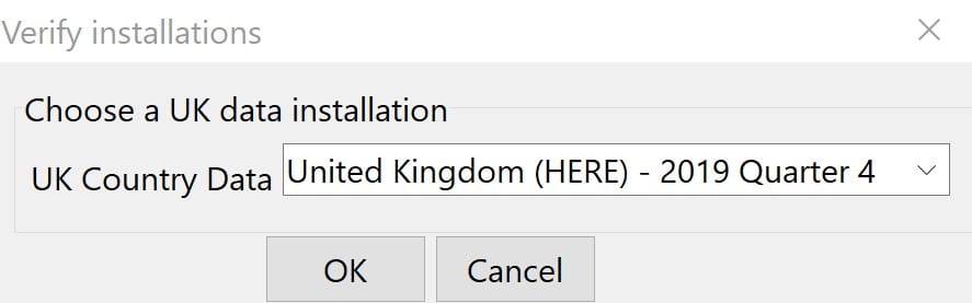
- Choose the appropriate version of the UK country package from the pulldown and click OK
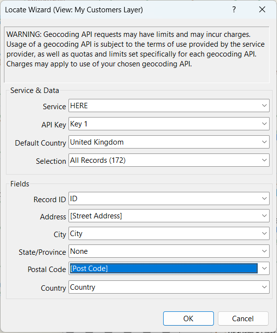
- Once this is complete, go to File>New Workspace and you can now locate Northern Ireland postcodes when using the United Kingdom country package by selecting “New Map of My Data/Table/Spreadsheet”. If you have records that were not located or a dataview with your address data open, you can go to Tools>Locate>Locate Wizard to locate Northern Ireland postcodes.
If you want to show postal sectors and districts for the Channel Islands, Isle of Man and Ireland, please see the Maptitude tutorial article on showing additional postal sectors.’
Using Web Services to Locate Northern Ireland Postcodes
To locate a table with a column for Northern Ireland postcodes, you can use the Locate by Web Services tool. This feature allows you to convert Postcodes into geographic coordinates using third-party geocoding services.
Additional Resources
If you want to locate Republic of Ireland Eircodes, you can refer to this Maptitude tutorial article on mapping Eircodes.
If you want to map other country data through a web service, please refer to this Maptitude tutorial article on mapping country data.