Last Updated: January 18, 2024
You can view the size of areas such as building footprints with GIS or mapping software.
Users of the latest version of Maptitude can download the free building footprints data.
Change the Units of Measurement
To change the units of measurement, go to Edit>Preferences>System and change the Map Units drop down to feet or meters.
Click OK to confirm the change.
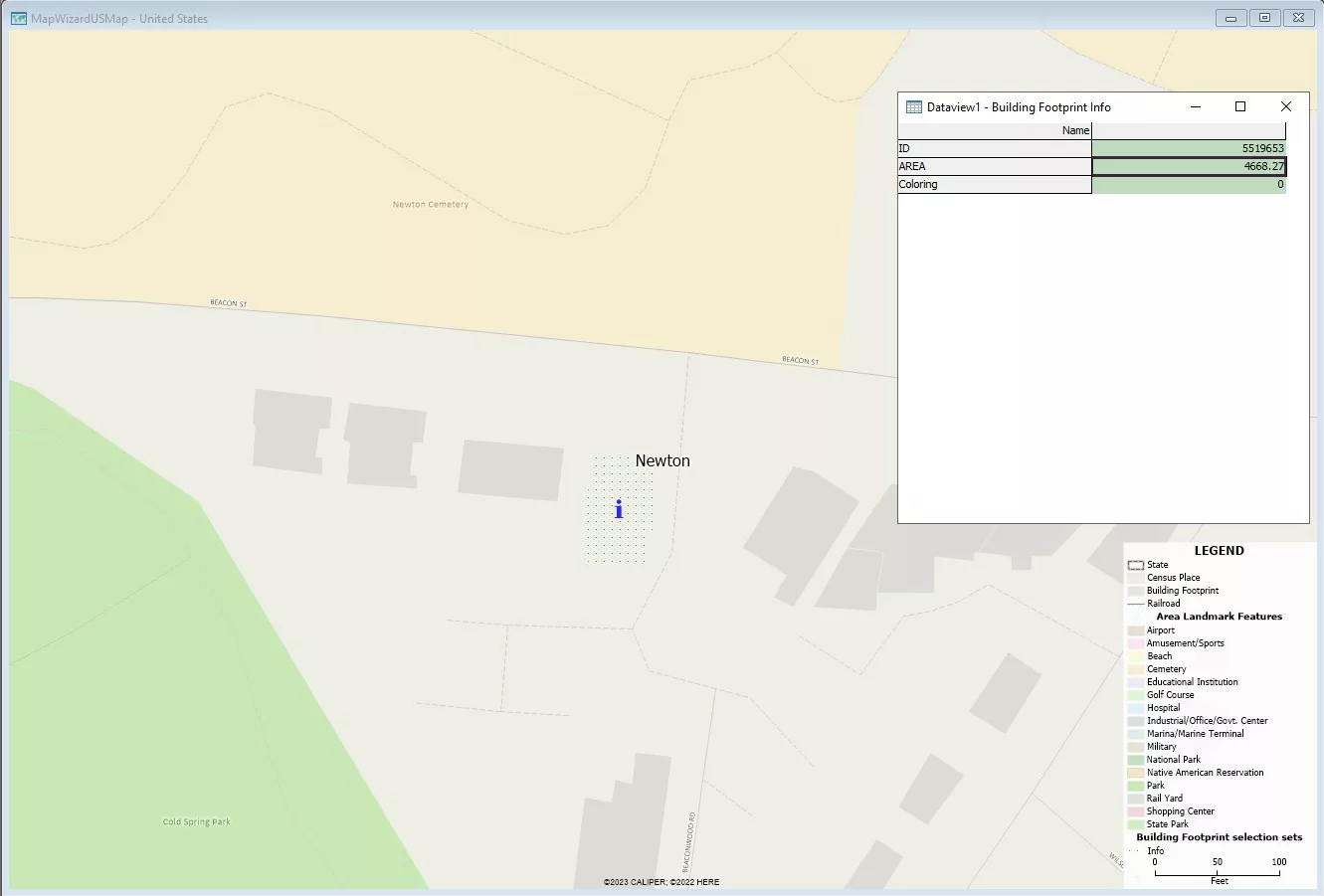
Use the Info Tool to View the Size of a Building Footprint
- From the Maptitude Home window, select New Map of United States, click OK, then click Finish.
- Use the Standard Toolbar or Edit>Find to zoom into an area that you are familiar with.
- Make the Building Footprint layer the working layer.
- Select the Info tool in the Standard Toolbar and click on the building that you are interested in.
- In the Dataview that appears, the size of the building is represented in the AREA field.
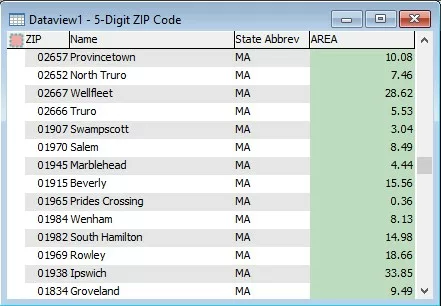
Open a Dataview for a Layer to View the Size of Areas
- In the Display Manager, right click the layer you are interested in and select New Dataview.
- The AREA field in the dataview shows the size of each feature in the layer.
- Optionally, you can go to Dataview>Fields>Show/Hide to only show the fields you are interested in.
If you are looking for more ways to measure distance, area, and feature proximity, please see this tutorial video.