Video
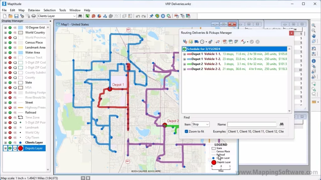
Vehicle Fleet Routing and Logistics
Creating optimized delivery and/or pickup routes for a fleet of vehicles with Maptitude mapping software.
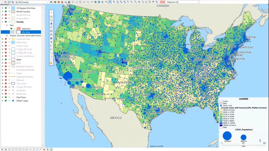
How to create County maps with user data in the US
This video shows how user data can be used to map at the County level in the US. The first part of this video shows how to locate user data by county. This will create a map showing points inside of counties. The second part of the video shows how to Show County boundaries with …
How to create County maps with user data in the US Read More »
Mapping Your Data with Maptitude Online SaaS
A walkthrough of the Maptitude Online SaaS, as well how to map your own tabular data using the platform and share with others