Access free versions of Maptitude, the best GIS software for getting work done fast, using integrated data and powerful Wizard-driven tools.
Maptitude is a powerful desktop geographic information system (GIS) software that allows users to create and analyze maps, data, and reports. Maptitude Online is a web-based mapping application that allows users to share and view maps created in Maptitude, as well as create their own maps even without the desktop product.
Both Maptitude and Maptitude Online offer 30-day free trials that allow users to try the software before they buy it.
Free Maptitude Trial Free Maptitude Online Trial
The free trial of Maptitude includes all the features of the full version of the software. This means that you can use the free trial to create and analyze maps, data, and reports. You can also use the free trial to share your maps with others.
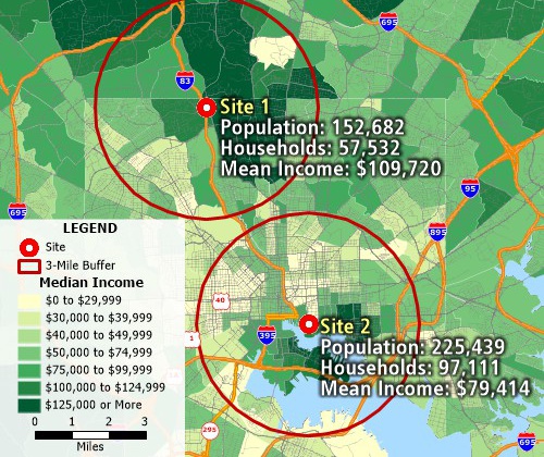
Use the included demographics to estimate populations
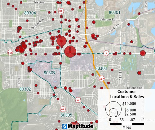
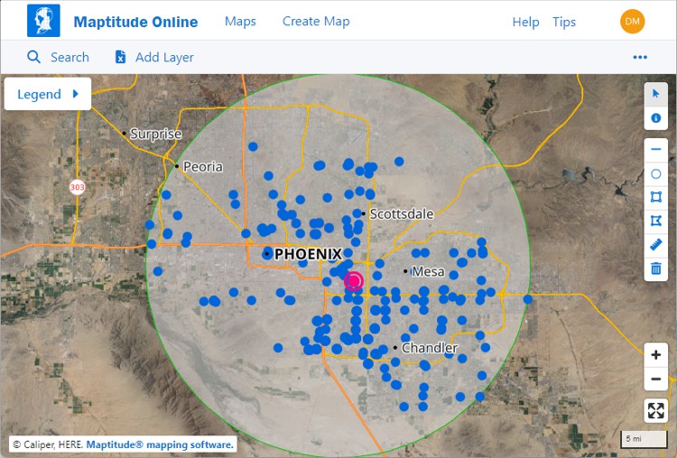
Create pin maps by address, postal code, coordinate, and more for unlimited numbers of records
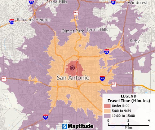
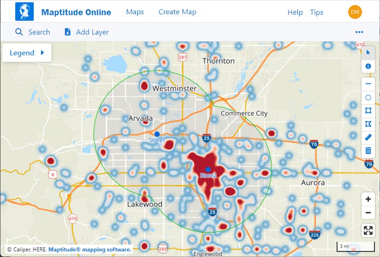
Determine drive-time or distance rings at any interval
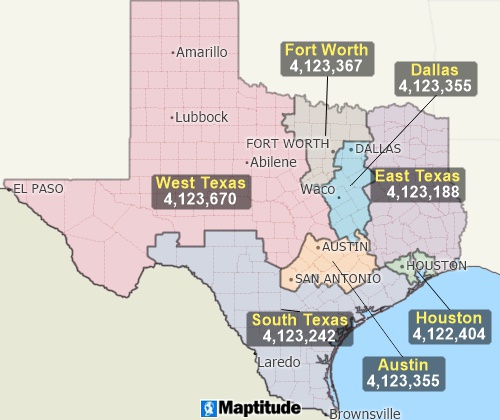
Build custom territories based on areas, proximity, or drive time
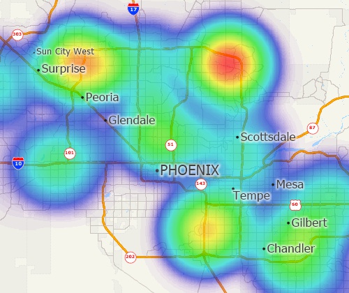
Identify weighted concentrations of features and over- and under-served areas
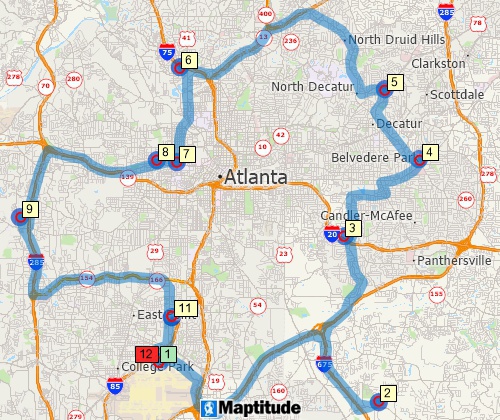
Measure distances and find shortest and fastest routes
Free Maptitude Trial Free Maptitude Online Trial
The free trial of Maptitude Online allows you to view and share maps created in Maptitude. You can also use the free trial to create your own maps directly from Excel spreadsheets. While Maptitude Online does not include all the features of the full version of the software, you can create sales territories, drive-time rings, thematic maps of demographics, and access many other mapping tools.
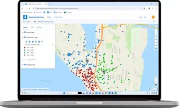
To change the customer theme:
• Click
![]() to see the list of layers in the map
to see the list of layers in the map
• Click + to expand "My
Customer Layer" in the legend
• Click on the "Cluster
Theme" drop-down menu and choose one of the available
visualizations for the mapped Excel locations
Maptitude and Maptitude Online are powerful and easy-to-use mapping tools. They can be used by businesses, organizations, and individuals for a variety of purposes. Maptitude can be used for:
Free Maptitude Trial Free Maptitude Online Trial
If you are a student or educator, you are eligible for a free copy of Maptitude. To qualify for a free copy of Maptitude, you must be an enrolled student, or a teacher at a K-12 or higher education institution. To request a free copy of Maptitude, visit the Academic webpage and fill out the academic license request form.
Maptitude and Maptitude Online offer many benefits to users, including:
A free trial of Maptitude or Maptitude Online is a great way to try out these powerful mapping tools before you buy them. If you are looking for a powerful and easy-to-use mapping solution, Maptitude and Maptitude Online are excellent options to consider.
Learn more about Maptitude to see how you and your team can make informative and insightful maps!

Home | Products | Contact | Secure Store

 If you are a student or educator, you are eligible for a free
copy of Maptitude. To qualify for a free copy of Maptitude, you must
be an enrolled student, or a teacher at a K-12 or higher education
institution. To request a free copy of Maptitude, visit the
If you are a student or educator, you are eligible for a free
copy of Maptitude. To qualify for a free copy of Maptitude, you must
be an enrolled student, or a teacher at a K-12 or higher education
institution. To request a free copy of Maptitude, visit the