If you need a custom map for your story, blog, or website, contact us because we offer a limited number of free custom maps on a first-come, first-served basis! See our Featured Maps for inspiration.
Featured in The Bulwark.
Maptitude is the best mapping software for business intelligence! Maptitude Country Packages include a landmark layer with the locations of businesses and Maptitude includes many geographic analysis tools including ones to create drive-time and distance rings and estimate their demographics.
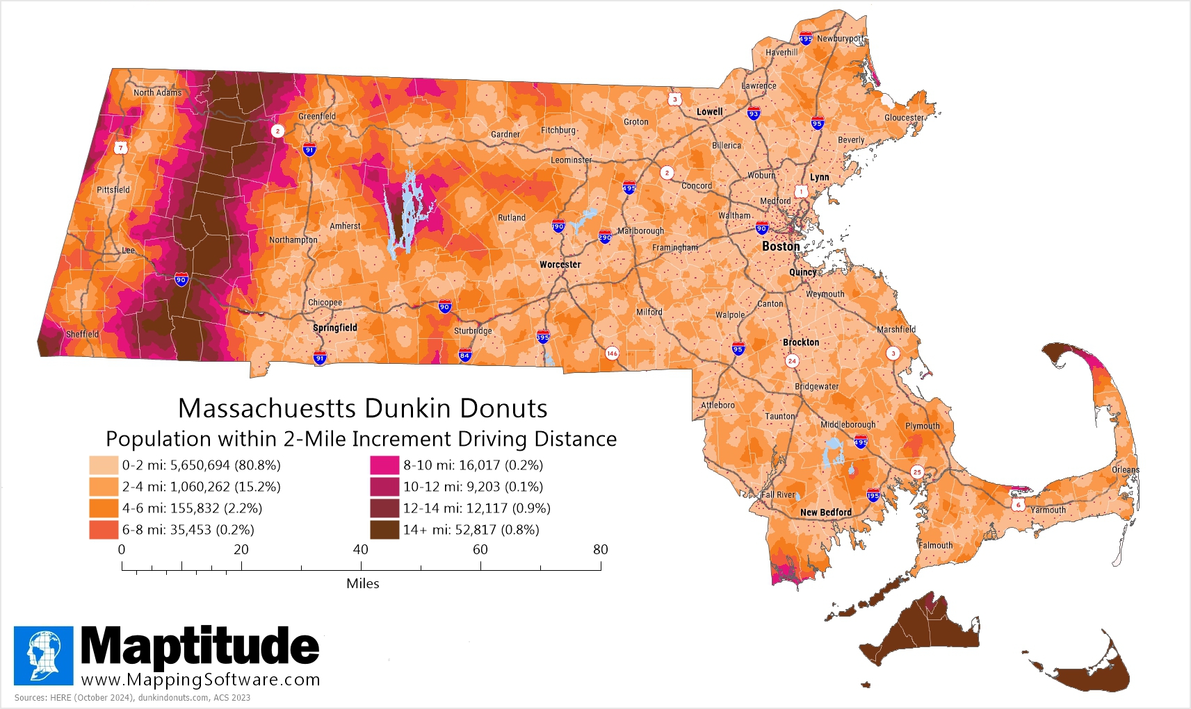
Dunkin' Donuts is headquartered in Canton, Massachusetts and has a huge presence in the state. For National Donut Day (first Friday in June) we created 2-mile driving distance rings around Dunkin' locations and overlaid the rings with Census Block Groups to estimate the population within each ring. What we found was an astounding 96% of the population of Massachusetts is within 4 miles walking or driving distance from a Dunkin' Donuts! Only the most rural parts of the Berkshires, the Islands, Mount Washington, and Provincetown at the tip of Cape Cod require you to travel more than a dozen miles to pick up your dozen donuts.
Map: Created with Maptitude Mapping Software by
Caliper, June 2025
Source: HERE (October 2024), dunkindonuts.com,
and Census
American Community Survey 2023
#Maptitude #NationalDonutDay #DonutMap #NationalDoughnutDay #DunkinDonuts
Home | Products | Contact | Secure Store
