Mapping Software and GIS Glossary
Geo mapping is the analysis of tabular data that is geographic in nature. Software is used to create an intuitive and revealing map visualization. Geo-maps communicate information about space and location in a very efficient way. They reduce volumes of data to a single, clear visual presentation. For example, a weather map lets you instantly know if it will be cloudy or sunny, warm or cold, or whether it will rain or snow. Traffic maps immediately tell you what routes avoid an accident or construction. In politics, history, advertising, and recreation, geo maps are a part of our everyday lives because they make data easy to understand.
Maptitude includes free geo mapping software data including census demographic data.
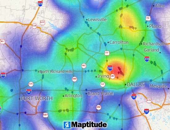
Find patterns in your data with Maptitude geomapping software.
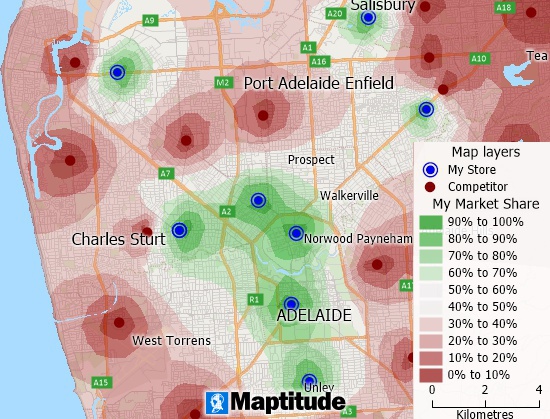
Use geo mapping tools to visualize the market share of competing businesses.
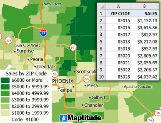
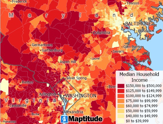
Map your Excel data and visualize spatial patterns with geo maps.
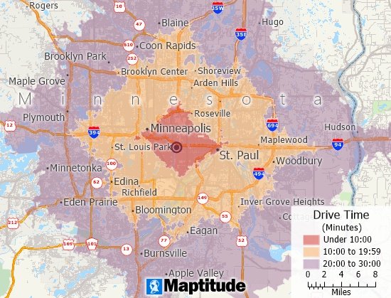
Maptitude is the best geo mapping software for drive-time analysis.
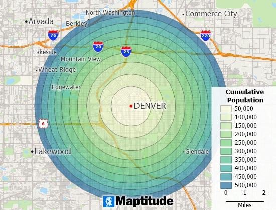
Use geomapping tools to study the population around a location.
There are many ways to create a geo map, depending on your needs and the geo mapping tools you have available. Here are some options:
In general, creating a geomap requires some understanding of geographic data and how to work with it. If you are new to this topic, you may want to start by learning more about geographic data formats and GIS concepts before diving into a specific tool or platform.
Geo maps are used for a wide range of purposes, including visualizing and analyzing geographic data, displaying location information, and creating interactive maps for websites and applications. Here are some examples of how geomaps can be used:
Overall, geomaps are a powerful tool for displaying and analyzing geographic data, and they can be used in a variety of contexts to help people better understand and interact with the world around them.
Get access to ZIP Code territory tools, ZIP Code heat maps, and many more advanced features by signing up for a free trial today!
Maptitude geo mapping software provides the tools, maps, and demographic data you need, with commands and special functions that let you tie in the data you use every day in your work. The MapWizard automatic mapping tools create brilliant and informative maps with a single mouse click. Even more importantly, Maptitude provides ways for you to use the maps you create to analyze and understand how geography affects you and your organization.
Learn More Free Trial Free for Students/Teachers
![]()
![]()
![]()
![]()
![]()
![]()
![]()
![]()
Home | Products | Contact | Secure Store
