

Author:
Stewart Berry
Images: Dan Martin
October 27, 2025
The new Maptitude Country Packages include updated maps, demographics, and tools, including streets that allow for accurate address locating and street visualization, directions, drive-time rings, and drive-time territories.
The following datasets were updated to version 2025:
 |
“Using Maptitude to work out the closest members of staff to each store we visit has been incredibly helpful in reducing the travel done by our merchandisers, leading to positive environmental and financial results.”
|
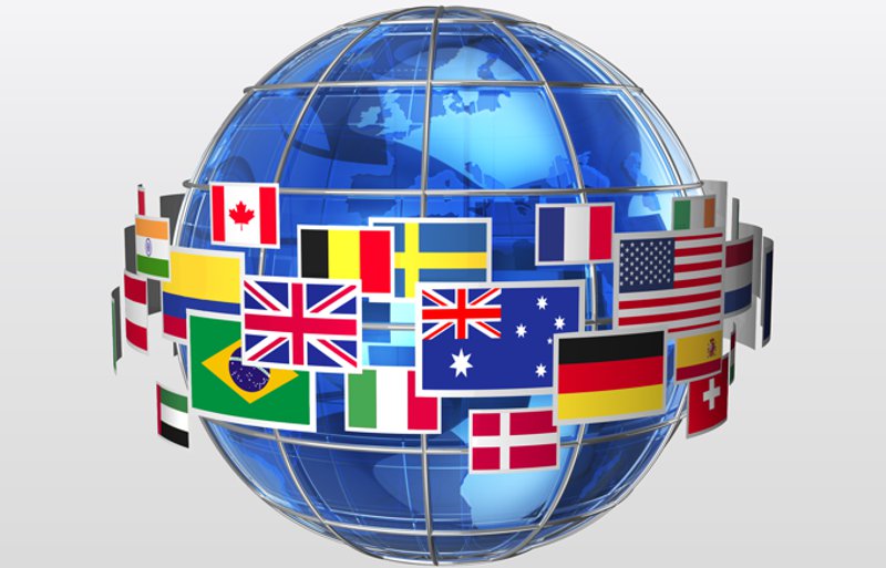
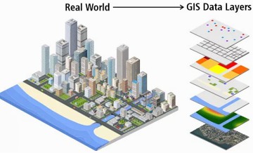
Maptitude 2025 comes standard with one detailed Country Package of your choice, and additional Country Packages can be purchased separately. Each Country Package includes a wealth of data unavailable in any other product, such as an up-to-date street layer with addresses for pin-mapping (geocoding) and travel time information for computing routes and drive-time rings. Features such as building footprints for many urban locations, railways, and named landmarks are also built into the software. The comprehensive landmarks range from public facilities to commercial buildings including businesses, restaurants, and retail stores, and include addresses and phone numbers where available. Where available, postal data and detailed demographics are shipped with the product.
As you switch between the countries you have purchased, Maptitude will seamlessly refresh the interface with country-specific tools such as Create-A-Map Wizard and tools for finding, pin-mapping, and routing. New Map Libraries allow you to easily create attractive geographic and demographic maps while locating unlimited numbers of addresses and territory-based records.

|
“Maptitude helped me to quickly locate and exhibit post code hot spots across the country in an effective and attractive way - it's turned my extensive datasets into compelling stories, and helped build credibility with my clients and the wider community.”
|
New USA datasets provide access to the most up-to-date geographic information available. Maptitude 2025 comes with October 2024 HERE® Map Content, which allows for accurate address locating and street visualization, in addition to robust data that you can use to calculate directions, drive-time rings, and drive-time territories. Speeds based on HERE Traffic Patterns are included.
Other 2024 U.S. map layers from HERE include those for buildings, highways, railroads, and landmarks. The Points of Interest layer contains over 2.9 million named public and business locations.
ZIP Codes
Maptitude 2025 ships with the January 2025 ZIP Code update to ensure that you are using the latest data. The 5-digit ZIP Code boundaries are a nationwide area database with ZIP Codes for all 50 states, the District of Columbia, Puerto Rico, and the territories.
Other standard features of Maptitude 2025 are updated 3-digit ZIP Code areas and a point database of ZIP Code points for the entire country. The ZIP Code area layers extend into non-deliverable areas to provide complete coverage of the USA. The 3-digit and 5-digit ZIP Code areas include updated counts of businesses by detailed industry type (retail, finance, etc.), along with the number of employees working in each ZIP Code, and annual payroll figures. The ZIP Codes are also classified by their updated rural-urban commuting characteristics and with the numbers of hospitals, hospital beds, and healthcare providers.
Census Boundaries
The US Census boundaries (e.g., Tracts, Places, Counties, MCDs, MSAs, States) and the 3- and 5-digit ZIP code areas that come with Maptitude contain some or all of several demographic profiles from a variety of data providers. These sources include the 2010 and 2020 Census and the 2023 ACS to name a few. This data is available for the USA, Puerto Rico, and the Territories. These layers include daytime population, median income, and mean income. The ZIP Code, Tract, County, and State layers also include updated buying power (disposable income for 2021) figures. Tracts also list updated banking compliance FFIEC data.
Personal income and change in personal income BEA data for 2020 are included for States and Counties, and 2023 GDP (by total, goods, services, government, and by 2-digit NAICS code) and change in GDP BEA data are included for Counties. 2030 population projections for Counties, States, and Tracts are included by age, race, gender, and ethnicity, and for population by 5-year increment for 2030-2100.
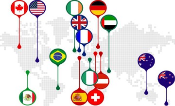
Canada is fully integrated into the Maptitude platform, as are all the Maptitude Packages, and exactly as the USA data is. For example, you have full control over the language and units of measurements displayed in the map legend.
Each Package also has elements unique to the geography and demographics of each region. For example, a critical business dataset for Canada is the ability to visualize and work with 6-character postal areas rather than as points or at the 3-character postal Forward Sortation Area (FSA) level. FSAs can cover huge areas and so are problematic for fine tuning sales or franchise territories, for example. Maptitude 2025 for Canada includes this detailed postcode layer at no additional cost.
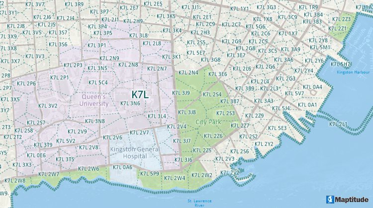
Maptitude allows you to map in Canada by full postcode area, not just 3-digit FSA!
 |
“Powerful, well thought out, intelligently crafted, efficient, cost effective. Having worked with a few different GIS packages in the past, I'm impressed to note Maptitude is a comprehensive blend of best features that are more than likely to meet the needs of most users.”
|
The basic global map that is provided with every Maptitude license enables you to view your data for anywhere on Earth, and it allows you to map your locations by coordinate, manually, or by any populated place (village/town/city).
We provide with Maptitude a world database with the following layers that allow you to create global territories:
There is also a free data downloader tool that includes a geocoder and creates a basic Country Package using opensource data for many countries that encompasses postcodes, boundaries, and streets/landmarks. You can also use this tool to geocode Northern Ireland postcodes.
Maptitude makes it easy to access free imagery from the Internet for any location in the world. Maptitude Web Map Layers give you access to satellite and aerial imagery for anywhere on Earth. This can be chosen under the Map>Imagery menu in Maptitude and includes map backgrounds down to the street and building level.
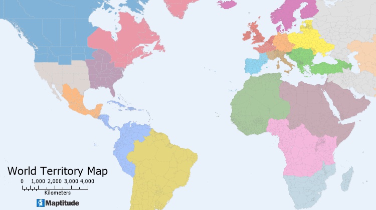
A territory map created using the Maptitude World Province Boundaries
There is an extensive library of free data for the USA that can be downloaded in the Maptitude Store. Several of these datasets are available for other countries:
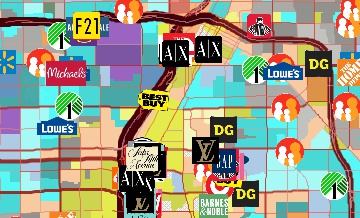
These data are extremely useful for many sectors, including healthcare. For example, the POI Layers and Business Location Layers provide address and phone number for:
In addition, the included demographics have some healthcare-related information depending on the Country Package that you can check out here.
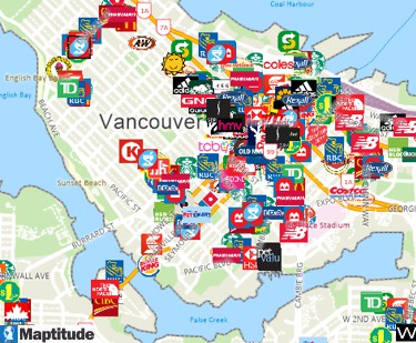
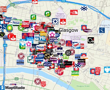
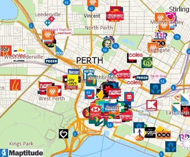
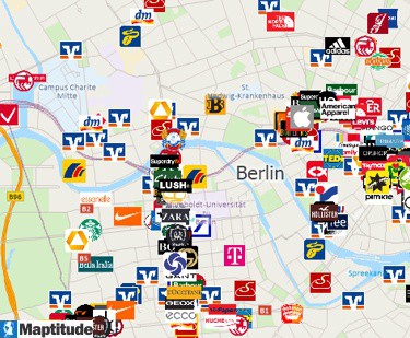
Maptitude business location layers are available for the United States, Canada, UK, Australia, and Europe
Maptitude ensures that your sales and marketing mapping projects and reports will be a success no matter where you are conducting business. By integrating with key geographic, business, and consumer datasets, Maptitude provides a one-stop wizard-driven interface. Maps are an intuitive way to convey and analyze large amounts of data. Maptitude can support all the above analytics and comes with all the data used in the examples shown, as well as information for almost any industry and sector you would need to map.
Learn more about Maptitude to see how you and your team can benefit from mapping software!
Schedule a Free Personalized Demo
Home | Products | Contact | Secure Store
