 Call Us

 Territory Map Tool
Build territories from areas, proximity, or drive time. Nest them in unlimited levels, such as rep, district, and region
Turn addresses, sales lists, and delivery data into territories, routes, and site decisions, with maps and demographic data included.
30-day free trial, no credit card • 30-day money-back guarantee
4.7/5 on G2 from 150 reviews • G2 Leader in GIS
 G2 Buyer’s Guide 2026: best for territory mapping and demographic analysis

Maptitude is mapping software that helps you:
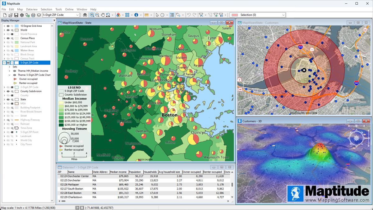
Read on for Maptitude desktop mapping software for Windows, including Windows on a Mac. The current version is Maptitude 2026.
Maptitude Online is the cloud (SaaS) version. It runs in any web browser, including on a Mac.
Optimize sales territories, districts, service areas, vehicle routes, and site locations
 Map customer locations, see sales performance, and find over- and under-served areas
 Find hidden patterns, trends, data density, and hot spots in your spreadsheets and databases
 See and study population, income, and other demographic data
 Plan efficient travel routes with advanced proximity, navigation, and travel time tools
 Customize every part of your maps, including color schemes, symbols, themes, layers, drawing items such as text and shapes, and 3D graphics, to highlight the data that matters most
 Connect to company databases, add your own data, and answer location questions about your business
 Find growth opportunities by spotting patterns you can't see in tables
 Create, edit, and manage interactive maps you can share, with zoom, pan, filter, query, and layer controls
“I've been using Maptitude for more than 15 years. It is simply the best tool available for businesses that need a market planning mapping and data resource. It can do everything I need it to do - from the very simple to the complex. It integrates nicely with other programs and file types making analysis and presentation very easy. I highly recommend Maptitude to firms who need a function-rich GIS mapping solution. It is the best!”
 Mike Sawyer
“Pros: Cost. Much easier to reach a purchasing decision. I loved the integrated country data package so I didn't have to download census layers and other info - it was all built in.”
 Alex Martin
G2 Buyer's Guide, 2026
Ratings
Multi-Award Winning Mapping Solution





Results Customers Report
to build balanced franchise territories across 80+ locations
The Glass Guru, a home-services franchise ›to make maps for 300+ client stores, instead of building each one by hand
AMP, which makes store maps for clientsMaptitude sends the nearest staff member to each store, so they drive less and use less fuel
eXPD8 Analytics, a UK company whose staff visit stores ›property inspection routes, so inspectors cover more ground each day
A Massachusetts city assessor’s office ›

Locate services based on patient demand and travel times
Assign store visits to the closest staff and design logistics networks
Map CRA assessment areas and branch service areas
Align territories and assign ZIP Codes or counties to reps
Plan and manage franchise territories
Find the next store location
Redraw police districts and plan inspection routes
Maptitude tools are easy to use for beginners and GIS professionals alike:
Advanced Geospatial Analysis Tools
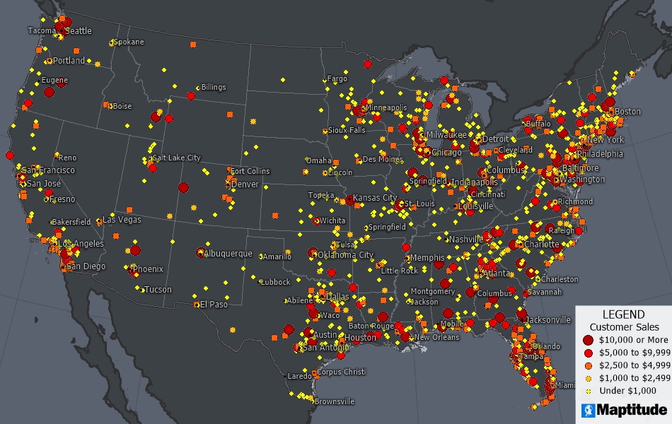
Nationwide map of geocoded customers with a color theme based on sales data
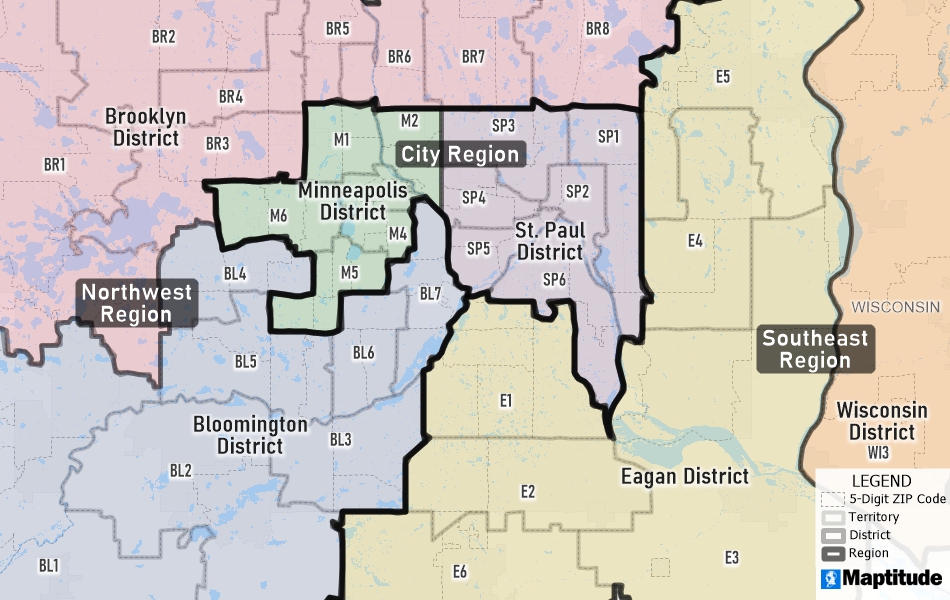
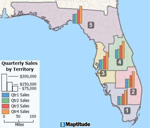
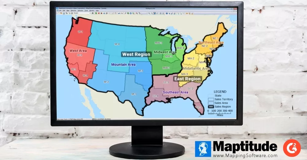
Build balanced, hierarchical territories with any number of levels

Drive-time zones: San Antonio area streets colored by their nearest site
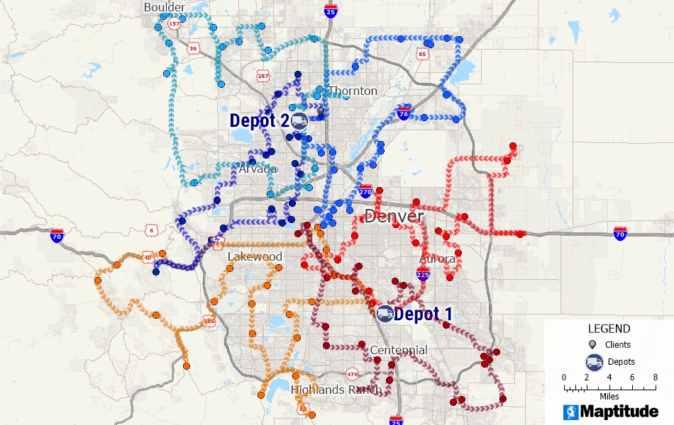
Fleet routes from two depots serving multiple customers and accounting for vehicle capacity and time windows
Extensive Built-in Data Libraries for Map Creation
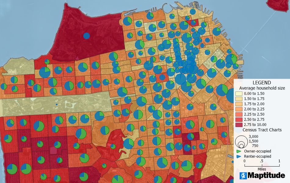
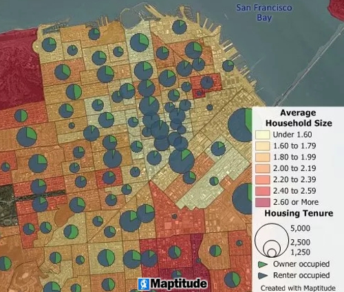
San Francisco Census tracts colored by average household size, with pie charts of owner- and renter-occupied homes
Country Packages: USA • UK and Ireland • Australia • Brazil • Canada • Europe • Mexico • New Zealand • South Africa • All Country Packages
Create Customized Maps, Visualizations, and Reports
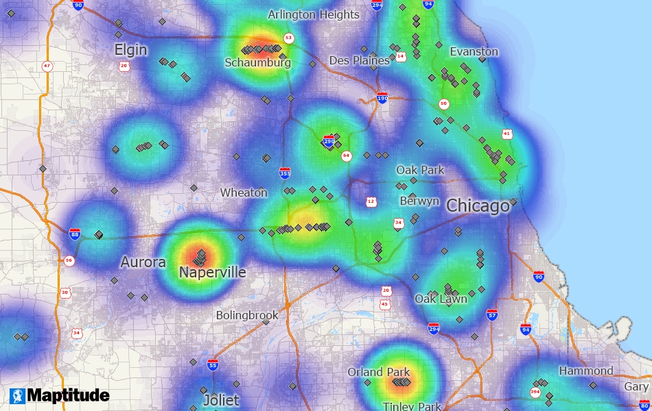
A heat map of automobile dealers in the Chicago area
Flexible Deployment: Desktop and Online Options
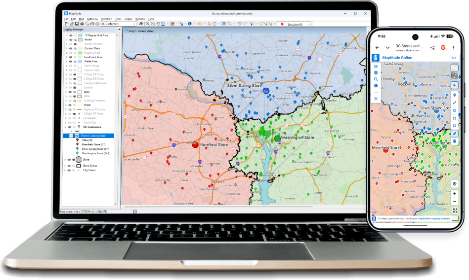
Share only the data you want to share with an optional Maptitude Online license
Data Integration and Compatibility
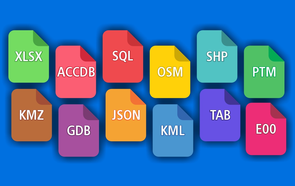
Maptitude reads over 50 file types and more than 100 GIS and CAD formats, including spreadsheets and databases
Intuitive Mapping Interface
Choosing the right mapping solution can be time-consuming. Here's what some of our users have to say:
“The software is very easy to use and can do a lot of analysis. It has helped me a lot with making strategic decisions for my analysis.”
 Rima Idir
“Best Mapping software available. Exceeded our expectations. Provides clear maps with plenty of customization to tailor our maps to fit our clients' needs. Excellent drive-time mapping and very simple customer database plotting. Light years better than our previous mapping software.”
 David Wuenschell
“We use Maptitude extensively for running complex Territory Alignment scenarios. The depth of the product, its total utility and functionality is immense. Import-Export capability with Excel is seamless. The Maptitude team [has] created a solid product and it is one of the best software investments we have made as an organization.”
 Esat Angun
“Maptitude provides me with the best maps and mapping software on the market! I love layering and the border filters. The software is easy to use, but you can still do complex projects.”
 Kendrick Buckingham
Maptitude works directly with Excel, Access, and SQL Server. The Maptitude Create-a-Map Wizard™ map creation tool gives you start-to-finish help with locating (geocoding), analyzing, and mapping your data. Geocoding is unlimited, by address, intersection, postal code, city, or coordinate. When your data is on the map, add demographics, color it by any field, and build territories or drive-time rings around it.
“You can easily import data to and from Excel, build multiple/quality custom Maps and overlay demographics and sales data. It's a GIS Jackpot!”
 Brian Klink
Why Choose Maptitude Mapping Software?
Maptitude mapping software contains location intelligence tools giving you a deeper understanding of the geographic relationships in your data. Here are 36 of the 150+ tools built into every license. See all 150+ Maptitude tools ›
Territory Map ToolBuild territories from areas, proximity, or drive time. Nest them in unlimited levels, such as rep, district, and region
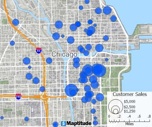 Geocoding Tool
Free, unlimited geocoding. Pin-map every record by address, postal code, coordinate, and more, with no per-record fees
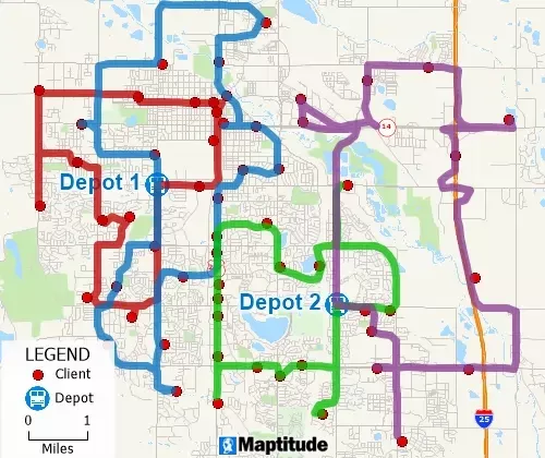
 Logistics Map Tools
Plan routes for several vehicles making deliveries and pickups at many stops, within fixed time windows
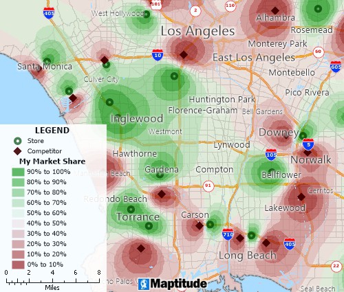
 Market Share Tool
Estimate the share of customers your sites and competing sites will draw, and find the trade areas and new sites worth adding
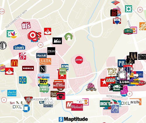
 Business Map Tools
Map competitors and prospects using the included business location data and business counts by ZIP Code
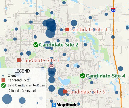
 Facility Location
Find good locations for expanding your business
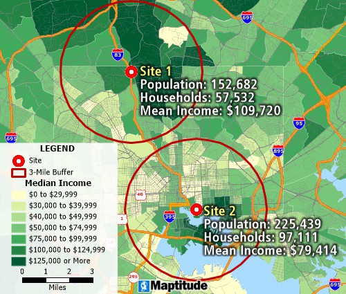
 Radius Map Tool
Estimate the population inside a circle with the included data
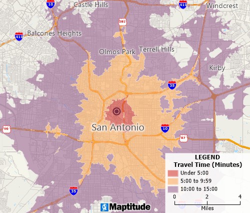
 Drive Radius Tool
Determine drive-time or distance rings at any interval
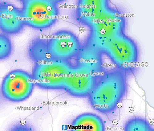
 Heat Mapping Tool
Find where demand is concentrated, weighted by any value, and spot over- and under-served areas
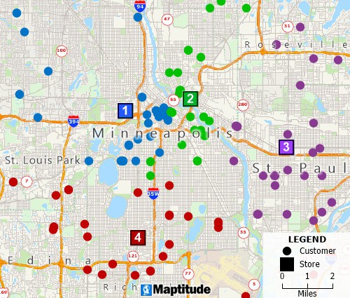
 Map Filter Tool
Filter features by location, by geographic attributes, or by conditions on your data
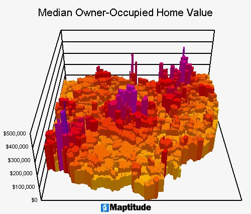
 Thematic Map Tools
Style features and make heat maps, chart maps, choropleth maps, 3D maps, and more
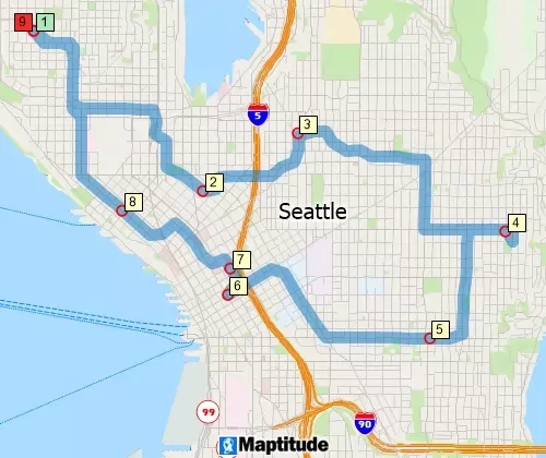
 Shortest Path Tools
Find the lowest-cost route through your stops, in a set order or in the best order
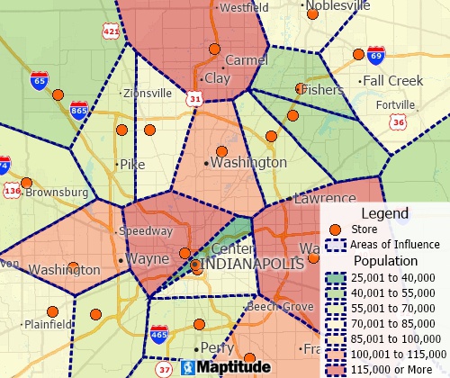
 Area of Influence Tool
Build straight-line distance territories with Thiessen polygons (Voronoi diagrams)
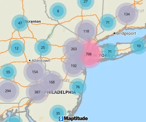
 Internet Mapping
Share your data as interactive, mobile-friendly maps that work on any device, with Maptitude Online
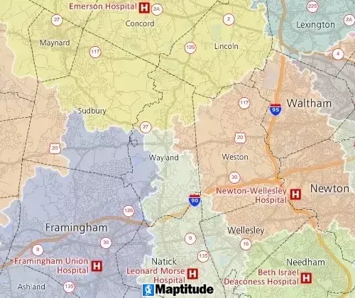
 Drive-Time Territories
Show the catchment area of each facility by drive time
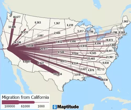
 Desire Line Tool
Show flows with desire lines, also called spider diagrams
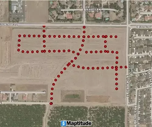
 GPS Mapping Tools
Read, import, and play back GPS data, and turn it into point and line layers
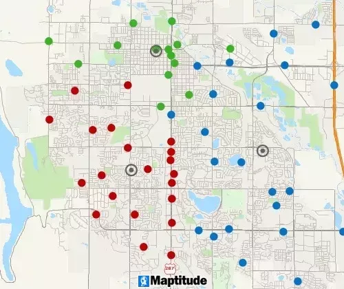
 Map Clustering Tool
Group points or areas into compact clusters. Set limits such as a maximum size, or balance a total such as sales or population
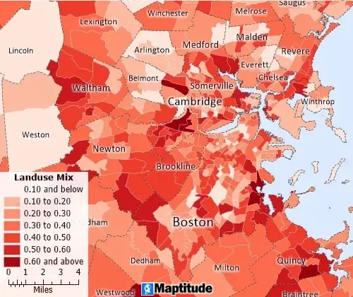
 Land Use Map Tool
Measure walkability and land use mix to assess equitable access to services, amenities, and jobs
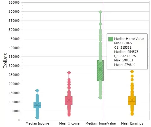 Statistical Tools
Compute summary statistics (sum, min, max, mean, standard deviation) and spatial autocorrelation. Make box plots, histograms, and radar charts
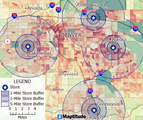
 Buffer Map Tool
Draw circular buffers and bands to study proximity
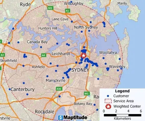
 Weighted Center Map Tool
Find the weighted center, or center of gravity, of a set of points
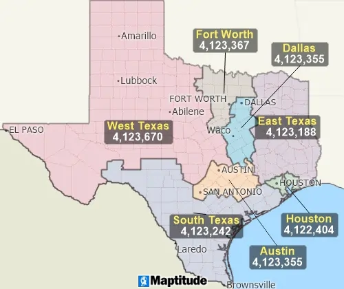
 Territory Balancing Tool
Automatically build territories balanced by a demographic you choose
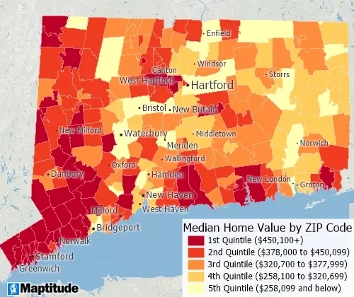
 Data Classification Tools
Classify data with quantiles, equal weight, equal interval, standard deviation, nested means, arithmetic or geometric progression, optimal breaks, categories, and manual classification
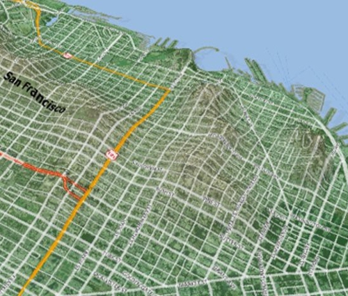
 Surface Analysis
Show surfaces on a flat map or in 3D, and export them as Digital Elevation Models (DEMs) or Triangulated Irregular Networks (TINs). Make profile charts and contour maps, and find terrain shortest paths, viewsheds, and lines of sight. You can also build 3D models and record fly-throughs.
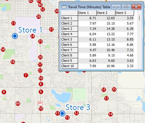
 Measuring Tools
Measure areas and distances, find closest features, and compute drive-time or distance tables
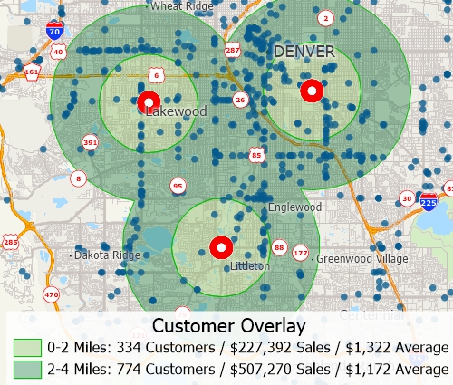
 Geographic Overlay
Move data between layers. Add up point data inside areas, or split area data by how much the areas overlap
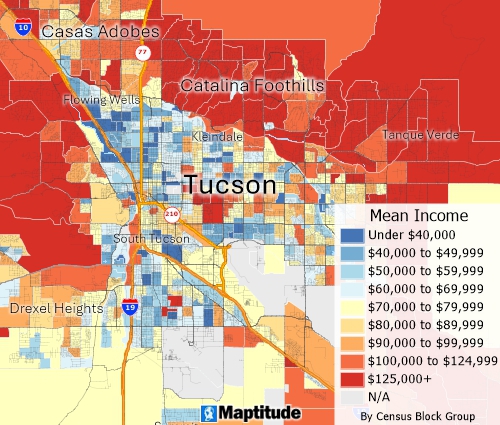 Demographic Data
Includes detailed Census demographics down to the Block Group. Use them to estimate who lives around your sites, inside territories, or within drive-time rings
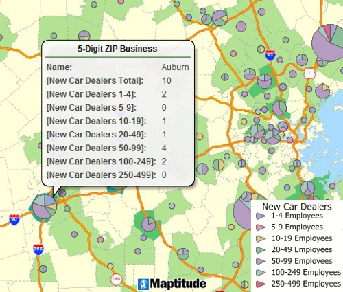 Business Data
Includes detailed business location data and business counts by ZIP Code
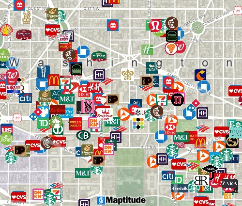 Map Customization
Use any logo, pushpin icon, image, or font for your locations
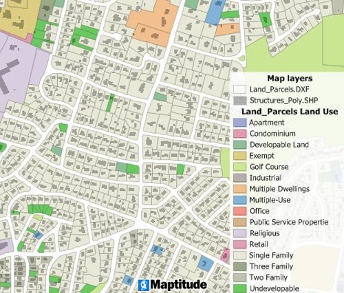
 Data Import
Open over 50 file types and more than 100 GIS and CAD formats, including Esri Shapefile, MapPoint PTM, Google KMZ, and Oracle Spatial
 Aerial and WMS Imagery
Use aerial and satellite images as a backdrop and for editing
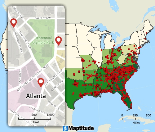 Maps at Any Scale
Examine your data at a national, state, city, or even neighborhood level
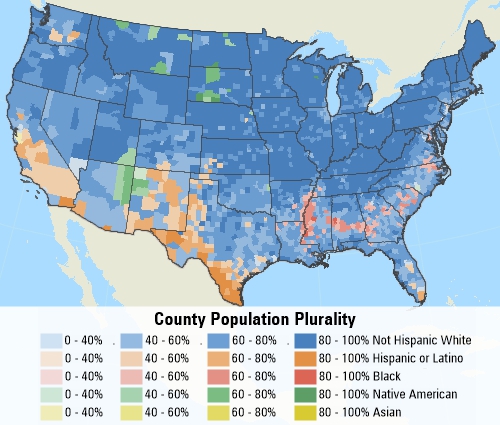
 Multivariate Mapping Tools
Compare several data fields on one map to show which value leads in each area
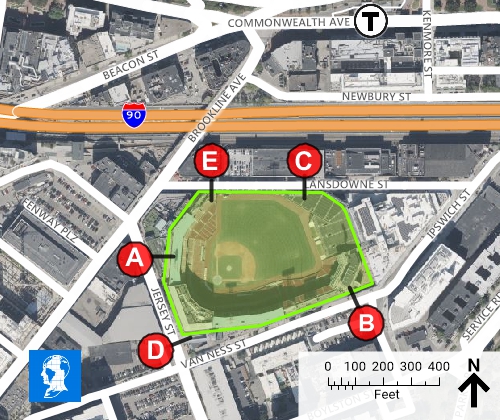
 Drawing Tools
Edit the legend, and add a north arrow, callouts, lines, shapes, a title, a great circle, images, or logos
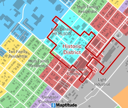 Layer Editing Tools
Create and update points, lines, areas, and their data. Conflate, clip, dissolve, merge, intersect, union, simplify, and convert between points, lines, and areas, with automatic topology.
The GISDK developer kit comes with every desktop license, at no extra cost.
Maptitude Geographic Information System (GIS) software gives you the tools, maps, and demographic data you need to analyze and understand how geography affects you and your business.
Maptitude is intuitive, Wizard-driven mapping software. Answer a few simple questions, and the Maptitude Create-a-Map Wizard™ map creation tool makes presentation-ready maps of any area, from local to national and international. With a few clicks, MapWizard® automatic mapping technology helps you make thematic maps. You can change every element, including colors, styles, and labels.
Once you see the patterns in your numbers, share your maps to tell the story. Create map reports and images for presentations. Copy and paste maps into Office, print them, or make wall-size posters. You can also upload your work to Maptitude Online to share it or publish it on the web.
Maptitude costs US$795 per year and includes a Country Package of GIS data* with everything you need to start right away. You get up-to-date streets, addresses, and postal boundaries, and you can pin-map (geocode) as many locations as you like. Routes and drive-time rings use real travel times, so they better reflect your markets. Demographic, business, and point-of-interest (POI) data are included.
Choose desktop GIS software that keeps your data securely on your own computer, an online mapping platform, or both. You can buy Maptitude Desktop with or without a subscription.

Maptitude Desktop Subscription
$795 per year billed annually
Includes:
Maptitude Desktop One-Time Purchase
$1,095
Includes:
Maptitude Desktop and Maptitude Online are free for students and educators.
See all pricing and license options ›
Support and Training
Our support engineers have decades of combined Maptitude experience.
Support is included with Maptitude. Contact support or see the support terms.
Mapping software, and in particular a Geographic Information System (GIS), lets you create, edit, and analyze location data. It turns tables and geographic data into maps that show patterns, relationships, and trends. Common mapping tools include geocoding, analysis tools, and geoprocessing. They sum up large amounts of data in clear pictures.
Businesses use mapping software to work more efficiently and to plan, in industries such as retail, logistics, and business development. Seeing data on a map leads to better decisions and better use of resources.
1. Most geospatial, image, and table formats: over 50 file types and more than 100 GIS and CAD formats. Maptitude works directly with Excel, Access, and SQL Server, as well as spatial databases such as Oracle Spatial and PostGIS. It reaches other databases, including the ones behind CRM and ERP systems, through ODBC.
2. Using your own API key, you can connect to services such as Microsoft Bing, HERE, what3words, and Google Maps. Use them to geocode, to find driving, public transportation, or walking travel times, or to get real-time travel times by arrival time, departure time, and date.
3. The GISDK included with Maptitude has more than 850 GIS functions, which can be called from .NET or as a COM object. Free packages called CaliperPy and CaliperR let you drive Maptitude from Python and R.
4. Map background tiling services from USGS, OpenStreetMap, and other web imagery sources.
5. The Maptitude Google Maps toolbar allows you to see your current Maptitude map location in any of the different Google Maps views including Street View.
Maptitude supports a wide variety of map types to meet different business and analytical needs. Users can create:
These maps help you understand your operations, customers, and opportunities, from local to global scales.
Maptitude Desktop costs US$795 per year for one user. You can also buy a $1,095 license with no subscription that you keep for 10 years. Enterprise and Remote Desktop licenses are also available. Every new license includes one Country Package of maps and data. Maptitude is free for students and educators.
Yes. The 30-day free trial has every feature turned on, and you do not need a credit card. If you buy, you also get a 30-day money-back guarantee.
No. The Maptitude Create-a-Map Wizard™ map creation tool walks you through locating, analyzing, and mapping your data. Free video tutorials, webinars, and training courses help you learn more. GIS experts can still use the full set of editing and analysis tools.
Yes. Build territories from ZIP Codes, counties, a customer list, or by clicking the map. Track one or more fields, such as sales or population, and see how far each territory is from its target as you edit. You can nest territories in as many levels as you need, with no per-territory fee.
Yes. Plan routes from one or more depots, with vehicle capacities, time windows, and service times. Maptitude Desktop handles unlimited stops and optimizes unlimited routes at the same time, with no additional fees. For a single trip, it finds the best order for your stops and prints turn-by-turn directions. Travel time tools build tables of drive times between all of your locations.
Copy and paste maps into Office, export images and PDF reports, or print wall-size posters. If you also have Maptitude Online, you can upload a desktop map and share it by a stable link, publicly, privately with specific users, or across your organization. You can also embed a Maptitude Online map in your own website.
No. Maptitude Desktop can run fully offline. Geocoding, routing, drive-time analysis, and demographic queries all run on your computer, and by default your data is not sent to outside services.1 When connected to the Internet, you can add imagery from web map services such as OpenStreetMap and USGS, and use your own API key with Google, Microsoft Bing, HERE, and what3words for geocoding and real-time travel times.
Maptitude Desktop runs on Windows, including Windows on a Mac. You can use virtualization software such as Parallels Desktop or VMware Fusion, Boot Camp on Intel Macs, or connect to a Windows PC remotely. Maptitude Online runs in a Mac browser with no Windows needed. See the system requirements.
 Check out our G2 Reviews

Maptitude Reviews and Testimonials
Learn more about Maptitude to see how you and your team can make informative and insightful maps!
Schedule a Free Personalized Demo
*Contact us by email or +1 617-527-4700 for Europe Country Package pricing.
1 The default Maptitude desktop installation uses a software key that performs periodic online license validation, and some features such as online background imagery need a connection. Fully air-gapped configurations, with manual activation and no online license check-ins, are available on request for free through Maptitude support. In both configurations, all mapping functions (geocoding, routing, drive-time analysis, demographic queries) run locally on the user's computer.



Home | Products | Contact | Secure Store

